
Satellite InSAR Data used to detect massive size of North Korean Nuclear Testing
Following the withdrawal of North Korea from the Non-Proliferation of Nuclear Weapons treaty over 15 years ago, a suspected underground hydrogen bomb exploded on September 3rd, 2017. This led to a team of scientists from the Space Applications Centre, Indian Space Research Organisation (ISRO), to use satellite data to measure the bomb size via the ground’s movement. The team uses the ALOS-2 satellite. They have been measuring changes from the underground explosion on September 3rd, 2017.
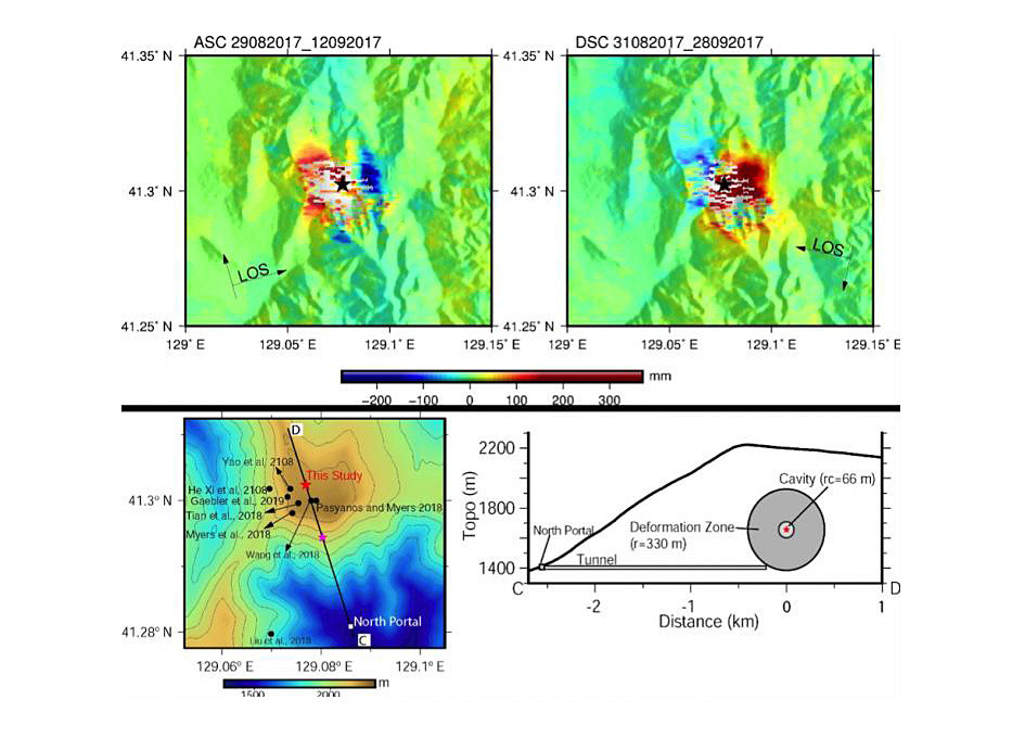
Based on the data collected, the ISRO team has predicted that the 2017 explosion “created a cavity with a radius of 66 metres. It had a yield of between 245 and 271 kilotons, compared with the 15 kilotons of the ‘Little Boy’ bomb used in the attack on Hiroshima in 1945.”
The data from this study demonstrates the value of InSAR data collected via satellite for the measurement of the severity of underground nuclear tests.
Space-based Radar Suggests North Korean Nuke Equivalent To ’17 Hiroshimas’
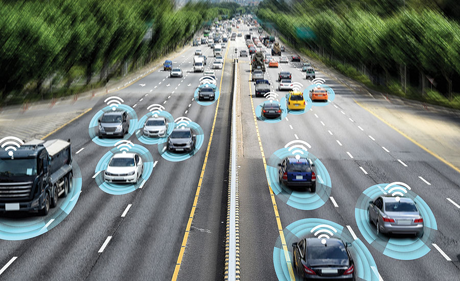
How GIS Makes IoT Data Come Alive

The Internet of Things (IoT) collects a variety of data types and is used in a vast range of applications. As IoT continues to grow, we continue to see its presence in ways to develop smart cities, such as self-driving vehicles, logistics and supply chain, and even farming. GIS on the other hand, captures, stores, manipulates, analyzes and manages the data collected. By putting them together, it is almost as though we are putting together two halves of a whole.
When combining IoT and GIS, there are a few challenges that need to be taken into consideration, such as “hardware ruggedization, data integration, data storage and data security”. Arguably the most important challenge listed is data security. The data collected via IoT devices only becomes more attractive to hackers with the addition of GIS data. Once a strong data security is established, the future of this dynamic duo will be even brighter.
How GIS Makes IoT Data Come Alive
Promise and Challenge in Self-Driving Vehicles
The presence of LiDAR in self-driving vehicles is crucial. Without the 360degree view LiDAR provides, the vehicles would be blind. However crucial it may be, LiDAR comes with its own sets of challenges. The challenges are as follows;
- Cost – The costs of new vehicles has increased by 29% over the last ten years. With the increase in vehicle costs and the high cost of LiDAR per vehicle, it is a challenge to find a budget friendly version that is functioning and attractive to potential clients.
- Size – Producers are looking to reduce the size of LiDAR, however there are many concerns about how the reduction in weight and size will affect its overall function.
- Reliability – As previously mentioned, LiDAR gives the vehicle a 360degree view of its surroundings. With such an important task, the system must be reliable. No matter the environmental factors, the system must function, and function well.
- Integration – Most vehicles already have hardware within, such as cloud-based software, radar and electrical. Integrating LiDAR with other software will be a challenge that producers will need to overcome in order to provide to the current and future market.
LiDAR: Promise and Challenge in Autonomous Vehicles
Bill Gates uses mapping tech to curb polio
The World Health Organisation (WHO) announced last month that type 3 wild polio virus has officially been eradicated worldwide. The Director General of WHO had this to say: “The achievement of polio eradication will be a milestone for global health. Commitment from partners and countries, coupled with innovation, means of the three wild polio serotypes, only type one remains. If we stopped now, the virus would resurge and could once again cause more than 200,000 new cases every year… We must stay the course. Together, we can make sure the children of the future only learn about polio in history books.”
Recently, a Netflix documentary entitled Inside Bill’s Brain: Decoding Bill Gates, focused its attention on the philanthropic efforts of Bill Gates and his foundation in regard to solving some of the world’s serious health issues.
With the funds provided from the Gates Foundation and Rotary International; satellites, GPS tracking and mapping software were used to create a GIS to analyze some highly detailed maps. These maps showed were the outbreaks of polio were, if anywhere was missed, and added an element of practicality in terms of deploying vaccinations.


Be the first to comment