• facebook
  • Twitter
  • Linkedin
  • Youtube
  • Linkedin Group
  • Post a Job
  • Post an Ad
  • Post an Event
  • Post a Directory Listing
  • Post a Press Release
  • Media Kit
  • My Account
  • Login
GoGeomatics
  • MAGAZINE
    • BIM & GIS
    • Community
    • Conference news
    • Earth Observation
    • Education & Careers
    • GEOAI
    • Announcements
    • Reality Capture & Lidar
    • Science
    • Technology
    • Between the Poles
  • Directories
    • ASSOCIATION
    • INDUSTRY
    • EDUCATION
    • Open Data
  • EVENTS
    • GeoIgnite Events
    • Events Calendar
    • GoGeomatics Meetups
  • Services
    • Advertising
    • Marketing
    • Post a Job
    • Post an Ad
    • Post an Event
    • Post a Press Release
    • Post a Directory Listing
    • Media Kit
    • Web Design
  • Find a Job
  • Volunteer
    • Start a GoGeomatics Group
    • Editors & Writers Group
  • About Us
    • About Us
    • Contact Us
    • Frequently Asked Questions
  • Videos
Home2018

Year: 2018

Community

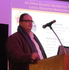
“Deep Mapping” with Dr. Mike Sawada Tuesday, March 20th in Ottawa

17 March 2018 GoGeomatics Newsmakers | CIG

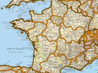
Please come and join us on Tuesday, March 20th at the RA Centre, Outaouais Room, for a very interesting and informative presentation from Dr. Mike Sawada, Professor, Department of Geography, Environment and Geomatics, University of […]

3D data

French national initiative to map all urban subsurface critical infrastructure by 2019

13 March 2018 Geoff Zeiss

I have blogged previously about a French presidential decree in 2012 that mandated that all of France’s critical underground utility infrastructure must be mapped in 3D to an accuracy of 40 cm (about 16 inches).  […]

||
Education & Careers

Interview with Dave MacLean at COGS: GIS Education, Chris Hadfield

10 March 2018 Peggy March | Chris Hadfield

“Oh the Places You will go!” Part 2: Continuing the “COGServation“ Everything is connected to everything else! I recently wrote an article for GoGeomatics on Ken Bragg of Safe Software. In the course of our […]

Technology

Calgary Geography of Health and GIS Analysis: Researchers map out seasonal surprise in city air quality

7 March 2018 Michael Wood | Air Pollution

A University of Calgary study of seasonal air pollution will be of cold comfort to thousands of Calgarians living south of the Bow River: that crisp, wintry air they’re breathing in is the worst in the city. […]

Community

Event Recap of the First National Geomatics Competition in Canada

5 March 2018 Murrium Zaheer | Canada

A National Geomatics Competition is a concept developed by a Geomatics student named Justin Collett who felt that geomatics was underrepresented at post secondary competitions for students. With this aim in mind, he decided to […]

Technology

Do You Care about Spatial Data and Canada’s Geospatial Data Infrastructure? If so take this survey

27 February 2018 GoGeomatics Canada | CGDI

Here’s your chance to express your needs and priorities around geospatial data and spatial data infrastructure, and help shape future activities and initiatives. In collaboration with Natural Resources Canada, Hatfield Consultants are conducting a series […]

3D data

P3 drives integrated geospatial + BIM in the Canadian construction industry

26 February 2018 Geoff Zeiss

Several years ago Rijkswaterstaat, the Dutch highway authority, initiated Design, Build, Finance and Maintain (DBFM) highway projects. Private Dutch engineering and construction companies bidding on these projects found that adopting an integrated geospatial + BIM […]

Technology

Les 5 = ensembles de données vectorielles SIG canadiens les plus populaires

26 February 2018 Jon Murphy | CanVec

Nous parlons ici de données vectorielles SIG. Il s’agit d’une sous-catégorie des données géospatiales que le Centre canadien de cartographie et d’observation de la Terre de RNCan collecte et stocke – Les données CanVec pour […]

Posts pagination

« 1 … 23 24 25 … 28 »

Events

Notice
There are no upcoming events.

View All Events

Services

  • Post a Job
  • Post an Ad
  • Post an Event
  • Post a Directory Listing
  • Post a Press Release
  • Media Kit
  • My Account
  • Login

Jobs

Post a Job
  • Volunteer Editorial Contributor – Be Part of Canada’s Geomatics Story
    Remote
  • Junior Geomatics Field Technician – Technical Surveys
    Montréal, QC
  • GIS Specialist
    Amherst, Nova Scotia
  • Precast Structural BIM Specialist
    Calgary, Alberta
View All Jobs
  • Directories
    • Associations Directory
    • Industry Directory
    • Education Programs
    • Open Data
  • Volunteer
    • Start a GoGeomatics Group
    • Editors & Writers Group
  • About Us
    • GoGeomatics Media Kit
    • Who We Are
    • Contact Us
    • FAQ’s
    • Advertising
    • Marketing
  • Subscribe
GoGeomatics
GoGeomatics is the largest and most popular communications hub promoting the Canadian geospatial community. The business was incorporated in 2011. GoGeomatics hosts over 100 fun, free, location technology networking events each year in cities across Canada.

© 2026 GoGeomatics

  • facebook
  • Twitter
  • Linkedin
  • Youtube
  • Linkedin Group