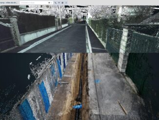
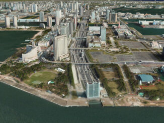
A 3D base map for the globe
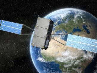
At the GeoIgnite virtual event Ryan Hamilton, Senior Manager 3D Products, at Maxar described a remarkable project Globe in 3D to create a 3D model for the earth’s entire landmass using the petabytes of 50 […]
Modern reality capture technology is not only providing a high accuracy alternative to paper as-builts, but is also being used to capture the location of underground utilities and other infrastructure exposed during during excavation or […]
Got a Drone – Now What? Mapping with your UAV It was inevitable that the proliferation of drone technology would quickly permeate the field of geospatial data acquisition and mapping. Just like a map, a […]
New Wyoming Mapping Project Helps Identify Important Habitats for Protection A new mapping project by the Wyoming Game and Fish department identifies all of the priority habitats in the state. Using GIS to identify and […]
When conducting Lidar surveys, efficiency and success are determined to a degree by conditions outside of the surveyors’ control. The best-laid plans can sometimes be delayed by inclement weather conditions, as wind, rain and fog […]
This half-day workshop cuts through the theory and fluff to present, in practical terms, the essential practices for successful GIS project planning and management. Its intent is to provide project managers, teams, and stakeholders with […]
Our Changing Climate The world we live in is changing, with global warming reshaping climate and causing more frequent, more extreme impacts and natural disasters. Climate change is the driving environmental challenge of our time […]