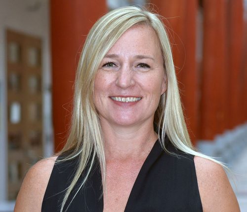
Marikka Williams talks Fleming College: A top GIS school for success-oriented students
Between Ottawa and Toronto, nestled in what many consider the best cottage country in the world is Lindsay, Ontario. It is in Lindsay we find one of the best GIS programs in Canada. Our GIS education explorations have brought us to the door step of Marikka Williams, one of the excellent instructors of the Fleming GIS program. 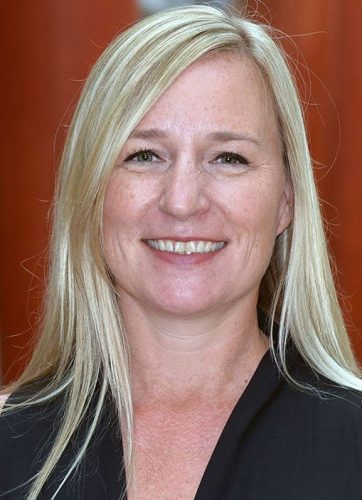
Jonathan Murphy: Hello and thank you for talking to us, Marikka. To get started, can you tell us about where you are from and why you decided to pursue a career in GIS?
Marikka Williams: I am from Canada originally, born in Manitoba and living mostly in northern Alberta, until my family relocated to Texas. After completing the requirements for my GISP designation I spent a few years living and working in Australia before I moved back to Canada, to southern Ontario, where I reside currently.
I began my career path when I started working on a Bachelor of Fine Arts Degree in 1991. My fascination with the human mind and the visual arts as a symbolic map of the mind attracted me to the field of Art History. I was fascinated by the symbolic aspects of paintings as a form of expression, communication and as a way of learning about past cultures beyond written history. I completed a BFA, with a major in Art History and a minor in English, at the University of North Texas in 1996. I planned to pursue a post graduate degree, with a long-term goal of teaching at a higher education level, so I accepted a full-time position in Student Services to stay connected to the academic environment while I defined a way forward that was in sync with my interests.
My enjoyment of the outdoors and interest in prehistoric rock art as a means of understanding ancient behaviors prompted travel around the Southwestern United States (primarily Texas, New Mexico, Utah and Colorado) hiking, camping and photographing rock art sites in my free time. This led me to start taking post graduate Archaeology courses at the University of North Texas in 1998 to develop a greater understanding of past cultures through the archaeological record that is associated with the prehistoric rock art. I felt that pursuing a MS degree in Archaeology would effectively prepare me for a teaching role in higher education while enabling me to increase awareness of the knowledge that past cultures left behind and support the preservation of indigenous cultural heritage.
After taking several ‘levelling’ courses I was accepted into the Master of Science Applied Geography program with a major emphasis in Archaeology and a minor emphasis in Linguistics. I also started working in a Teaching Assistant (T.A.) position as an instructor for Archaeological and Earth Science lab courses. In the first year of the program I took core program courses which included a Research Design and Geographic Applications course that introduced me to the concept of GIS. I was drawn to the ability of the technology to map archaeological data and perform integrative geospatial analyses that could provide answers to questions about prehistoric cultures. I started taking GIS courses in 2001 as part of the program requirements and to learn how to effectively use the technology to perform integrative analysis.
In 2002 I was hired as a GIS Intern for a nearby lakeside community where I received a significant amount of on-the-job GIS training. With the encouragement of Bruce Hunter, Director of the Center for Spatial Analysis and Mapping at the University of North Texas, I applied for and was awarded an ESRI Student Assistant Scholarship, which enabled me to attend and participate in the ESRI International User Conference in San Diego in July of 2003. This experience opened my eyes to the vast number of GIS applications in academia and industry. I began to discover the utility of the technology for understanding the world in both the past and the present as well as supporting planning for the future in a variety of contexts. It was an incredibly inspiring experience that had a significant impact on my career path.
Soon thereafter I completed the GIS courses required to fulfil the requirements to receive a GIS Certificate and completed my Thesis, ‘Interpreting Prehistoric Patterns: Site-Catchment Analysis in the Upper Trinity River Basin of North Central Texas’ to earn a MS Degree in Applied Geography in 2004. The experience that I had in underdeveloped countries and while working as the GIS Administrator for the City of Highland Village inspired my decision to shift my focus from archaeological analysis to delivering GIS solutions that support planning for the future. This is what formed the basis for my decision to pursue a career in GIS. It was my enthusiasm about what can be achieved with GIS technology paired with the knowledge that I acquired while working in GIS industry and my desire to share this knowledge that inspired me to seek to become a GIS Professor.
Jonathan Murphy: How has your career progressed since you completed you schooling and training in geomatics? Who have you worked for and where?
Marikka Williams: My GIS career began while I was in the process of working on my MS degree. My first job in GIS was a part-time GIS Internship for the City of Highland Village in 2002. The internship was funded by the Public Works Department. As such, I primarily worked on building and maintaining a GIS system that contained water, wastewater, and street assets but I was also tasked to create maps and exhibits for Planning and Zoning, Community Services, Parks and Recreation, Special Events, Police Services, the Fire Department and City Council. In November of 2003 the GIS internship with the City of Highland Village transformed into a full-time position and I began working for the City as a GIS Administrator while I continued to teach 4 labs per semester at the University and complete my thesis.
During my tenure with the City of Highland Village I enjoyed the opportunity to work with city staff ranging from field operations crew, to front counter staff, to managers from every department in the city, to city council members. The integrative nature of GIS afforded me the opportunity to develop relationships across the city which led to a variety of opportunities to utilize GIS to serve the community and to grow both personally and professionally. The opportunity to get to know people across the city led to a nomination, from the Mayor, Dianne Costa, to participate in a Rotary International Group Study Exchange Program with Peru. After interviewing I was chosen to be on the team to participate in a 6-week vocational exchange program in Peru that facilitated a cultural exchange, built business professional relationships, and established partnerships to raise money to sponsor project initiatives for communities in need. During the exchange I learned about the extent to which GIS was being used in several cities of Peru which helped me develop a greater understanding about how the technology could potentially be used to support these communities.
The supportive character of the management team at the City of Highland Village and the City Manager, Mike Leavitt, enabled me to attend GIS conferences annually, to attend local GITA chapter events and to pursue continued training in the field of GIS following my graduate work. The opportunity to actively participate in the professional GIS community, present at conferences, and attend seminars nurtured my growth in the field of GIS and ultimately led to earning a GISP (a professional certification in GIS) which I continue to maintain.
In 2008 I accepted an opportunity to serve in a role as a Senior Spatial Analyst for an Australian Engineering Consulting firm (GHD) based in Brisbane, Queensland, Australia. During my tenure with GHD in Australia, I worked on a vast range of projects including supporting GPS data collection, data processing and analysis for reporting, to preforming advanced multi-criteria analysis, to innovating creative solutions with multi-disciplinary teams, to creating maps, to performing QA/QC on products produced by our GIS Team. I also built a few web GIS solutions to facilitate internal project management or external field data collection. The bulk of my project work was focused on performing multi-criteria analysis, data processing/analysis and providing mapping services. It was an exciting job that enabled me to grow my GIS skills while providing the opportunity to work with engineering professionals from a wide range of business sectors including ecology, environmental management and planning, asset management, community consultation, contaminated lands, water, transportation and urban planning. I lived and worked in Brisbane, Australia until 2011 when I transferred to a regional GHD office in Markham, Ontario, Canada.
During my tenure with GHD in Canada I continued working on projects remotely with GIS professionals and multi-disciplinary teams in Australia, New Zealand and the United States. The focus on asset management in the Markham office led to opportunities to work on multi-disciplinary risk assessment projects which was incredibly helpful in developing a more in-depth understanding of how GIS could be utilized to facilitate risk assessments within an environmental context. I worked on innovative GIS based Water infrastructure Risk Assessment projects in collaboration with the City of Markham and Region of Peel.
Following my time with GHD I worked for a small GIS consulting firm in Sherwood Park, Alberta called Accurate Assessment. I worked for them for 6 months as a Coordinator supporting their staff in delivering Geomedia based Web GIS services for 40 municipalities in Alberta.
In 2014 I accepted my current position as a GIS Professor for Fleming College and moved to Lindsay, Ontario which is where I reside now. It is exciting to have the opportunity to share what I learned while working in the GIS Industry. I am enthusiastic about providing the opportunity for students to learn how to utilize the technology in the context of real world applications, to create a learning environment that supports innovative analytical thinking and to help students discover how to effectively communicate their findings by utilizing a variety of Geovisualization techniques.
Jonathan Murphy: What is it like being a GIS instructor at Fleming? What do you teach? 
Marikka Williams: It is both a challenging and rewarding role to be a GIS Professor at Fleming College. I teach courses for both the Applications Specialist (AS) and Cartographic Specialist (CS) Streams in the GIS Post-Diploma Certificate (GIS-PDC) Program, as well as for the Environmental Technician (ET) Program. I teach Geovisualization I, II and III; Spatial Analysis I and II; and Municipal Mapping and GIS for the GIS-PDC program. I also teach the Geomatics in Survey lecture and a lab for the ET program.
I love teaching about the variety of techniques associated with data visualization, as well as sharing knowledge about design principles, cartographic conventions and human cognition factors associated with effectively communicating information using symbols. It is both fascinating and exciting to me. I also enjoy the artistic and exploratory components of creating maps. The Geovisualization courses that I teach provide students with the opportunity to learn how to use GIS technology, such as ESRI ArcGIS Desktop, with a focus on cartographic conventions, generalization and cartographic representation toolsets, specialized toolsets that Esri has customized to facilitate terrain visualization and flow mapping; and Esri Model Builder to customize visualization workflows. Within the Adobe software environment students learn how to use Avenza MAPublisher, Adobe Illustrator and Photoshop to create cartographic products using a variety of techniques.
My attraction to the capability and potentiality of GIS to perform analysis is what drew me to pursue GIS analysis and mapping as a career. The functional applications of spatial analysis to support decisions across all sectors of government and private industry are expansive and exciting. I love teaching about the possibilities of how GIS analysis can be applied by translating real world business needs into analytical models to innovate solutions. The Spatial Analysis courses that I teach provide students with the opportunity to learn how to use GIS technology such as ESRI ArcGIS Desktop Spatial Analyst, ModelBuilder, and ArcGIS Pro to perform a wide range of analysis techniques. I am evaluating ways to effectively incorporate ESRI Insights into the learning sequence and I am also working to create opportunities for learning with Open Source Software Solutions such as QGIS and Tableau.
During my tenure at the City of Highland Village and in my role as a Senior Spatial Analyst at GHD I learned a tremendous amount about how to provide GIS services to support governance for municipalities in the United States, Australia and Canada. I enjoy sharing this knowledge alongside case studies from a variety of other cities and coming up with creative ways for students to integrate this knowledge into their learning. In the Municipal Mapping and GIS course I teach students how to utilize GIS to perform analyses and create cartographic products for municipalities based on real world examples. During the past few years I have progressively developed a class project to connect students to GIS professionals who work for Municipalities in southern Ontario. The project involves two components. The first component is for a group of 3-4 students to select a municipality they are interested in learning more about, to design and send out an electronic survey to learn more about how the GIS team provides services for their municipalities, to follow up on the survey with additional questions by visiting the municipalities, and then to create a group presentation to show their findings to their peers in the classroom environment. The second component is for each of the students to create a map in a paper-based format (a map book, brochure or large format map) for the municipality in collaboration with the municipal staff who select a theme that would be of benefit to their community. At the end of the semester the students present their work in a Municipal Map Gallery event held at the College.

Image by Brodie Elder – Cartographic Specialist grad and recipients of the Canadian Institute of Geomatics Award
I enjoy the fieldwork component of GIS and I am pleased that I have had the opportunity to stay active by teaching a Geomatics in Survey lab for the Environmental Technician Program during each Fall semester since I started working for the College. In this course the students learn how to set up and use Total Stations, Levelling Equipment, and GPS units. They also learn how to take properly formatted survey field notes in field books and integrate the data collected with the surveying equipment using AutoCAD software, as well as how to summarize their findings in professional memorandums. There is a similar course that is taught in the GIS Post-Diploma Program that is called Survey in CAD Mapping.
Jonathan Murphy: Please describe the differences between the Cartographic specialist program and Fleming and the applications specialist program. How many students do you get in each one per year? How long are they?
Marikka Williams: The Cartographic Specialist (CS) and Application Specialist (AS) streams share many of the same courses. As such, the students in both streams are introduced to core content to develop a basic understanding of the components involved in delivering GIS services. The courses that are not shared by both program streams provide the opportunity to focus on specialized aspects. The primary difference between the two streams is that the CS stream is more focused on visualization and analytical techniques whereas the AS stream is more focused on database and programming techniques. The program is 10 months in duration for both streams.
During the Fall semester students in both program streams take the same courses. During the Winter semester the students take four shared courses and three courses that are not shared. In addition to the shared courses the CS students take the following specialized courses: Geovisualization II; Municipal Mapping and GIS; and Web Communication and the AS students take the following specialized courses: Spatial Analysis II; GIS Database Development; and Customization of GIS Applications. During the Spring semester students from both program streams work together to complete a collaborative project. The students in each stream take a course in addition to the collaborative project. The CS students take Geovisualization III and the AS students take GIS Data Management.
The CS students have unique opportunities to perform analyses and create advanced cartographic products whereas the AS students have unique opportunities to build applications using the programming and database skills they acquire. Students in both program streams have an opportunity to learn skills that are taught in both program streams by working together and with real world clients to complete integrative GIS project work throughout the duration of the collaborative project portion of the program.
At the end of the day employers are hiring a person who fits within the structure of their organization rather than with specific skills taught within a specific program stream. While in some cases the technical skills required for a position may be specific and influence the decision for some organizations, typically, students who excel in one area of GIS have the capacity to excel in other areas of GIS. Employers are looking for GIS employees who are friendly, respectful, knowledgeable, agile, adaptable, and trainable. The skills that are in demand in the GIS Industry are well represented in the skillsets that are taught in both streams.
The perception that the skills of the AS stream are in greater demand than the CS stream has historically influenced the numbers in our program streams. Typically, a greater number of students enrol in the AS program than the CS program due to this perception. The on campus program is capped at 80 students and the online program is capped at 30 students. Since I have been teaching at Fleming College the number of students who have graduated from the CS on-campus program has ranged from 12 – 33 students and the number of students who have graduated from the AS on-campus program have ranged from 18 – 38 students. Since the online program began, in 2015, the number of students who have graduated from the AS online program has ranged from 15 – 21 students. Currently Fleming College does not offer the CS program online.
Jonathan Murphy: What does Fleming look for in prospective students joining the program? What makes for an ideal background to succeed?
Marikka Williams: Due to the nature of the GIS Post-Diploma Certificate, Fleming College seeks students who have a College Diploma or Bachelors’ degree. The application process is reviewed on a sequential basis. As such, if a student has the application paperwork filled out properly and meets the admission requirements early on they will be given priority. As far as an ideal background is concerned I think that students should be enthusiastic about learning GIS and be willing to engage in an intensive program that is designed to teach skills that will enable them to be successful in utilizing GIS in a wide range of GIS employment opportunities. It helps to have specific interests and employment goals but sometimes this is a more organic process that is discovered while learning about how GIS can be used in industry. For some students this program is akin to learning an entirely new language and to other students this program enables them to take their existing skills and/or knowledge base to the next level. Whatever the skill level of the incoming student population may be this program requires a tremendous amount of self-discipline and a positive success-oriented attitude.
Jonathan Murphy: Can you describe the skills and attributes that it takes to be a great GIS instructor?
Marikka Williams: I think that being a GIS Professor requires a solid knowledge base in both the technical aspect as well as the applied aspect of GIS. It also requires great patience, flexibility, openness, enthusiasm, agility, an ability to listen thoughtfully and integrate feedback, as well as a willingness to continually learn and stay active in the professional GIS community.
Jonathan Murphy: In terms of GIS concepts, what are some of the most difficult to teach new students? Projections and datums? Or is it the programming?
Marikka Williams: I do not teach programming outside of building analytical workflows in ESRI Model Builder, so I cannot speak to how difficult it is to teach programming. However, projections and datums are an important part of performing spatial analysis and creating maps so I can speak to that. I think that projections and datums are difficult to teach because they are abstract concepts. The concept may seem easy to one who understands it but to the untrained eye that is looking at an ‘un-projected’ dataset on the computer it is more complex. Given that the data is shown on a screen indicates that it is literally ‘projected’ in computer space and therefore students often have difficulty grasping the concept that data is not necessarily ‘projected’ or in an appropriate projection simply because they see it on a computer screen. The fact that the concept involves mathematical transformations that are designed to wrap a flat 2D surface around the curved 3D surface of the earth in an effective way, to facilitate increased alignment and measurement accuracy, while it still appears ‘flat’ is a very abstract concept for some people to grasp. The reality is that people have unique brains that are wired differently and have a range of learning styles so what might be easy for one person to learn might be very difficult for another person to learn.

Image by Kristina Hutchinson – Cartographic Specialist grad and recipients of the Canadian Institute of Geomatics Award
Jonathan Murphy: How does the program keep up with industry’s needs? Is there a co-op program or work term part of the experience?
Marikka Williams: The GIS Post-Diploma program at Fleming College has several mechanisms for keeping up with industry needs through the annual PAC meeting, the Collaborative Project, sponsoring ESRI Conference attendance, and either hosting or encouraging attendance at GIS Day events.
The Dean, Academic Chair and GIS faculty at Fleming College host an annual Program Advisory Committee (PAC) meeting which has members who represent GIS Industry in attendance. It is during this meeting that faculty and GIS Industry Professionals review how the program delivery is aligning with industry needs and areas where the program delivery could be improved to align with industry needs. While there is not a co-op program or work term there is a collaborative project each year which provides the opportunity for students to collaborate with real-world clients such as WWF, MNRF, OMAFRA, the Conservation Authority, Ganaraska Forest Centre, Haliburton Forest and Wildlife Reserve, municipalities (such as Peterborough, York Region, City of Barrie), ESRI Canada, the Canadian Federal Government (Department of Fisheries and Oceans), universities (University of Ontario Institute of Technology, Wilfrid Laurier University) and Fleming Faculty (Ecological Restoration, Urban Forestry) and Fleming Staff (Security, Marketing) to complete a major project that integrates the skills that they learned in the program.
During the Fall session each year we encourage students to attend the ESRI Canada User Conference in Toronto by providing bus transportation to the event and rescheduling classes so that they may attend. In the Fall of 2016 GIS faculty and staff hosted a GIS Day event at Fleming College with representatives from the GIS industry (Avenza, ESRI, PCI Geomatics, City of Peterborough and County of Peterborough) to help raise awareness of how GIS can be utilized to provide decision support in various contexts. This is an event that we were unable to host in the Fall of 2017 but hope to host again this year.
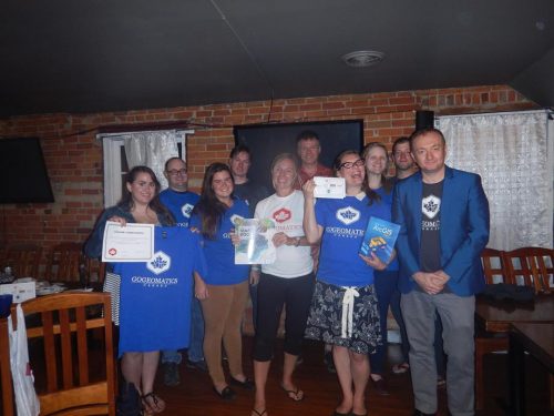 Jonathan Murphy: Marikka thanks for sharing the Fleming GIS program and your insights as a GIS instructor with the community. We look forward to seeing you and your students this September at the Peterborough GoGeomatics Socials this fall. Everyone in is welcome to this free event where we will give out our famous GoGeomatics Tshirts and share some munchies. GoGeomatics will be having our Back to School Meetup in Peterborough on Wednesday, September 19th at 180Hunter.com pub.
Marikka Williams: Thank you for the opportunity to be a part of it!


