GeoIgnite 2019: 3 weeks away
The last month has been a lot of fun and a lot of work. Now that we are just weeks away from our first national conference and everything is coming together.
First, the support from the community has been tremendous. Across the board I’ve never felt such enthusiasm for what we are trying to do with this conference. From the private to the public sector, people have expressed how much they want this event. If you take a look at our exhibition hall you will see the companies that have stepped up to support a vendor neutral IT and Location Tech event. We are featuring companies like MapBox, Spatial Networks, Ecopia, SkyWatch, Planet, MAXAR and so many more. Not only are they exhibiting, but many are speaking about their latest data products and services. 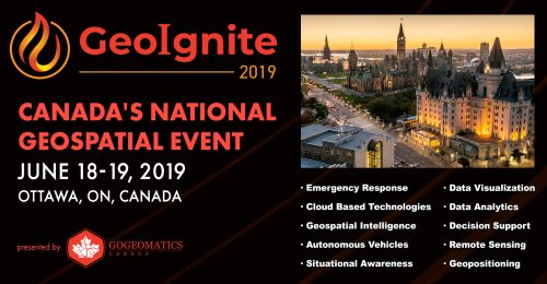
We also have organizations like NRCan, Statistics Canada, Department of Defense, Public Procurement, Agriculture Canada, Nav Canada, the office of the Privacy Commissioner and Statistics Canada exhibiting, speaking, and most importantly engaging with each other and with the community.
The open source community is also involved, with OSGEO Ottawa putting together an excellent full day of training and expertise. Get your tickets soon. The afternoon is almost sold out!
The goal of the event is to create an annual national-level conference that has a focus on location technology and services with geospatial at its core. We are inviting all those players that leverage location in sectors like telecom, finance & insurance, Smart Cities, space, energy and utilities, legal, construction, security, and sustainable development.
This year we have over 40 speakers on topics ranging form the legal issues around “big Data”, to Consumerization of Geospatial Knowledge Platform and Products, to the Future of Discrete Global Grid Systems. For a full list of topics, view the schedule on the GeoIgnite website.
We also have a number of talks focused on doing business and getting hired by the federal government. In particular, businesses looking to tap into the $22 billion of goods and services that are bought each year by the Government of Canada. Anyone invested in winning contracts or finding vehicles for sales will appreciate our session on doing “Geospatial” business with the Government of Canada. Public Services and Procurement Canada supply specialist Stephane Champagne will explain how to sell and win contracts with the federal goverment.
Our keynote panel will discuss the current global digital transformation that is at the heart of our inaugural event. Joining us are Keith Masback, chair of the National Geospatial Advisor Comittee (NGAC), Nadine Alameh, CEO of the Open Geospatial consortium (OGC) and Prashant Shukle, Director General of the CCMEO with NRCan.
The brand promise of GeoIgnite is that each year we will bring the latest technology and future trends in the location intelligence space to Ottawa. The global digital disruption taking place is not going to stop. Senior members of the government, business executives, and professionals will benefit from an event that showcases Canadian innovation, science and industry.
The GeoIgnite exhibition hall has sold out, our workshops are filling up, and we are putting the final touches on the agenda. Mayor Jim Watson is joining us for our plenary day, which speaks to the welcome we have received as an event in Ottawa.
Canada’s capital has been a global leader in telecommunications technology for many years. Today, Canada’s capital is one of the hottest and most diverse tech hubs in North America. This conference has a great home in Ottawa at the intersection of innovation and the public and private sector.
I hope I see you this June at GeoIgnite 2019.
A big thank you to our sponsors:


