Tags:
, , , ,

Coronavirus Maps of Canada

What follow is a list of websites that are hosting online maps of the coronavirus in Canada.

As our community is all about the maps I would be curious as to what you think is the best map in terms of GUI and information presented in a useful manner.

In no particular order:

CTV has a tracking page with stats and a map here
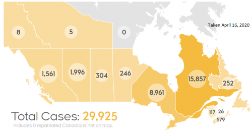
https://www.ctvnews.ca/health/coronavirus/tracking-every-case-of-covid-19-in-canada-1.4852102

Macleans’s has a “Heat” map of the outbreak available

https://www.macleans.ca/news/a-heat-map-of-coronavirus-cases-in-canada/

Health Canada has another example of mapping the data here:
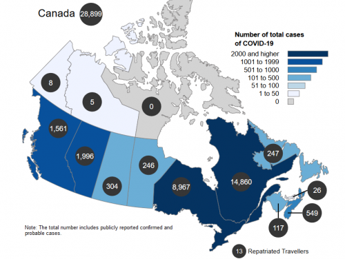
Taken on April 16th, 2020

https://www.canada.ca/en/public-health/services/diseases/2019-novel-coronavirus-infection.html

Related Articles

Canadian Geospatial Digest Nov 26

Canadian Geospatial Digest for November 26th, 2024

Canada’s National Geomatics Expo MUNStar-1 Satellite Project Launched with Provincial Support GIS Tackles Homelessness in Abbotsford UK and Canada Partner…

Canadian-digest-Nov-11

Canadian Geospatial Digest for November 11th, 2024

Solar Solutions Developed by the University of Waterloo for Safer Airports Real-time provincial road traveler information is part of the…

Significant increase in lidar-derived elevation data coverage

Significant increase in lidar-derived elevation data coverage

The National Elevation Data Strategy team has increased its production rate. Detailed 3D products now cover 49% more area since…