GoGeomatics Editors & Writers Picks of Important Canadian Geo Stories of 2022
- Zalak’s Pick: Restoring the Great Lakes is a Multination Effort
- George’s Pick: GIS Used to Map Canadian Health Access Gaps
- Jake’s Pick: AI Used to Measure Canada’s Urban Sprawl
- Ken’s Pick: New Long Range LiDAR System by Draganfly
- Alefiya’s Pick: British Columbia’s Earthquake Notification System Proves Its Worth
- Jon’s Pick: Funding Granted to 21 Canadian Organizations for Satellite Earth Observations
Zalak Bhavsar, GIS Technologist, City of Winnipeg, Zalak’s Pick: Restoring the Great Lakes is a Multi-nation Effort
It’s been 50 years since the Great Lakes Water Quality Agreement came into being.
Over the centuries, the Great Lakes have suffered extirpation of beavers, wetland loss, waterborne diseases, sedimentation, invasive species, habitat destruction, industrial pollution, and fires.

Image of Lake Superior, which accounts for 10% of the worlds fresh water
In 1970, the Canada Water Act was established by the Canadian Government, and the USA established the US National Environmental Policy Act. Just two years later, these two countries created the Great Lakes Water Quality Agreement. This agreement was designed to protect and restore the Great Lakes.
Research, new perspectives, goals, laws, and negotiation led to a new, updated agreement in 1987, revealing 47 (26 American, 12 Canadian) of the most polluted areas. It took a while to get funding, but by cleaning and restoring the Great Lakes the two countries had spent $6.5 Billion Canadian and $17.5 Billion US by 2019.
After 50 years, three Canadian and 6 USA sites have been removed from the areas of concern. Although this is a great step, there is still more to do.
George Petropoulos, GIS Technician, George’s Pick: GIS Used to Map Canadian Health Access Gaps
Effective geographical healthcare access is a challenge in Canada.
There is no need to explain the importance of being within a reasonable distance from hospitals, clinics, health providers, and pharmacies.
ArcGIS tools are being adapted to measure and give a realistic picture of healthcare network accessibility. Nova Scotia was used as an example as it is currently suffering from doctors retiring while communities age and supporting infrastructure is slow to be built. Drive times and walking distances were measured. Social determinants of healthcare were measured as well. Problems like long drive times and serious health risks due to the inability to find timely care were also addressed. 
Using GIS to measure healthcare access will help healthcare decision-makers and planners. GIS can measure adequacy effectively when used as an intuitive tool, combining distances between services and communities. In Canada, access to government-funded healthcare is the responsibility of the provinces and territories.
Using GIS tools gives a clear picture of the issue.
Jake MacLean, Intermediate Geospatial Technician with MDA, GIS Analyst with Statistics Canada, Jake’s Pick: AI Used to Measure Canada’s Urban Sprawl
Urban sprawl affects climate change.
To control this issue, cities need to control the sprawl, as well as population density. Over the last 20 years, major Canadian urban centres have grown 34% with a 6% fall in population density.
New and expanding urban areas are also adding more vehicles to the roads and highways. This article discusses urban sprawl in detail. Canadians seem to occupy more space, living farther from city centres and causing more commuting. This increase in commuting creates more emissions. 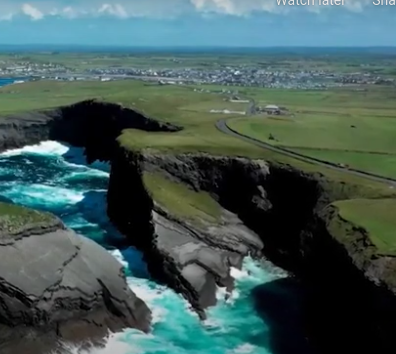
Information from satellite images and an AI algorithm were used to get the data needed to create the maps showing urban sprawl and population density.
Remote work created a new kind of urban sprawl. Even though there is less traveling to work, there are still other related costs.
Provinces are dealing with the issue in different ways. To handle this issue, travel and home-ownership options need to be addressed. This will involve construction entrepreneurs, transit planners, environmentalists, and urbanists working together to develop a long-term solution.
Ken Ang, Geospatial Specialist, Ken’s Pick: New Long Range LiDAR System by Draganfly
The LiDAR drone market is growing rapidly and Draganfly is a part of it.
The drone market can attribute lightweight drones and affordability for the steady growth of the market. Draganfly, a company that has been a part of the Canadian market for a while, has announced its new North American product that improves on conventional photogrammetry methods. It produces high-resolution data (two million points per second) and includes procession software. It is compatible with UAVs and aircraft, as well as being mountable on vehicles to be used as a mobile scanning unit. 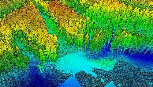
This long-range system can be used on difficult or dangerous terrain while the operator stays at a safe distance.
Draganfly’s use of LiDAR will increase the focus of this technology in Canada as drones make it easier and safer to survey and map the various, vast terrains in this country.
Alefiya Dungrawala, Volunteer Writer for GoGeomatics, Alefiya’s Pick: British Columbia’s Earthquake Notification System Proves Its Worth
On November 25, 2022, at 7:50 p.m., a 4.8 magnitude earthquake rocked northwest of Tofino on Vancouver Island. ONC (Ocean Network Canada) says its seismic sensor network analysis shows the value of an upcoming notification system.
ONC sensors provided 43 seconds of warming before the ground began shaking 231 to 235 km from the epicentre on Vancouver Island. The system has been tested for several years to provide increased emergency and safety measures, as well as increased notification for the public.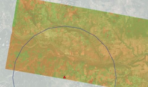
The real-time sensors are located in the ocean near the Cascadia Subduction Zone, as well as being attached to a network of land-based sensors. This is designed to give maximum warning time. This location of sensors, minimizes data-processing delays and communication, allowing timely warning delivery.
A special algorithm calculates the magnitude and location of the earthquake to determine when the ground-shaking will travel to certain locations. The amount of warning received depends on the location to the epicentre.
The earthquake warning system is a collaboration between several community, government and industry, and academic groups. Some groups are Ocean Networks Canada, Natural Resources Canada, Emergency Management BC, the University of British Columbia, the United States Geological Survey, and the Pacific Northwest Seismic Network.
When it comes to earthquake warning systems, every second matters.
Jon Murphy, Founder of GeoIgnite, CEO of GoGeomatics Canada, Jon’s Pick: Funding Granted to 21 Canadian Organizations for Satellite Earth Observation
Satellites have been used by Canadian experts for 60 years to monitor our environment.
Minister of Innovation, Science and Industry, Francois-Phillipe Champagne, and Parliamentary Secretary to the Minister of Natural Resources and the Minister of Environment and Climate Change, Julie Dabruisin, announced the release of “Resourceful, Resilient, Ready: Canada’s Strategy for Satellite Earth Observation,” as well as investing $8 million into 21 Canadian organizations. The funding is through the Canadian Space Agency’s (CSA’s) smartEarth initiative and is to be used for advancing innovative applications focusing on Earth observations and sustainable developments.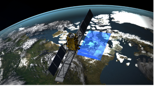
Earth observation is important to take action when it comes to climate change and its effects. Methane and carbon dioxide emissions, as well as sea ice changes, can be studied easily from space with satellites. They have become critical to adapting to climate change and gathering precise information about our planet.
The unique data collected from satellites like RADARSAT Constellation provides much-needed information that will help with current and future climate issues and solutions.


