Exploring Geospatial AI: Fighting and Tracking Wildfires
With the rapid growth of AI in recent times it has become clear that its application to many fields will bring added value and capabilities that lead to great leaps and bounds in those respective fields. We have already looked at some of the ways AI is being used in concert with geospatial data and some of the amazing breakthroughs that have been made. Fighting wildfires is something that has traditionally been done from the ground and with limited resources compared to the task at hand at times. However, putting AI together with geospatial applications is proving to be useful and promising for the future of wildfire fighting.
Due to multiple record breaking fire seasons worldwide over the past few years, including 2023 being Canada’s worst in recorded history, many people are looking for any solution they can find to help in the struggle to contain these overwhelming fires. A few solutions that have come to the forefront of this conversation include geospatial technologies for forest fire protection and detection. However effective these technologies may be on their own, it appears that AI will give them the ‘level-up’ needed to make them exceedingly efficient and effective.
Faster Detection
While visual observation has always been important when it comes to fire detection, sometimes it can be too little too late and fires may have grown too large when they reach a suitable size for detection. However, California has deployed a new software from DigitalPath, to train AI models to detect visual signs of wildfires using the existing Cal Fire network of 1039 HD cameras, which covers roughly 90 percent of California’s most fire-prone areas.
The system processes “billions of megapixels” every minute, improving response times and identifying early fires, allowing for the firefight to begin when the events are still at a manageable size. Cal Fire has also partnered with Fireguard, using classified spy satellites, drones and other aircraft to detect fires. The hope of the Cal Fire AI project is that it’s success will be measured by the fires you never hear about, as their early detection will lead to being extinguished before becoming a threat to public safety.
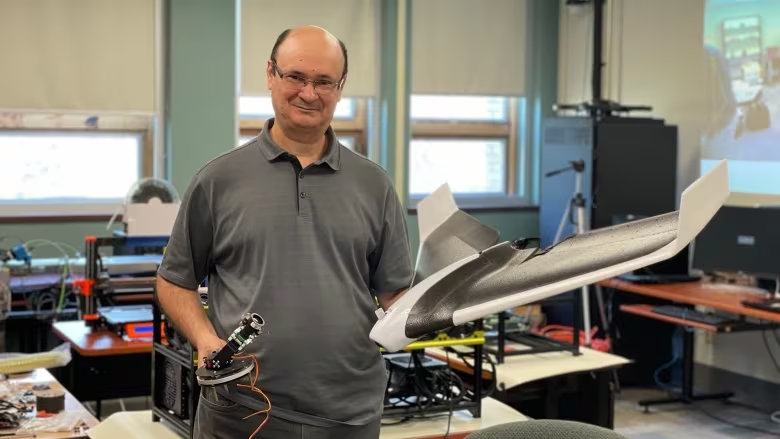
In Canada, researchers and engineers from Université de Moncton are working on the threat of wildfires in a similar manner, using AI to detect them faster and more accurately. The system developed at the Perception, Robotics and Intelligent Machines Laboratory, works around an algorithm that incorporates satellite and drone imagery. The algorithm, while still being finely-tuned, is already performing at higher than 99% accuracy in some fire-detection trials, spotting fires in the data that would be missed by the human eye. The algorithm also provides predictions of where a fire may spread to, allowing for resource allocation decisions to be supported from the moment of detection, hopefully greatly improving our ability to extinguish the fires before they become a threat.
Faster Response
The team is also exploring the use of drones to fight the fires themselves, which seems straight out of science fiction. AI is better suited to control thousands of drones at once than a human is, or at least that’s the hope, as student researcher Marc-André Blais works to fine-tune an algorithm that could coordinate a “swarm” attack of drones to extinguish fires that have been detected, further enhancing the systems ability to get a jump start on the fires before they have a chance to become dangerous.
Google is also contributing significantly to the fight against forest fires with their AI model integration into popular applications like Google Maps. Using a combination of AI and satellite imagery, Google provides updated boundary outlines of large active forest fires every 15 minutes in the most fire-prone areas of Canada, USA, Australia, and Mexico, with plans to continue expanding their coverage. Knowing where a fire currently is is a good first step, but they also have plans to work with machine learning algorithms to understand fire dynamics better, and set forth providing training to firefighters and developing better fuel treatment plans.
Identifying High Risk Areas through Prediction
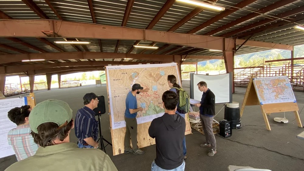
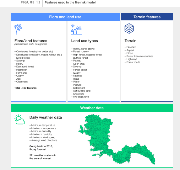
Since the first models of how forest fires spread were created in the 1940s, they have continually evolved and improved. These complex models integrate the variables that contribute to the path a forest fire may take, such as forest type, weather, topography, ignition source and more. The development and improvement of these models have allowed us to predict with greater accuracy the direction a fire will move, along with its intensity, providing decision makers with timely information to organize evacuation orders and protect both human lives and infrastructure. Two types of fire prediction models generally exist.
The first type of prediction is considered “pre-fire prediction” and, as the name suggests, it concerns identifying areas where fires are most likely to occur. Scientists involved in pre-fire prediction look at “whether and where a fire will ignite” based on the available data for the variables discussed above to determine the likelihood of fires occurring at a given location. For this type of prediction, modelling longer-term conditions like drought and precipitation patterns, forest makeup and fuel availability, likelihood of storms or events that could start fires is very important.
The second type of predictions that currently exist are those “post-fire predictions”, or essentially, “we have a fire that has started and we need to know what it is going to do next”. The modelling variables that are important to this second prediction type are generally more here-and-now conditions like wind direction, imminent weather, and precipitation expectations.
Future Prevention Efforts
Canada is serious about using technology to fight fires in the future, as it plans to launch WildfireSat, “a $170-million satellite meant to use thermal imaging to deliver vital information to fire stations twice daily to facilitate decision making”, something that researchers and developers will welcome. With more data available to incorporate into AI and machine learning models, we can expect greater accuracy and efficiency, leading to improved fire fighting results.
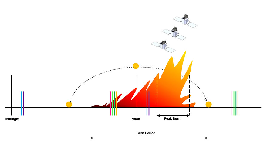
These emerging applications of AI and geospatial technology are already proving extremely useful when it comes to the fights against wildfires. From faster detection of fires in remote areas thanks to AI detection algorithms to faster response times due to the use of drones, AI, and satellite imagery, wildfires should continue to become more manageable. These efforts that contribute to the early extinguishing of fires and the prediction of ‘hot-spot’ areas to monitor closer are yet another important proof of the overwhelming power of combining geospatial technology with AI and machine learning.
Further Reading
[1] https://arstechnica.com/information-technology/2023/08/firefighters-use-ai-to-spot-wildfires-in-california/
[2] https://www.cbc.ca/news/canada/new-brunswick/moncton-researchers-developing-artificial-intelligence-to-fight-wildfires-1.7039569
[3] https://www.theglobeandmail.com/business/article-how-artificial-intelligence-can-help-detect-and-fight-wildfires-in/
[4] https://www3.weforum.org/docs/WEF_The_Next_Frontier_Wildfire_Fighting_2023.pdf
[5] https://theconversation.com/predicting-and-planning-for-forest-fires-requires-modelling-of-many-complex-interrelated-factors-207185
[6] https://blog.google/outreach-initiatives/sustainability/google-ai-climate-change-solutions/
[7] https://www.fs.usda.gov/rm/pubs_int/int_rp115.pdf


