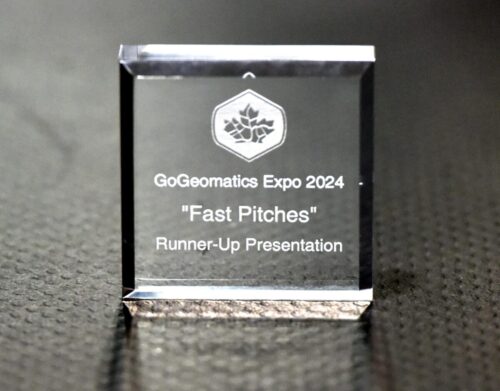
The Art of the 3-Minute Geospatial Presentation
It takes certain skills to make a rapid and effective pitch for your project, product, or paper. Participants in the “Fast Pitches” session of the 2024 GoGeomatics Expo demonstrated such skills splendidly. We present the winners and recap all presentations.
In an hour, nine excellent presentations were made—rapid, sometimes frenetic, but quite informative and fun!
The GoGeomatics Expo, held in Calgary Canada October 28-30, 2024 exceeded all expectations, as did the inaugural vent in 2023. In addition to a large exhibit hall, there were educational sessions, industry talks, and a career fair. One of the sessions allowed geospatial practitioners and students to practice their rapid presentation skills before an audience and panel of judges. Every presentation was not only delivered effectively but also demonstrated advances in geospatial technologies and techniques.
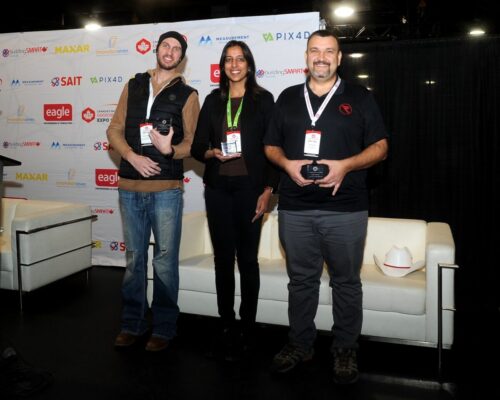
Winners of the GoGeomatics Expo 2024 “Fast Pitches”: Runner-up Christopher Kercheval, presenting on behalf of: “The Committee” (left), Tania Chahal, who presented the winning entry on behalf of Dalux (center), and runner-up Horia Jurcovan, delivering on behalf of R-E-A-LiT (right).
The format was 3-minute pitches (with or without PowerPoint decks), followed by 2 minutes of questions from the audience and judges. Presentations were judged on the effectiveness of the pitch, and not necessarily the merits of the project/product/paper (though all were pretty amazing on that count). “Fast pitches” was inspired in part by the “Pitch the Press” session of the GeoWeek event (held annually, in February in Denver), expanding the scope to encourage and include student projects/papers.
It might sound cliche, but every presentation was top-notch. However, per plan, three presentations were chosen (to be covered in full articles for publication in GoGeomatics and/or xyHt magazine).
Overall Winning Pitch: Dalux
The judges unanimously selected the pitch by Tania Chahal, PMP, customer success manager with Dalux. Chahal delivered engagingly, with clarity of purpose, and with essential elements covered. Dalux is an international developer of tools and solutions for BIM. Among the challenges facing adoption of BIM, that Chahal effectively addressed viewing and sharing among partners and stakeholders, data management, the crucial on-site component, and facilities management. Chahal then demonstrated Dalux’s approaches to managing and addressing these challenges showcasing real-world examples.
Runner-Up Pitch: “The Committee”
Christopher Kercheval, a Reality Capture senior support specialist, and Mack Kowalski, principal of LiDAholics Consulting, tagged teamed on an introduction to “The Committee”, an initiative they have recently launched to foster baseline education and standardization for the booming field of Reality Capture. Both are well-known geo-personalities (among who I call the “literati”) and are seasoned presenters. Judges were impressed with the way they shared the presentation duties, transitioning from point to point without missing a beat. “The Committee” has been formed to help new reality capture practitioners (there has been a huge wave of adoption of the evolving technologies). How can new users make sense of the inconsistent ways manufacturers state performance specifications? Do training and supporting resources have a baseline of what aspects of reality capture are the most critical, and how to effectively teach them? Could some kind of certification program be developed? The Committee, they explained, will address these and other elements, with a commitment to solution agnostics, and openness (responding to user community input).
Runner-Up: R.E.A.LiT
One of the hallmarks of a good presentation for the geospatial sector (and any sector) is how well the presenter understands the audience, potential clients, and the subject technologies. And delivering this in a manner that engages as many as possible. Horia Jurcovan is a pro at this, evidently with much experience in this field. Judges were impressed by his folksy, conversational style—and appropriate geo-humor. R-E-A-LiT is a provider of hardware, software, and solutions for reality capture, and has been rapidly growing their footprint in North America.
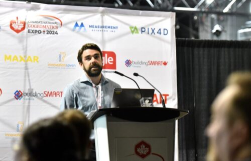
Jeff Benjamin, GIS Specialist with Dillon Consuting
Dillon Consulting
Jeff Benjamin designed and presented a very effective PowerPoint that fit perfectly into the 3 minutes allotted. The broad portfolio of Dillon Consulting’s services and solutions was outlined: data integration for mapping, development, infrastructure analysis, and more.

Vivienne Wu, MDA Sales Director, Canada and Latin America, Data and Services
MDA
In a decidedly technical presentation, Vivienne Wu outlined a new approach from MDA for remote sensing. Well-paced, effective, and informative; a splendid example of a great way to convey a technical subject.

Lukas Fraser, Vice President, Product, Looq
Looq
The Looq team has developed a novel AI+camera approach to terrestrial photogrammetry for surveying and utility applications. How to convey this in 3 minutes was the challenge that Lukas Fraser, vice president for product, met handily. A very engaging speaker, Fraser stepped through the challenges this new approach can solve, followed by a brief outline of how it works and where it could best be applied.

Christy Monaco, Cheif Operating Officer, OGC
Open Geospatial Consortium
A great overview of the OGC’s mission, activities, and importance for the geospatial sector was presented by Christy Monaco, chief operating officer. Christy’s use of firsthand anecdotes added to the effectiveness of this presentation
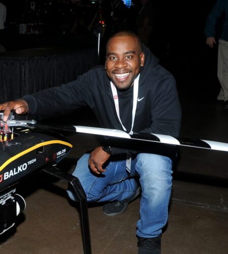
Yvonel Grimard-Ducharme, Balko Tech
Balko
The audience could not help but be impressed by the enthusiasm for geospatial (and Balko’s solutions) demonstrated by Yvonel Grimard-Ducharme. Balko has developed a truly modular solution for UAS payloads. Yvonel deftly presented the advantages of modular systems and real-world examples.
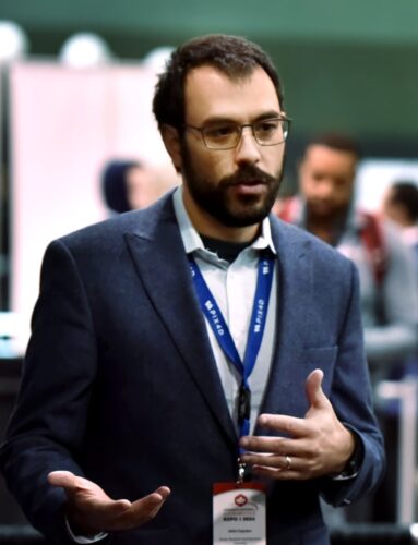
Sleim Erguden, Senior Business Development Executive, Pix4D
Pix4D
New options from Pix4D for their cloud services, and Pix4D Engine was the theme of Selim Erguden’s pitch. The adoption of terrestrial and airborne capture has seen a meteoric rise, and so have the challenges in processing and managing large numbers of capture instances. Erguden outlined very clearly where these updated tools can alleviate bottlenecks and streamline worksflows.
A big shout out to geo-journalists Anusuya Datta and Mary Jo Wagner for joing the judging panel.
Do you have a cool geospatial project, paper, proposal, product, or service? Consider presenting at the GoGeomatics Expo 2025 “Fast Pitches”.


