The Impact of Machine Learning & AI on Geomatics
What is Machine Learning?
Machine learning and Artificial Intelligence (AI) are hot areas of technology commercialization these days. So, what is machine learning? It is the ability of machines (computers) to learn like humans without the need to program them. This learning can be supervised where a teacher directs the learning through training sets of data, it can be completely unsupervised or it can be somewhere in between. Many of popular technology terms have something to do with machine learning. These include data science, big data, data mining, data analytics, statistical learning, pattern recognition and computer vision. In summary, machine learning is the attempt to give computers human-like abilities to process data, find patterns from it, come to conclusions about them and predict outcomes in similar situations in the future. 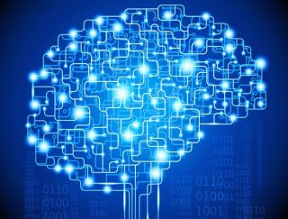
How is machine learning different from AI? AI is the general field of making computers acquire human-like abilities that make them “smart”, whereas machine learning is a specific application of AI where machines are given a set of data and they process it, acquire inferences from it and generally learns from it like we humans do. Machine learning research has been going on since the 60s, but it is only now that its commercialization in technology has really peaked due to cheap and abundant processing power of computers as well as discovery of new implementation techniques. As a result, universities are losing AI and machine learning researchers to industry.
Applications of Machine Learning in Geomatics
Although machine learning and AI were traditionally used in remote sensing and image processing, recently new applications of it have cropped up in location selection and smart navigation in GIS. Thus, the field of Geomatics as a whole is being transformed by machine learning and AI. Esri calls the marriage of GIS and AI, “Geo.AI” and is beginning to incorporate it in its software. In its next phase of advancement, it is pushing towards AI-enabling its products. It is hiring data scientists and AI researchers to lead this transformation.
Perhaps the most visible application of machine learning has been in autonomous vehicle research. Self-driving cars use multiple sensors. Their data is fused together and real-time decisions are made for cars to successfully navigate through heavy traffic. Road signs are “read” and “understood” by the cars, the movement of other vehicles and pedestrians are processed and affect the movement of such cars, while constantly using information from map databases for location and navigation needs. 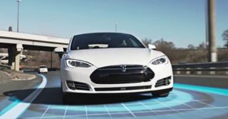
Similarly, machine learning is being used in drone or UAV technology. The sensors on the drone capture images and video which are being processed in real-time to make decisions. This uses research in pattern recognition, feature detection and feature extraction to learn about the environment around the flight path of the drone and make autonomous decisions. Soon, it will be possible for drones to be on autopilot and fly their missions successfully with minimal instructions and control.
How will the Geomatics Job Market be Affected by Machine Learning?
All these changes mean that Geomatics job market and education will change in a few years. Already, there is significant demand for professionals who have experience in both machine learning and Geomatics in the United States. Universities like John Hopkins are incorporating AI in its Geomatics curriculum. These changes will happen in Canada and the rest of the world as well. Good quality Geomatics programs will be impacted by computer sciences not just by teaching how to program, but also in teaching machine learning, AI and computer vision techniques.

FILE – In this Tuesday, Aug. 1, 2000 file photo, visitors of the world exhibition Expo 2000 stand in front of a robot display at the “Planet of Visions” exhibit at the Expoground in Hanover, northern Germany. Use of robotics in manufacturing and other sectors is increasing in countries from the United States and China, and robots have long been embraced for a variety of uses in countries such as Japan. There also has long been “robophobia,” stoked by science fiction writers and moviemakers. (AP Photo/Fabian Bimmer)


