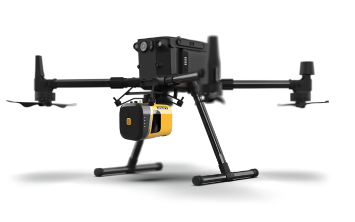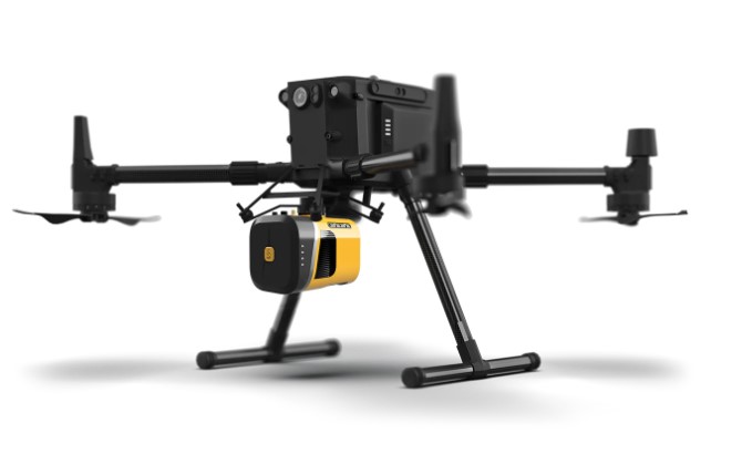
With the exponential growth of the Unmanned Aerial System (UAS) industry in the last decade, the geospatial community has greatly benefitted from its usage. Resultantly, a wide variety of LiDAR sensors from a range of manufacturers are available on the market. YellowScan, GeoCue, DJI, LiDAR USA and Phoenix are just a few. This article will highlight the necessary considerations for adopting such a sensor.
The UAS
The UAS that will carry the sensor can complement or can be a limitation. Ensuring the weight and size of the LiDAR system meets the UAS payload capacity is a factor contributing to safe operations [1]. In addition, the lighter the payload, the more time aloft the UAS will be.
Direct geo-referencing capabilities of the UAS can impact what solutions can be used. For example, the DJI M300 RTK and the L1 LiDAR sensor combination eliminate the need for a post-processed Global Navigation Satellite System (GNSS) solution while a sensor with an Applanix solution would require a post-processor [1]. This directly impacts ground survey control activities as well.
Attaching the sensor of choice to the UAS can be as easy as a turn-key solution whereby a mounting system has already been created by the manufacturer for a specific UAS [1]. However, building a custom mount may be necessary when using a custom UAS platform [1].

Capabilities Of the LiDAR System
A geospatial program can have a variety of needs, deliverables and projects. These range from construction projects, volumetric surveys, general topographic surveys, and forestry surveys to powerline inspections [1]. Each of these surveys requires a different grade of sensors [1]. For example, a volumetric survey of sand piles would not need multiple returns from the sensor. However, a forestry survey would require a sensor with multiple returns whereby the LiDAR can penetrate tree canopies to reach the forest ground. In addition, it must be able to collect data when an area is slightly wet and has an effective range that allows the UAS to fly above the tallest trees safely [3].
Determining the level of both relative and absolute accuracies is important as well. For example, performing change detection on a slide area which is rapidly changing over a short period of time compared to a road survey where engineers require an end product that can be used for their planning purposes [3].
The density of the senor measured in points per square meter determines the level of definition needed for the project [1]. Powerline surveys typically require a high definition where the integrity of the structures and wires are of interest [3].

Photogrammetric capabilities
Having a camera part of the system can greatly benefit the deliverable. Benefits range from creating a high-resolution orthomosiac that can aid in engineering designs, a low-resolution orthomosiac for general spatial awareness to a camera that’s capable of colourizing the LiDAR point cloud [3].
However, a drawback can be the additional weight of the camera on the limited UAS of choice payload capacity. Typically, the larger the sensor size with its associated lens the larger the weight. In addition, some systems have cameras and their associated mounts requiring a separate purchase [2].

Software
Post-processing of the collected data upon returning from the field can be just as challenging as collecting the data. To handle this, most manufacturers have created integrated software suites that can perform the necessary post-processing steps [1]. YellowScan, DJI and GeoCue are some examples. However, the range of software capabilities is extensive and a program might need a few different types.
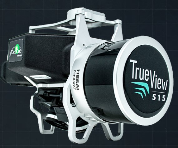
Typically, when working with an inertial navigation system (INS), a dedicated processor is required. [3] Examples are Applanix PosPac or Waypoint GrafNav. Next, the INS solution and calibration procedures would need to be applied to the raw LiDAR point cloud and raw images. These software suites are usually produced by the manufacturer. Examples are GeoCue TrueView EVO and YellowScan’s CloudStation. In addition, if an orthomosiac is required, photogrammetric software will be necessary. Examples are PIX4D or Agisoft Metashape [2].
Conclusion
With a wide variety of systems made for a range of different purposes, the decision can be hard to reach. However, the above considerations combined with determining the deliverables and internal workflow of the geospatial UAS program can be a good starting point.
Sources
[1] https://geocue.com/sensors/sensor-selector/
[2] https://drones.measur.ca/collections/lidar
[3] https://www.terraremote.com/services
[4] https://www.phoenixlidar.com/solutions-overview/
[5] https://www.lidarusa.com/products.html


Be the first to comment