Saeideh Hejazi
Saeideh Hejazi holds a GIS certificate from Fanshawe College and a master's degree in urban and regional planning.
In the past Saeideh has worked with GIS for humanitarian relief. Volunteered for UN, Crowd2Map Tanzania and URISA’s GISCorps as a web mapper using OpenStreetMap, ArcGIS Online and Story Maps. This experience motivated her to obtain her GIS graduate certificate in 2019, and afterward, she worked for the City of Waterloo as a GIS infra technician. Saeideh also worked as a data analyst and Tableau developer. She has more than 1 year of experience with data visualization and analytics tools including Tableau Desktop and Tableau Prep.
In her spare time, she researches and writes geospatial articles and manages the volunteer team for GoGeomatics Canada.
Articles by Saeideh Hejazi
Overcome Challenges, Interview with Roshni R. Sharma Part 2/2
In the first part of this interview, Roshni talked about her professional journey and the geospatial global mentorship program that…
Geospatial Mentorship program, Interview with Roshni R. Sharma Part 1/2
I had a great conversation with Roshni R. Sharma, Project Manager & Geospatial Analyst, at FrontierSI in Australia and one…
Pesticide use public presentation using ArcGIS StoryMaps and Instant Apps
The beginning of the story In the past summer, Kamloops Food Policy Council (KFPC) launched a research project to study…
Canadian Wildfire Mapping Resources 2021 Fire Season
Western Canada has been experiencing extreme fire conditions following an intense heatwave since late June. According to BC Wildfire Service,…
Code in Place: Free Python course hosted by Stanford University
Last year, almost at the beginning of the COVID-19 pandemic, I attended a Python programming course for almost five weeks.…
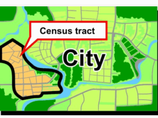
What are Statistics Canada’s geographic terms: CT, CSD, CMA and more
Geographic data are applied in any location-based projects. We all might hear a lot about geographic terms but when we…
GeoIgnite 2020 Video: Diversity in Leadership Panel
GeoIgnite is Canada’s National Geospatial conference hosted by GoGeomatics Canada. GeoIgnite was held online using Zoom July 22nd to 24th,…
GeoIgnite 2020 Video: Statistics Canada DEIL experiments and outputs with open geospatial data
GeoIgnite is Canada’s National Geospatial conference hosted by GoGeomatics Canada. GeoIgnite was held online using Zoom from July 22nd to…
GeoIgnite 2020: Growing Canada’s Next Earth Observation (EO) Generation
GeoIgnite is Canada’s National Geospatial conference hosted by GoGeomatics Canada. GeoIgnite was held online using Zoom July 22nd to 24th,…
Leadership in Times of Disruption: GeoIgnite 2020 talks at a Glance
Canada’s geospatial community is gathering next week for GeoIgnite 2020. The second annual conference is being held online this year…
COVID-19: Supporting Kamloops, BC businesses using Story Maps
In the middle of March 2020, COVID-19 pandemic leads to social distancing rules in Canada. Public areas such as restaurants…