Fall 2022
LIDAR ACQUISITIONS 2022 IN SUPPORT OF THE FLOOD HAZARD IDENTIFICATION AND MAPPING PROGRAM (FHIMP)
Flood hazard maps are essential to understanding a community’s risk to flooding. In Canada, many flood maps are not always available or up-to-date. High quality flood mapping that is current and accessible will help governments, communities, and individuals understand flood hazards and implement effective mitigation strategies to reduce the impacts of flooding.
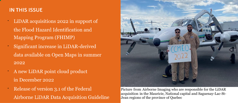
In this context, Natural Resources Canada has been leading the Flood Hazard Identification and Mapping Program (FHIMP) since 2021 in partnership with Environment and Climate Change Canada and Public Safety Canada. Under this program, the federal government, in partnership with provinces and territories, are currently deploying a joint action plan to advance flood hazard mapping in highest-risk areas. This plan includes airborne LiDAR acquisitions to provide an up-to-date three-dimensional representation of the terrain, and in some cases, of riverbeds, which are essential to the creation of flood hazard maps.
According to this action plan, it is expected that after the first two years of the program (2021 and 2022) a total of 67,000 km2 of topographic LiDAR data (mapping terrain) and 1,200 linear km of topo-bathymetric LiDAR data (mapping riverbeds) will have been acquired in various regions of Canada. All of these data are aligned with the standards of the Federal Airborne LiDAR Data Acquisition Guideline and will be integrated with existing Open Maps products to be made freely available to all Canadians. In addition to being used for flood hazard mapping, these data will therefore be useful for several other analyses.

SIGNIFICANT INCREASE IN LIDAR-DERIVED DATA AVAILABLE ON OPEN MAPS IN SUMMER 2022
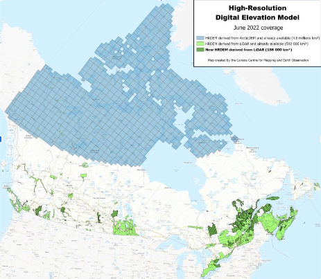
NRCan announced in June 2022 a new release of HRDEM and HRDEM Mosaic products.
With this, more than 185,000 km2 of LiDAR-derived elevation data have been added to Open Maps. In terms of area covered, this is the largest release of LiDAR-derived data to date by NRCan.
This new data is located in the provinces of British Columbia, Alberta, Saskatchewan, Manitoba, Ontario, Quebec, Nova Scotia and Newfoundland and Labrador. The total coverage of LiDAR-derived HRDEM and HRDEM Mosaic data now reaches nearly 800,000 km2 and covers 91 of the 100 largest Canadian cities.
With this new data release, over 34 million Canadians – 89% of the population – lives within the region covered by the HRDEM and HRDEM Mosaic products. The LiDAR data used comes from numerous government organizations across the country, as well as from acquisition projects performed by NRCan. All of this highly detailed 3D information provides essential foundational geospatial data for many government projects and priorities, such as flood mapping, forest inventories, climate change monitoring, and urban management.
For LiDAR projects acquired by NRCan in the Niagara-Hamilton (Ontario) and Last Mountain Lake (Saskatchewan) regions, building footprints that have been extracted from LiDAR have also been added to the Automatically Extracted Buildings product. These footprints are automatically extracted from building classifications in the LiDAR data. They contain information such as elevation and minimum and maximum building heights. The data is available either by download or through a Web Map Service.
A NEW LIDAR POINT CLOUD PRODUCT IN DECEMBER 2022
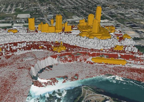
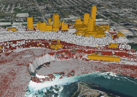
 A new LiDAR point cloud product will be officially announced in the fall of 2022. The LiDAR point cloud product will be the 3rd product in the CanElevation Series, created in support of the National Elevation Data Strategy led by NRCan.
This new offering will contain the entire LiDAR point cloud datasets acquired so far by NRCan, which equals to close to 60,000 km2. Coverage will increase as new LiDAR acquisitions are carried out.
All LiDAR point clouds in the product will be distributed in a compressed .LAZ / Cloud Optimized Point Cloud (COPC) format. The new open COPC format is an octree reorganization of the data within a .LAZ 1.4 file, allowing for more efficient use and rendering of visualizations via HTTP calls (e.g., via the web), while providing the capabilities of the compressed .LAZ format that is already well established in the industry. The point cloud files will therefore be downloadable on Open Maps for local use as well as viewable directly via URL links from a cloud environment.
The LiDAR point clouds will be referenced to the Canadian reference systems currently in use, i.e. NAD83(CSRS) epoch 2010 and the corresponding UTM zone for the horizontal system and CGVD2013 for the vertical system.
As with all NRCan CanElevation series products, the LiDAR point clouds will be distributed under the Open Government License.
RELEASE OF VERSION 3.1 OF THE FEDERAL AIRBORNE LIDAR DATA ACQUISITION GUIDELINE
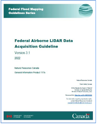
Natural Resources Canada is pleased to announce that the Federal Airborne LiDAR Data Acquisition Guideline version 3.1 was published in July 2022.
The purpose of this document is to provide guidelines for airborne LiDAR acquisitions in Canada to support the development of high-resolution elevation data products at the national scale. The approach is to try to harmonize airborne LiDAR collection requirements within the federal government and across all provinces and territories.
This new 3.1 version contains many new features. Thanks to a collaboration with the Canadian Forest Service, the Forestry appendix has been thoroughly updated to reflect the newest advancements in LiDAR technology, and how they relate to the best practices in forest inventory applications and the most up- to-date scientific literature. Various changes have also been made to the guide to make it easier to use and to correct certain minor issues. This new version of the guide is part of NRCan’s desire to continuously improve it based on recent advances and emerging
trends in the field of airborne LiDAR in Canada and internationally.
This document is published as part of the Federal Flood Mapping Guidelines Series developed to advance flood mapping activities across Canada, which is critical to support informed decisions to reduce the impacts of flooding in communities. Natural Resources Canada and Public Safety Canada work in partnership to increase the resiliency of Canadian communities to flood through mitigation measures such as flood mapping, which is a key tool for a better understanding of flood risk.


Be the first to comment