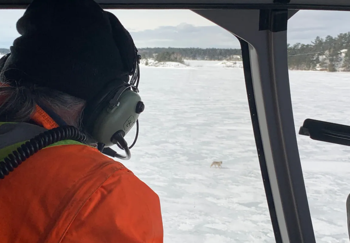
A study on eastern wolves near Georgian Bay is taking a unique approach by braiding western scientific techniques together with Indigenous knowledge systems.
Researcher Jesse Popp and Theodore Flamand, the Wiikwemkoong species-at-risk coordinator, are working with the University of Guelph and the Ontario Ministry of Northern Development, Mines, Natural Resources, and Forestry (MNDMRNF) to study wolf conservation. Scholars commonly use the term ‘two-eyed seeing’ to describe the weaving together of Indigenous and western approaches.
Eastern wolves are a somewhat elusive species. Popp said there is a long history of eastern wolves interbreeding with other wolf species and coyotes; at present, researchers don’t know for certain whether a genetically unique eastern wolf population exists in the area. The wolves are known to exist in larger numbers near Algonquin Park, but their behavior near Georgian Bay remains somewhat of a mystery. The eastern wolf is designated as of special concern under Ontario’s Endangered Species Act.

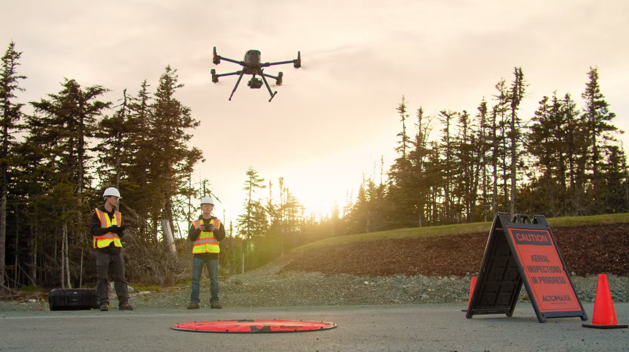
Newfoundland upstart AltoMaxx takes lead in the global drone industry
AltoMaxx, a St. John based company, has carved out a niche as the first independent provider of certification for the drone industry. AltoMaxx uses high-end drones — some costing more than a tricked-out pickup truck and equipped with infrared sensors and thermal imaging — to service government agencies and heavy industry.

They perform aerial inspections of power lines and wind turbines, scan underground infrastructure using ground-penetrating radar to help engineers assess sites for large construction projects, detect methane gas leaks in natural gas pipelines or at refineries and use thermal imaging to scan the woods for lost hikers. Realizing a massive opportunity in 2019, they started to run certification programs to train licensed drone operators.
Yellowknife man creates an alternative to Google Earth for northerners
Northerns are aware of the lack of detail Google Maps provides. Logan Rudkevitch created an alternative, Logan Earth. Rudkevitch, a passionate climate change advocate, found that Google Maps’ 30 x 30m resolution limited awareness of changes happening to the land as well as exacerbating efforts at finding people lost in compromising situations.
Logan cites the difficulty of noticing the massive permafrost mega slumps in the Peel region as a sort of wake-up call to develop the mapping tool. With the elevation of the land changing from year to year as the ground thaws, current mapping programs can fall short in conveying the scale of permafrost thaw in the territory. The end result, he argues, is that comprehending the scale of permafrost activity becomes challenging and is accessible only to specialists.

Apple Maps just launched a really cool 3D feature in Toronto
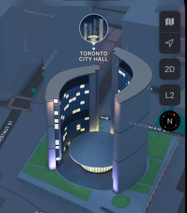
The multinational technology company announced the new feature this week for three Canadian cities — Montreal, Toronto, and Vancouver — along with a bunch of upgrades to their map app. The CN Tower, City Hall, and Toronto’s many, many condos now appear in three dimensions with a new map feature by simply tapping 3D in the slide menu bar on an iPhone.
The three-dimensional city view comes with “rich detail” and includes enhanced navigation and “amazing details for road markings, land cover, trees, elevation, and public transit routes,” Apple said in a press release. Users can see elevation details across a city, new road details, and custom-designed landmarks such as Notre-Dame Basilica in Montreal, and Robson Square in Vancouver.

Why UPEI has the largest drone fleet for a Canadian university
Members of the University of Prince Edward Island’s (UPEI) climate lab fly drones from remote areas every suitable day in the spring and summer months. Twenty-nine drones are used for everything from monitoring farmland to figure out which areas produce higher yields, to surveying how climate change affects coastal erosion rates. The coastal erosion monitoring initiative is the reason the fleet exists in the first place.

The drones come in an assortment of sizes and functionality; some of the larger ones are outfitted with LiDAR sensors. Hundreds of missions are flown each year and the data the team gathers provides invaluable climate tracking information and trains potential drone pilots for gainful employment.
Next Generation 911: Location matters when verifying addresses and allocating resources
Across Canada, the public safety 9-1-1 community is facing a critical, pivotal moment in its history. The existing 9-1-1 system was designed in an era of landline telephones and assumes the calls are coming from fixed, known addresses. Today, most emergency calls originate from smartphones and IP devices, often while away from home. As a result, these changes are driving this historic evolution to next-generation 9-1-1 (NG9-1-1).

NG9-1-1 will enhance the safety of the Canadian public by allowing the use of new media and data for reporting emergencies and events; for example, streaming video from an emergency incident, sending photos of accident damage or of a fleeing suspect, or sending personal medical information–such information could greatly aid emergency responders and provide for greater situational awareness.
The coordinates of a mobile device will be used to route the call to the correct Public Safety Answering Point (PSAP). The coordinates of the call will be overlaid with the PSAP boundaries. To work properly, accurate and up-to-date GIS data is critical. The effectiveness of the NG9-1-1 system will be dependent on the GIS data it uses. What is required is a rapid update system that can consume and aggregate GIS data, built from authoritative sources which meet public safety (NENA) standards.


Be the first to comment