
- Navy Testing Explosive Drone Boat in First Proof of ‘New Operational Concept’
- New Mapping Tool Supports Aquaculture Growth
- Esri Adds Indigenous Datasets in the New Living Atlas
- Nearly a Third of Forests in Northeast B.C. Could Burn by Year’s End
- Protecting North Atlantic Whales From Collisions with Vessels
- Canada’s Largest Cemetery Launches New Map Locating Final Resting Place of Notable Montrealers
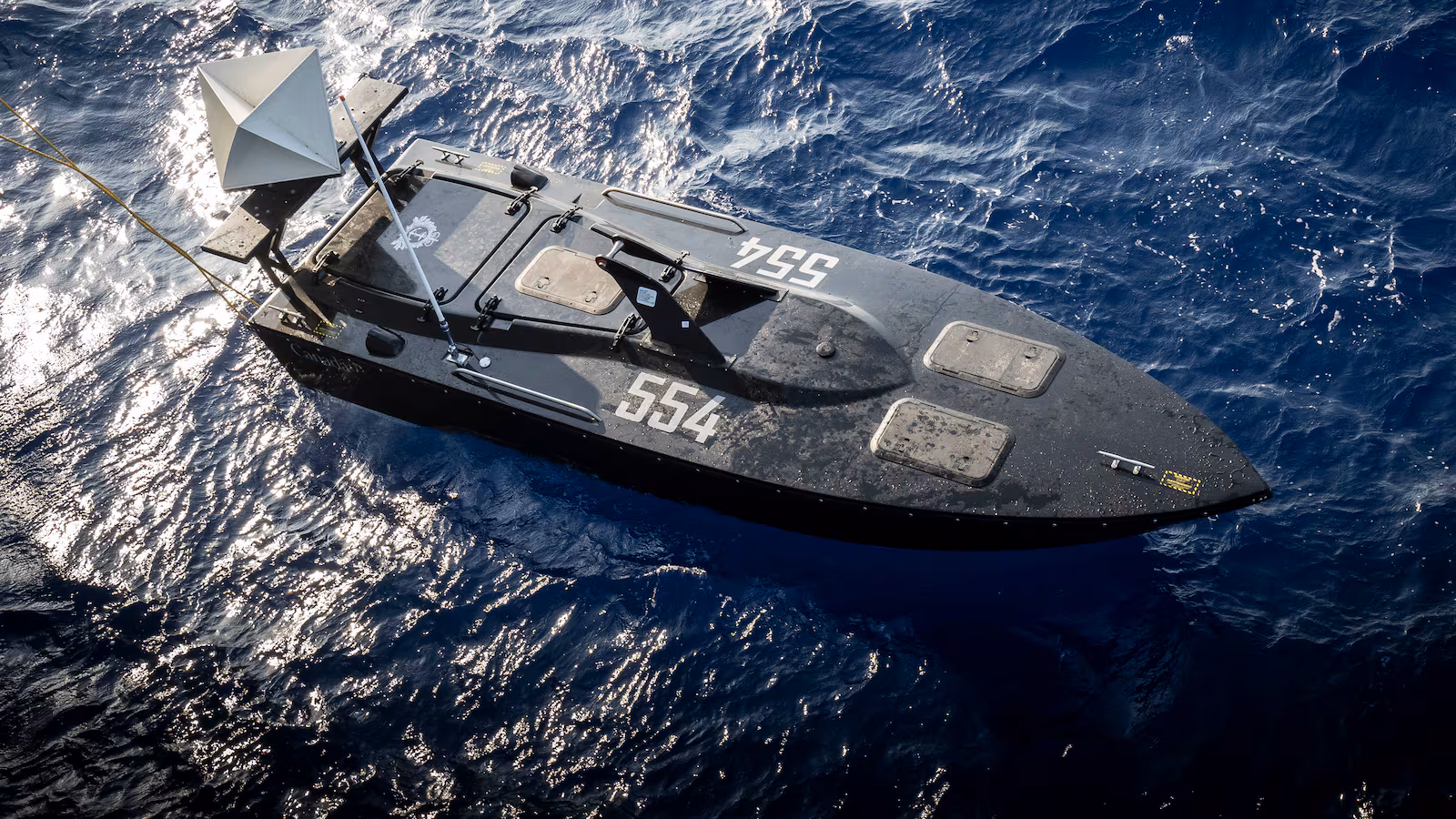
Navy Testing Explosive Drone Boat in First Proof of ‘New Operational Concept’
Concepts for explosive-packed drone boats are being tested by The Royal Canadian Navy. The boats themselves were controlled and detonated by a satellite link, which involves a high degree of precision from the satellite and real time data analytics to accurately navigate water to the destination. The concept of the explosive-packed drone boat was inspired by Ukrainian innovation in the early stages of the Russian – Ukrainian war.
Read more details and quote from military professionals here
New Mapping Tool Supports Aquaculture Growth
The Province of Nova Scotia is supplying the aquaculture industry with detailed mapping and data analytics to help with optimizing the industry and maintaining responsible growth within the local ecosystem. The tool is publicly available farming suitability ratings, as well as mapped out perimeters for coastal ecosystems.
Read more here and view the tool here
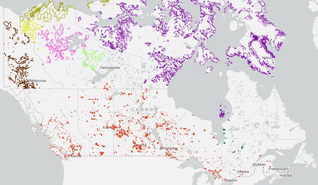
Esri Adds Indigenous Datasets in the New Living Atlas
Indigenous communities are pushing for self-determination now more than ever. To help them with independent decision making on their land, mapping is a powerful tool to support this. The Living Atlas combines geographical and cultural for a national database that not only keeps things accessible, but is able to educate all Canadians. The current state of the map showcases land boundaries, assists with remote community energy organization and sources, mining agreements, modern and historic treaties, and a lot more. Each topic has their own database and is available publicly.
Read more here
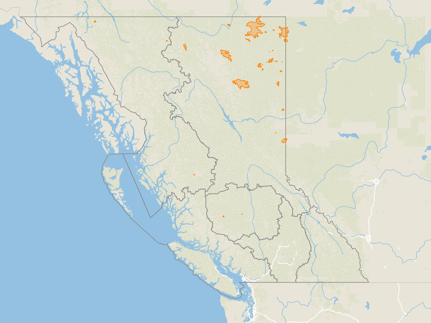
Nearly a Third of Forests in Northeast B.C. Could Burn by Year’s End
Canadian wildfires are a continuous effort that all Canadians will have to participate in preventing. With such wide spread hazards, it crucial that we not only maintain current mapping and analytical data, but use this data to prevent more fires. The human element as well as climate change has turned conditions for Canadian summers to be in a “wildfire season” for the foreseeable future. Droughts, thunderstorms, weakened forests, and human negligence are all factors affecting Canadian forests. Mapping has made a major impact in safety and monitoring as tracking fires close to populated areas not only helps people stay safe, but allows us to better understand and distribute data for first responders and fire fighters to make safe and fast decisions in a high stress environment.
Read in more detail as well as interact with the public maps here and here.
Protecting North Atlantic Whales From Collisions with Vessels
The Government of Canada, specifically Transport Canada, has issued protection measures for the North Atlantic in the Gulf of St. Lawrence area for marine transportation. The goal is to help protect iconic whale species by mapping seasonal zones and restricted areas. Monitoring will be conducted by visual and acoustic detection technologies. The combination of all these technologies showcases the how mapping can be utilized for several actions all in one graphic.
Read more here

Canada’s Largest Cemetery Launches Map Locating Final Resting Place of Notable Montrealers
Montreal has Canada’s largest cemetery and has recently taken the initiative to digitize an interactive map for individuals looking to find loved ones. Features on the map included cemetery maintenance, high profile individuals resting sites, and notable monuments. Users can now search for a loved one in the menu, and the map will locate the deceased.
Read more here and interact with the map here


Be the first to comment