
-
Teach autonomous vehicles to drive in bad weather
-
Canadian microsatellite to monitor space
-
‘CubeSats’ designed and built by Canadian students launched into space.
-
‘EOCANEX’ The Canadian Earth Observation Virtual Expo is coming soon
-
Is your house solar-friendly? Find out using the Saskatoon solar mapping tool.
-
A new mapping initiative at the Lethbridge Museum reveals the invisible lines that separate cities.
Teach autonomous vehicles to drive in bad weather
Big snowfalls, heavy rains, or fog normally make driving conditions poor. When it comes to autonomous vehicles, which have to make instant driving decisions depending on the data that they collect from their surroundings, it is not easy either.
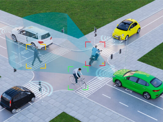
Drivers for Ottawa-based software firm Sensor Cortek have attempted to teach automated vehicles (AVs) how to drive in snowy conditions by taking them out for a test drive in a special testing area. These cars are covered with LiDAR sensors, radar cameras, and advanced GPS systems from rooftop to bottom.
The information gathered from this test drive will then be used by Sensor Cortek to build an artificial neural network and AI-based model that will enable autonomous cars to operate more securely by improving their ability to “see” in all visibility conditions. Read more in detail here.
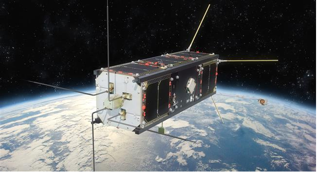
Canadian microsatellite to monitor space
Canadian microsatellite called Redwing will observe our crowded orbits in the future.
Magellan Aerospace, Winnipeg being the key contractor in this, will assist a team to design, build and operate the Redwing microsatellite which will be equipped with a group of optical sensors.
Redwing will transmit its data to ground stations in Happy Valley-Goose Bay, Newfoundland and Labrador, and Inuvik, Northwest Territories. With the design phase most likely to be ready by the fall of 2024, the construction and testing of the microsatellite will be covered by 2026.
Operating years for Redwing are said to be from 2027 to 2033. Read more about Redwing here.
‘CubeSat’ designed and built by Canadian students launched into space.
15 teams of Canadian students from each province and territory collaborated to design and construct their own CubeSat under the guidance of ‘Canadian Space Agency’(CSA) experts and representatives from the Canadian Space industry.
These teams came up with a concluded version of their miniature satellite in November 2022 at CSA.
- NEUDOSEfrom McMaster University
- Ex-Alta 2 from the University of Alberta
- YukonSat from Yukon University
- AuroraSat from Aurora Research Institute of Aurora College
On March 14th, 2023, at 8:30 p.m. ET, a new batch of CubeSat was launched at International Space Station. This was the second launch under Canadian CubeSat Project (CCP). Find out more here.
‘EOCANEX’ The Canadian Earth Observation Virtual Expo is coming soon
During EOCANEX, Canada’s Earth Observation Expo, GeoIgnite welcomes the Earth observation community to collaborate together by exchanging updates, services, and data.
In 2023, GeoIgnite will once more take place virtually, enabling the audience to grow significantly. Our event is free and open to the Canadian geospatial community, thanks to the support of our sector partners and sponsors.
From LiDAR Expo to GeoTech Training, from the Mapping Strategy Forum to GoGeomatics Meetups and Digitial Twin 2023, it’s not worth missing any. Collect details here.
Is your house solar-friendly? Find out using the Saskatoon solar mapping tool.
The City of Saskatoon is anticipating a mapping tool this year that is going to come in handy for homeowners to decide whether they should install solar panels on their rooftops. The residents can use this tool to discover how many hours of sunlight their location receives all year. This will provide a precise figure for the amount of energy the solar panel can produce.
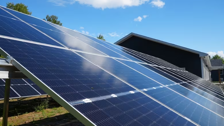
Choosing the correct panel orientation and the area size it is estimated to take up will help the resident in calculating their cost savings.
MyHEAT SOLAR (a mapping tool) will utilize data from Google Maps and Google’s Project Sunroof to give homeowners an idea of the approximate amount of dollar savings that can be achieved in the span of 25 years, covering the one-time cost of solar panel installation.
The tool is said to be the first of its kind in terms of energy-minded renovation tools. Read more here.
A new mapping initiative at the Lethbridge Museum reveals the invisible lines that separate cities.
Students from the University of Lethbridge participated in an important map-making workshop. Critical map-making was to put emphasis on existing power structures and social issues. One of the students built borderline maps that displayed a thick border surrounding the areas where households are facing housing instability.
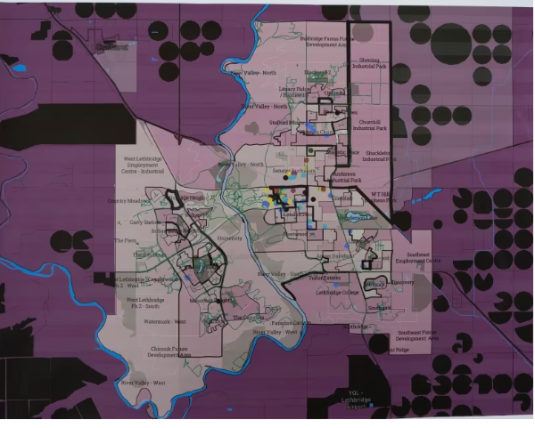
She along with her team at Urban Borderlines Research Lab compared census data to calculate the level of differences between adjacent areas. As seen on the map, thick black lines are quite prominent. The thicker the borderline, the bigger the financial differences. These are in fact the invisible borders that a present in the cities and the neighborhoods within.
Students were effective in identifying areas in Lethbridge where residents are having trouble making ends meet financially using their maps. Read more about this here.


Be the first to comment