“CHORUS will evolve our understanding of climate change”
CHORUS, MDA’s commercial Earth observation mission and a collaborative multi-sensor constellation, is gathering a lot of interest in the geospatial community.
The idea was introduced at GoGeomatics Canada’s annual geospatial conference, GeoIgnite Winter Geo. MDA’s presentation gave an overview of CHORUS and explained how the technology will be complementary to existing SAR missions and open new cases for SAR.
With this year’s theme of the conference being climate change, we explore how CHORUS will aid in the complex real-time data gathering and how we view the changes happening on the Earth.
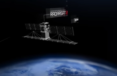
A 4th Generation C-Band SAR satellite providing RADARSAT-2 data continuity, CHORUS will be providing enhanced capabilities to existing and new end users. It will include C-band and X-band SAR satellites functioning in mid-inclination orbit in all weather conditions. Added to this, the X-band spacecraft will be in the same orbit as the MDA-built C-band SAR satellite making it extremely unique in its approach to faster tracking, delivery times, and its ability to zoom in on the cue. All this will open many new services and applications.
For example, at present, one of the biggest challenges for iceberg tracking in the northern Atlantic is navigation safety. The risk of colliding with an iceberg goes along with a bigger carbon footprint and increased cost for shipping companies to deliver products across the Atlantic. The bigger question here is how you accurately map out icebergs that provide data in all weather conditions, says Wayne Hoyle, Senior Director of Business Development at MDA, while speaking to GoGeomatics Canada.

Earth observation satellites are used to bring the data by covering portions or ‘strips’ of north and south. Hoyle explains that for us to have continuous coverage across the Atlantic we need a lot of such strips but there’s always the limitation of missing the iceberg, if, for instance, it is positioned between the strips. Therefore, the orbit of Chorus will provide better coverage across the Atlantic. Hoyle added that tracking and monitoring icebergs more precisely in all weather conditions will ultimately lead to ice map development that is temporal and will help ships to navigate more economically.
These thoughts were also echoed by Professor Dr. Vern Singhroy, who has worked as Chief Scientist of the Canadian Space Agency RADARSAT Constellation. “Chorus offers potential due to its numerous nimble characteristics i.e., high-resolution functionalities complimenting the bigger satellites. With CHORUS, we can improve our climate change monitoring because we will get data on an hourly basis,” said Vern. “With rapid data to monitor quickly, society and scientists will be able to watch the processes to better understand what is happening on the ground.”

The same technology of varied data gathering and image capture will allow CHORUS to monitor deforestation on a ten-day cycle. The X-band and the C-band will help gather hi-res images from broad areas spanning hundreds of kilometers and help in narrowing to small areas to see changes in forestation over a significant period and determine if it is an illegal activity or anything else, explained Hoyle.
Hoyle further added CHORUS will be working with RADARSAT 2 in a complementary fashion. “CHORUS is evolving from the same baseline as RADARSAT 2. It’s a more mature and capable solution to RADARSAT 2 or the Canadian government’s RADARSAT constellation missions.”
With its launch yet to be announced, Professor Singhroy is positive about CHORUS’s capabilities in helping us reflect on the future. Indicating oil spill surveillance as another niche market for CHORUS to potentially tap into, he says that the imaging capacity of over 55 million square kilometers means it can detect both small oil spills and large coastlines. He says that while we have existing systems for surveillance, the strong winds tend to change the currents, so we need rapid imagery to overcome the issue.
“High resolution optical and radar is the future. It will help in observing the processes of climate change, flooding, and damages arising from it and help in adapting mitigation techniques and resilience,” said Prof Singhroy.


Be the first to comment