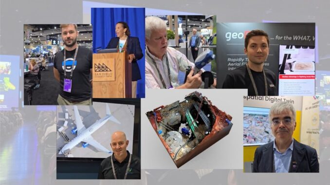
In addition to the always inspiring plenary and informative tracks, there was plenty of Geo-Coolness in the exhibit hall. We conducted impromptu LinkedIn interviews of exhibitors with innovative products and services.
On-the-fly Anonymization

Anonymization for privacy (e.g. faces, license plates) is a hot topic, as it is mandatory in some countries for reality capture. Increasingly there are requirements for this to be in real-time (i.e. so that no private elements exist in images or videos at any point in the reality capture process).
While some of the large geospatial product and solution providers have incorporated OTF anonymization into, for instance, large format mobile mapping platforms, what we found intriguing about Celantur, is that this is a standalone solution that could easily be incorporated into almost any reality capture platform or workflow. This startup from Austria has both post-processed and real-time solutions. Interview video here.
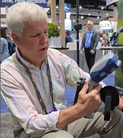
New Eos Modular Handheld+Rover GNSS System

I was connected with my old GPS bud Eric Gakstatter of Discovery Management Group, at the Eos Positioning Systems booth. Eric gave an overview of the features of the newly released Eos Skadi series modular GNSS system: built-in antenna, pole and handheld adapters, hot swap battery, tilt, offset laser, and more. This will complement the Arrow Series, which is already very popular in the GIS sector. We would not be surprised to see more surveyors tapping into this new series.
In the extended interview, we also compared notes on recent solar storms; what classes of GNSS receivers were affected, and which were not. Spoiler: cheap did not do well. Interview video here.
A NZ Underground Mapping Solutions Firm Launches in North America
 Next to space, and the world’s oceans, underground is truly one of the final frontiers. What we do not know about what we’ve put underground in the way of utilities is a source of frustration, clashes, construction hazards, and other risks. We ran into Sam Wiffen and the Reveal team. Originating in NZ, Reveal has taken a fresh approach to mapping underground utilities that we have previously profiled in xyHt Magazine and GoGeomatics. Interview video here.
Scalability for BIM and 3D Model Imports into Esri Environments

The import of complex 3D models into Esri platforms is an invaluable option. However, large amounts of data can present challenges. We spoke with the Italian firm ACCA which has developed tools for tackling such challenges. We were impressed by how seamlessly their processes are. They have many other BIM tools as well. Interview link here.
Tackling the Cost/Time Challenges of Scanning of Aerial Photo Archives

Legacy scanning methods for aerial image archives can be prohibitively time-consuming and costly. Startup Geodyn Technology has developed tools and workflows to reduce the process from minutes to seconds. A key element of their solutions is a 6-camera capture unit and an automated feed tool (which could work great for other records as well). They outlined other services, such as georegistration. Interview link here.
Sub-inch Aerial (Including Oblique) Imaging

We have featured EagleView many times, noting new and updated products and services; which we heard more about in a recent catch-up Q&A with their CEO. Their huge aerial imaging catalog continues to grow, as well as value-added services such as roof and property reports, and more recently, 3D models. We had to ask about the new sub-inch image option and were not disappointed. Interview link here.
Data Mesh Computing for Geospatial Applications

Data meshes are a powerful approach in the broader data world, but this is one of the first times we’ve seen it applied in the Geospatial sector. We got a brief from SeerAI, Inc. Their solution employs Kubernetes to provide data federation solutions for tapping any kind of geo data from distributed sources. This was one of the most deep-geek things we ran into, and with a tremendous potential for improved mining, and management of big-geo-data. A lot of recent hype might be about what can be done with data using AI, but you need to access and manage the source data first—this is especially challenging for big and widely distributed data. Seer is addressing this. Interview link here.
Other Noteworthy Items
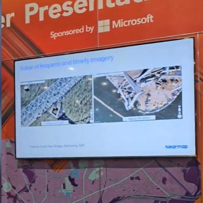
 In one of the partner theaters, NearMap presented on how GeoAI can be a key to tackling the feature extraction bottleneck that plagues mass data capture (imaging and scanning). They also showed timely before/after images used in the aftermath of the recent Baltimore Bridge event. Video clip here.

The Esri UC 2024 has its share of Geo-celebrities! Dawn Wright, PhD, chief scientist for Esri, kicked off the 9th annual Science Summit (formerly called Science Symposium). We would encourage you to attend this event in the future; this is one of the most interesting and educational parts of the UC. It is where the “science of where” meets the world of scientific endeavor. Dr. Wright also introduced and signed copies of her new book. “Mapping the Deep: Innovation, Exploration, and the Dive of a Lifetime”, chronicling her historic dive into the Challenger Deep. Video clip here.
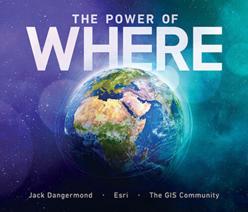
 Another great geo book: Esri President Jack Dangermond announced the publication of “The Power of Where: A Geographic Approach to the World’s Greatest Challenges”.
From the press release: Written by Esri president Jack Dangermond with a dedicated Esri team and numerous contributors, this important new book explores the geographic approach—a way of solving problems using spatial analysis to perceive and understand patterns ranging from wildlife migration and rising seas to urban planning and food production.
According to Dangermond, sustainability begins with geography. “I believed this when we started Esri, and I’m even more convinced today,” says Dangermond. “GIS [geographic information system technology] provides a platform for addressing problems, exploring alternatives, designing solutions, and sharing them in a visual way that inspires action.”
The plenary, hosted by Esri President Jack Dangermond is always inspiring. Jack invites noted geo-celebrities and customers who have taken GIS innovation and practical application to the next level. Full plenary videos are here.
One of the keynote speakers who credits Jack with inspiring him was a geography teacher. He then took this love of geography and applied it to multiple terms in national office, and later as governor of a state that leverages GIS to manage state functions and improve delivery of services to citizens. His presentation made no mention of politics, which is completely appropriate for the Esri UC plenary. Unrelated to the UC appearnce, and a week later though, he was suddenly thrust into the public spotlight on a national and international level. You can see the entire, GIS-centric presentation here.
There were key Esri product and partnership announcements, that sometimes go under the radar. However, we feel that these deserve the spotlight as such developments could have a tremendous positive impact on the rapidly growing big-geo-data trend:
Esri announced an expanded collaboration with IBM. Maximo is quite popular in the utilities and asset management sectors, and there has always been a desire for even more geospatial functionality.
From the press release: ArcGIS Enterprise on Kubernetes integrated with the IBM Maximo Application Suite is now available as an add-on, enabling users to visualize, analyze, and manage spatial data for indoor and field operations more effectively.
The integrated ArcGIS Enterprise and IBM Maximo Application Suite product is designed to give clients access to a more holistic view of asset locations, conditions, and performance, as well as augmented maintenance scheduling and resource allocation capabilities.
And an expanded collaboration with Microsoft to integrate spatial analytics technology with Fabric, Microsoft’s unified analytics SaaS platform.
From the press release: By integrating Esri technologies, data experts—including analysts, data scientists, engineers, and their executive stakeholders—can seamlessly use Esri’s advanced spatial analytics tools and visualizations within Microsoft Fabric. This results in powerful spatial analytics easily shared across organizational tools like Microsoft Fabric, Power BI, and Esri’s ArcGIS environment.
“With this collaboration, Esri is committed to helping our shared customers understand and leverage spatial data to uncover insights and make better decisions,” said Jack Dangermond, Esri president. “We are pleased to deepen our work with Microsoft and provide our spatial analytic capabilities for data professionals within Microsoft Fabric.” Initially, these tools are in private preview.
And lastly, but by no means least, for those in the geo sector who deal with land records, this year’s Land Records/Cadastral track was one of the strongest we’d seen at a UC. We are hoping the Esri puts more of the proceedings from that track online.
See you in October at the GoeGeomatics Expo; we’ll be doing more geo-coolness-hunting clips and posts.


Be the first to comment