
The 2020 Geolgnite conference was put online and brought the Canadian geospatial sector together for some important updates to ongoing work by the federal and provincial governments. One of the topics discussed was the NRCan update on the flood mapping guidelines by the federal government. The speaker was Dr Heather McGrath.
Updates on the Flood Mapping Guidelines
From 1696 to 2016, 5,780 flood incidents were recorded across Canada. To strengthen the community’s resilience against this major calamity, it will be necessary to map the hazards associated with it. In this 44-minute video, Dr. Heather McGrath, a Geospatial Scientist at the NRCan presented the progress of flood mapping guidelines by the federal government. She gave an interactive update on the completion of the guideline components, activity phases and collaborations.

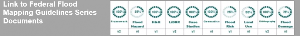
In 2015, a technical working group composed of stakeholders from the government, Indigenous organizations, academia and the private sector was assembled. This group works on drafting the guideline and the framework for its structural implementation. Overall, 78% of this guideline, which is composed of several documents, has been completed. Some of these documents can be viewed through the link provided below.
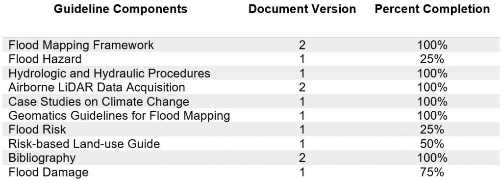
List of the guideline components and their status
Program phases and role in emergency response plan
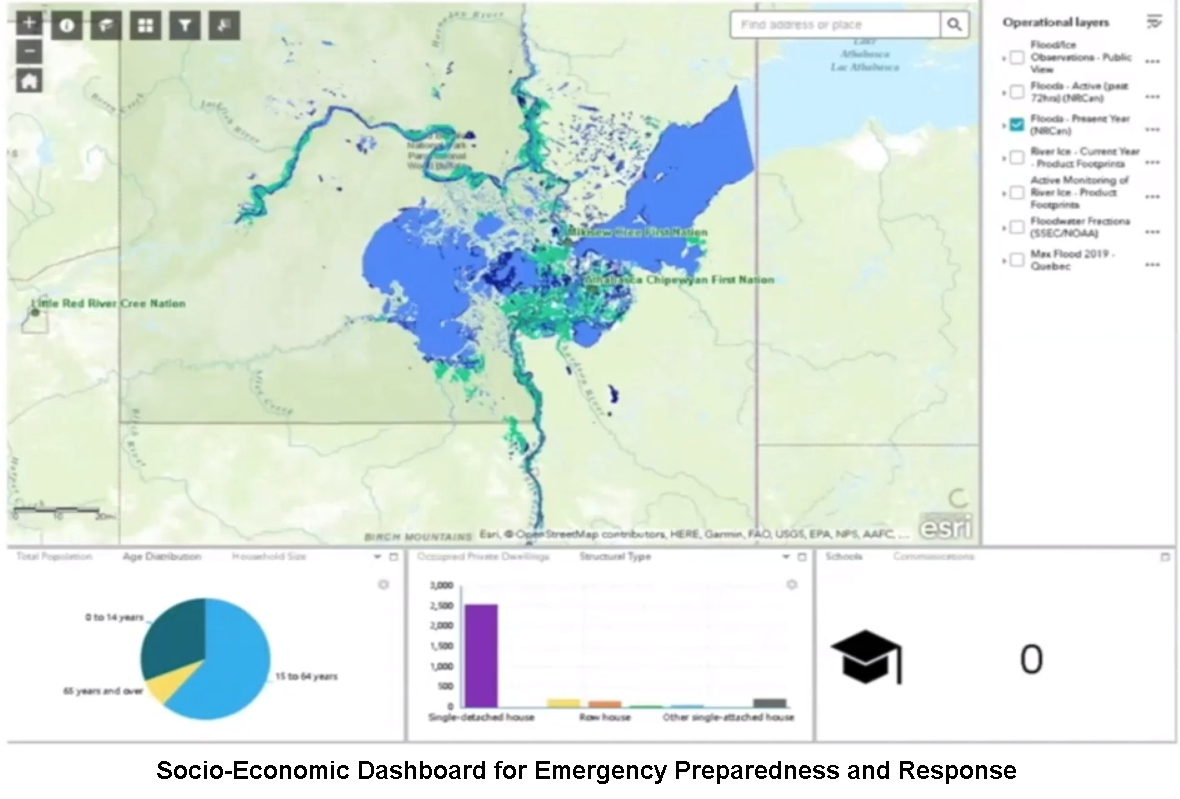
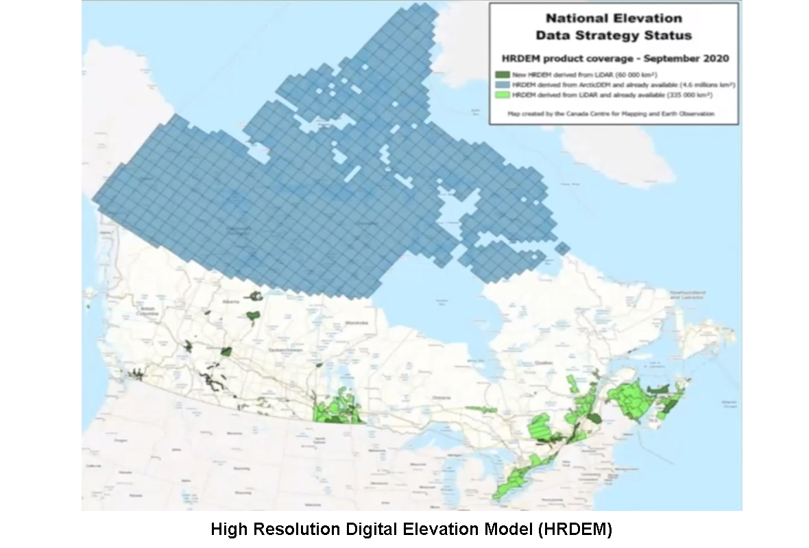
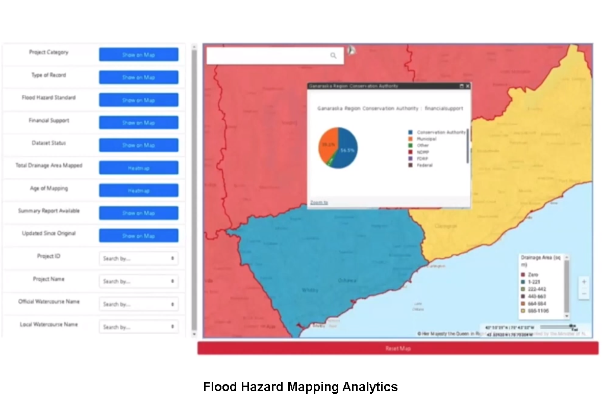
In addition to flood hazard maps and streamlining of metadata, the NRCan is devising flood mapping tools and modelling toolbox for the QGIS as extensions of these maps for software users as well as to support policy making and drafting of emergency response plans. To learn more about the program’s phases of activities, the NRCan has been organizing series of workshops and open source portals that describe how stakeholders can access its data testing and sharing platform. Some of the open source portals comprise the High-Resolution Digital Elevation Model (HRDEM) and Flood Hazard Mapping Analytics platforms.
Furthermore, the program is associated with the federal government’s program for disaster prevention and mitigation and emergency preparedness. Aside from geospatial data sharing, this program involves tapping government branches and private sector organizations to undergo series of emergency response field training to organize human resource and ground assets utilization during calamities. Moreover, this program has hierarchical response levels like municipal, local, regional and national depending on the degree of a calamity and its corresponding damages. Each response level activates a certain volume of ground resources that can be mobilized.
Significance of the session
This video is of interest to groups that focus is on integrating GIS and remote sensing technology with policy making and emergency management. This video technically demonstrated how geospatial information gaps and inconsistencies arising from various DEM sources and timelines can be resolved and what the NRCan technical working group was able to perform with its datasets. At the moment, the NRCan is exploring the usability of optical satellite imaging in addition to informative details that can be extracted from DEMs, hydrological data and ground truths.


Be the first to comment