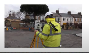

The DT-DICT Is Reducing Damages
Patrice Lemire, Directeur General Geosystems France, was the keynote speaker for the March 22, 2022, SUMSF livestream. The topic of interest was “Reducing damage to underground utility networks with the French National DT-DICT system.
In the late 2000s, several fatal accidents caused the creation of “Construire sans Detruire,” “Building without Destroying,” an anti-damage regulation.
France implemented a national damage prevention system in 2013, which requires 40 cm accuracy when locating all underground networks and infrastructure prior to the start of construction. Since 2013, in France, the annual statistics show a decrease in underground utility damage.

Lemire discussed the DT-DICT system and how it impacts France’s utility, telecom, and locate industries. He spoke about the results, constraints, challenges, and F3D. The response to a DT-DICT includes verification of the project’s technical compatibility to existing networks, technical safety recommendations are acknowledged, and the plan of the network. Lemire discussed what happens if the accuracy class of networks doesn’t meet requirements, as well as the impact of the DT-DICT on network damages.
The reasons for damages to utility networks are lack of reliable information on network location, lack of tools to correct location, and lack of real-time visualization for underground networks.
Lemire spoke about the creation of “Guichet Unique,” an online service for network operating companies to list overhead, underwater, and underground utilities, including location. He also spoke
about the classification of networks, which are represented in three classes. There is class A, B, and C, with A being the target classification.
The future of utility networks surveying looks like less time and traveling to get to sites, increased georeferencing quality while simplifying projects, 3D modeling, and reality visualization.
An informative Q and A session was held after the presentation. You can watch the en
tire presentation on YouTube below.


Be the first to comment