
It was indeed a pleasure for GoGeomatics to attend INTERGEO 2022, world’s leading convention and trade fair for geodesy, spatial data and land management. Jonathan Murphy, Managing Director at GoGeomatics and Gavin Schrock, Consulting Editor at GoGeomatics, have made great connections, especially Canadian organizations.
INTERGEO 2022 focused on the use of spatial data for internal security and for civil protection and disaster prevention. The Conference reflects the motto “Inspiration for a smarter world” in all its facets. It shows current developments in surveying: from spatial reference and positioning to 4D geodata and geospatial IoT to mobile mapping applications. The conference focused on trending topics such as Building Information Modeling (BIM) and the diverse application possibilities of the Digital Twins , but also the current requirements for the Smart City and rural areas have their place in the conference.
On behalf of the GoGeomatics team, we would like to thank INTERGEO for providing a space for the geospatial community, across the world, to gather and learn about the most trending topics, products and services in the sector.
Canadian Organizations attending INTERGEO 2022
![]()
Ecopia’s mission is to digitize the world using AI. Ecopia provides foundational information for critical decision-making, improve the welfare of societies, efficiency of economies, and health of environments. Ecopia specializes in extracting insight from geospatial big data. Their intelligent systems leverage groundbreaking advancements in artificial intelligence to convert high-resolution imagery of our earth into HD Vector Maps, which are embedded into critical applications around the world. Learn more about Ecopia here.
![]()
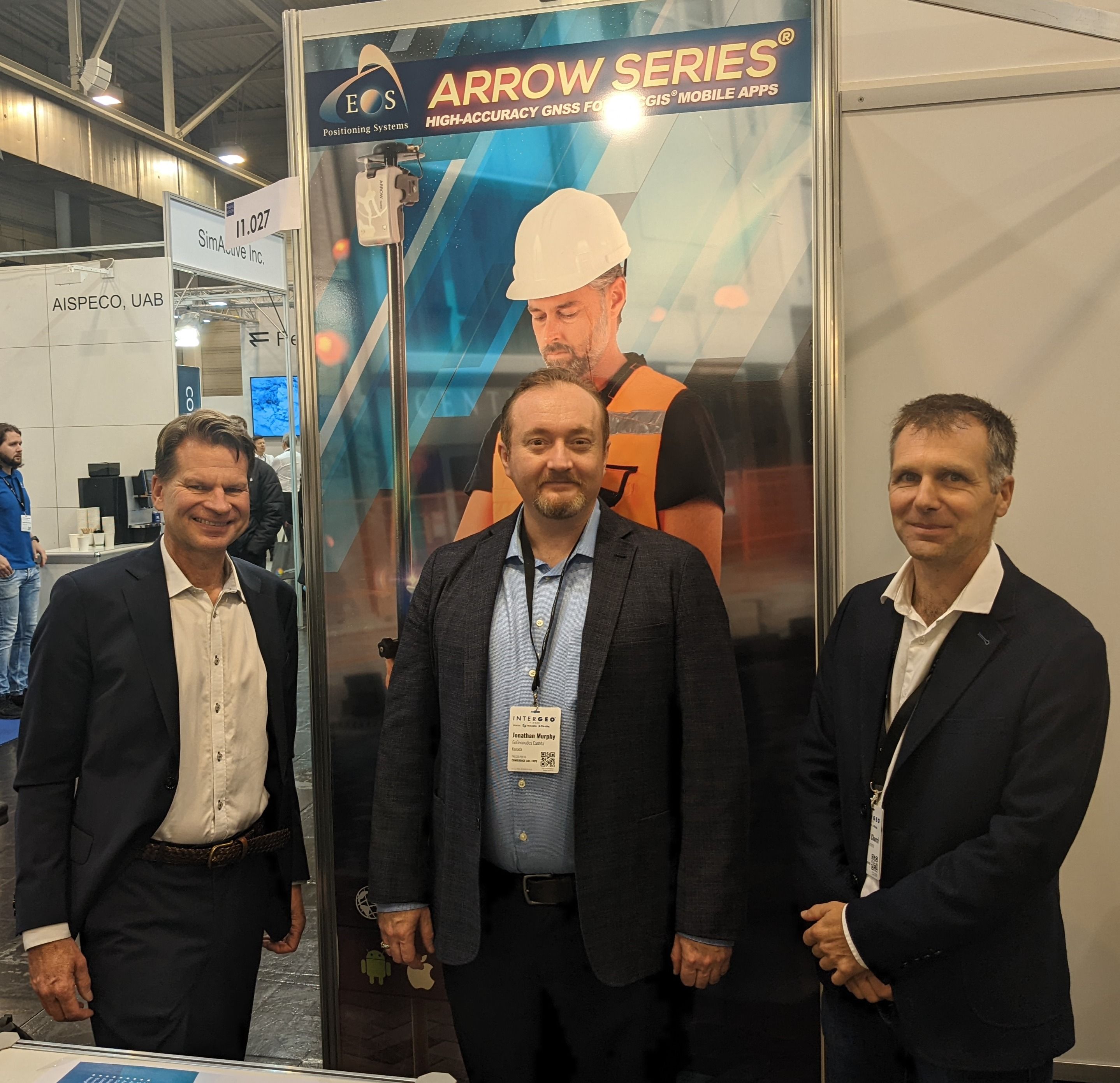
![]() Eos Positioning Systems, Inc.,® (Eos) is the North American designer and manufacturer of high-accuracy GNSS hardware and related solutions, including the Arrow Series® GNSS receivers. All Eos products and solutions are designed and manufactured just outside of Montreal, Quebec, Canada in the suburb of Terrebonne. In an effort to support the increasing flexibility demanded by today’s field crews, sometimes called the “Bring Your Own Device” (BYOD) market, Eos has made all Arrow GNSS receivers compatible with all mobile devices (e.g., iOS®, Android, Windows) and any third-party data collection app, including popular Esri ArcGIS apps and partner apps. To learn more about Eos, click here.
Eos Positioning Systems, Inc.,® (Eos) is the North American designer and manufacturer of high-accuracy GNSS hardware and related solutions, including the Arrow Series® GNSS receivers. All Eos products and solutions are designed and manufactured just outside of Montreal, Quebec, Canada in the suburb of Terrebonne. In an effort to support the increasing flexibility demanded by today’s field crews, sometimes called the “Bring Your Own Device” (BYOD) market, Eos has made all Arrow GNSS receivers compatible with all mobile devices (e.g., iOS®, Android, Windows) and any third-party data collection app, including popular Esri ArcGIS apps and partner apps. To learn more about Eos, click here.

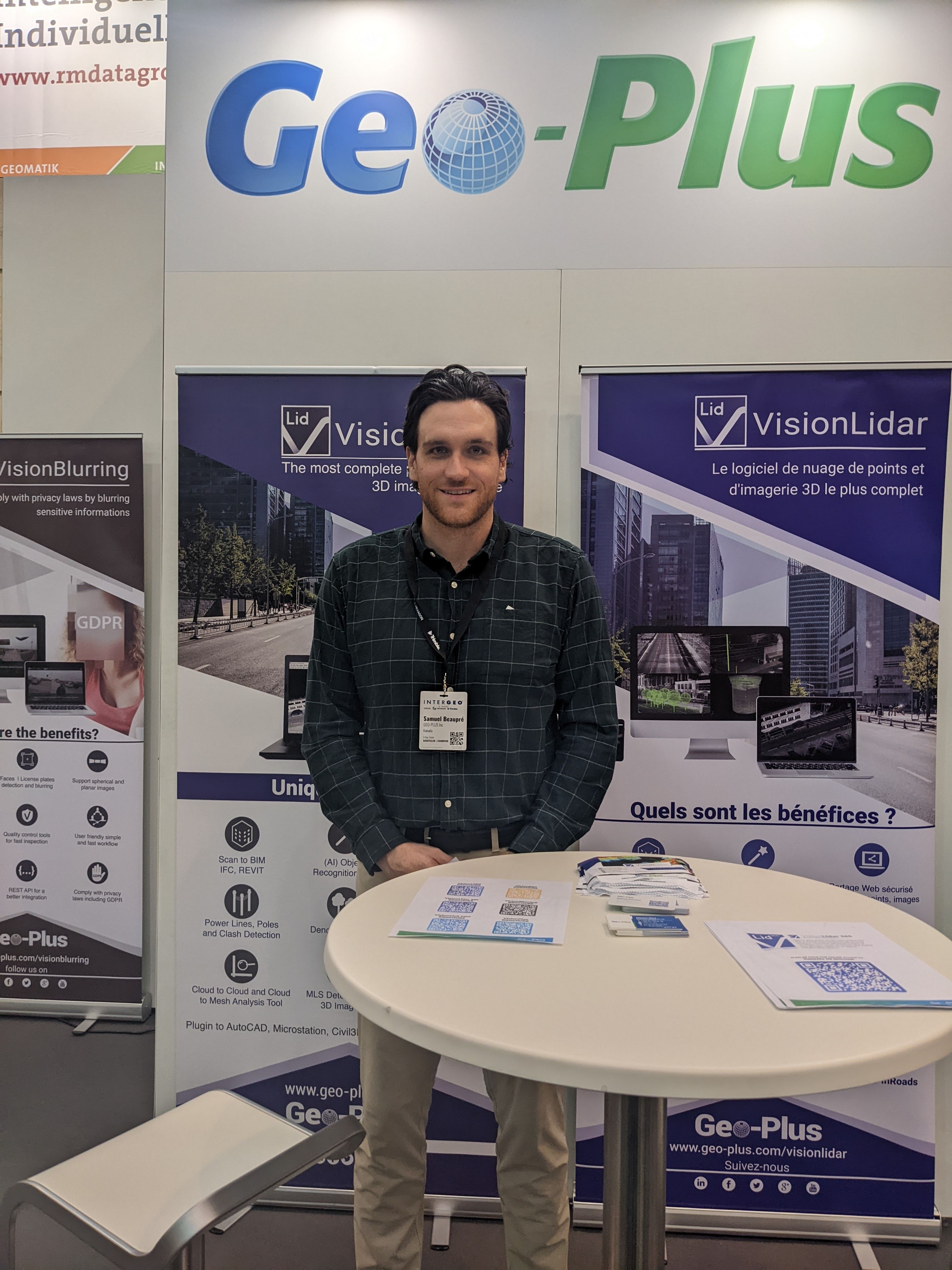
Geo-plus offers a broad selection of services which will assist you in rendering your work easier & more effective. These services include software implementation, training programs, software maintenance and geo referencing. Do you have a project you want to talk to them about? Reach out to Geo-plus and one of their representatives will be in touch with you.
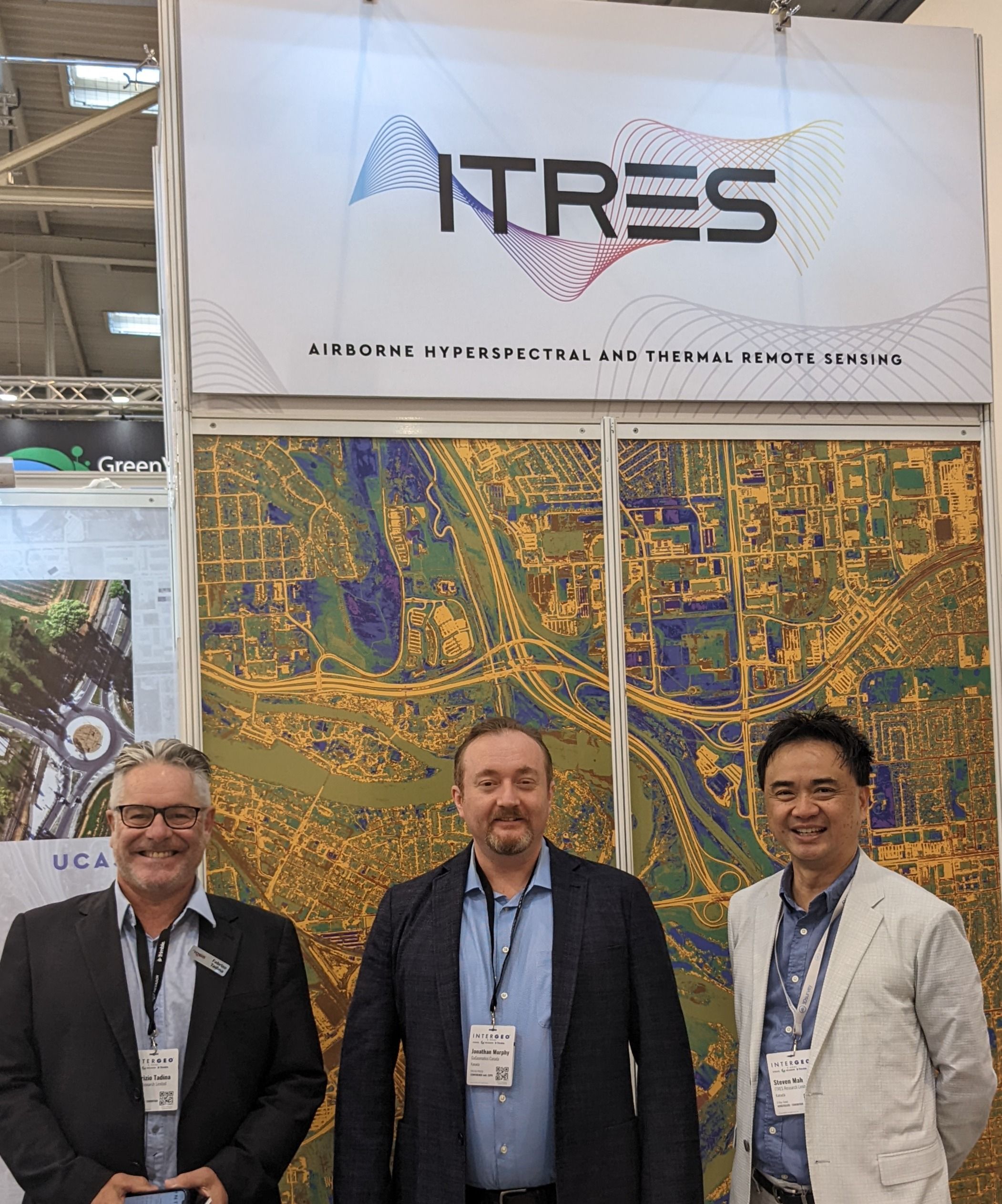
At ITRES, their commitment is to lead the commercial airborne remote sensing industry through innovation and thereby provide our clients with the highest-performing hyperspectral and thermal airborne mapping imagers available anywhere, without compromise. They’ve been doing this since our inception, more than three decades ago. ITRES continue with the introduction of the industry’s first wide-array, internally cooled broadband thermal imager, the TABI-1800.
![]()
![]() Prevu3D is a Montreal-based company that reimagines the way we experience physical spaces. Founded by mechanical engineers looking to improve their practices, Prevu3D offers a unique solution to the challenge of operating large indoor and outdoor spaces through a simple—yet powerful—collaborative 3D software. Prevu3D’s software was designed with ease of use in mind, providing users with an intuitive interface to create, edit, and share interactive 3D models based on real-life environments.
Prevu3D is a Montreal-based company that reimagines the way we experience physical spaces. Founded by mechanical engineers looking to improve their practices, Prevu3D offers a unique solution to the challenge of operating large indoor and outdoor spaces through a simple—yet powerful—collaborative 3D software. Prevu3D’s software was designed with ease of use in mind, providing users with an intuitive interface to create, edit, and share interactive 3D models based on real-life environments.
![]()
![]()
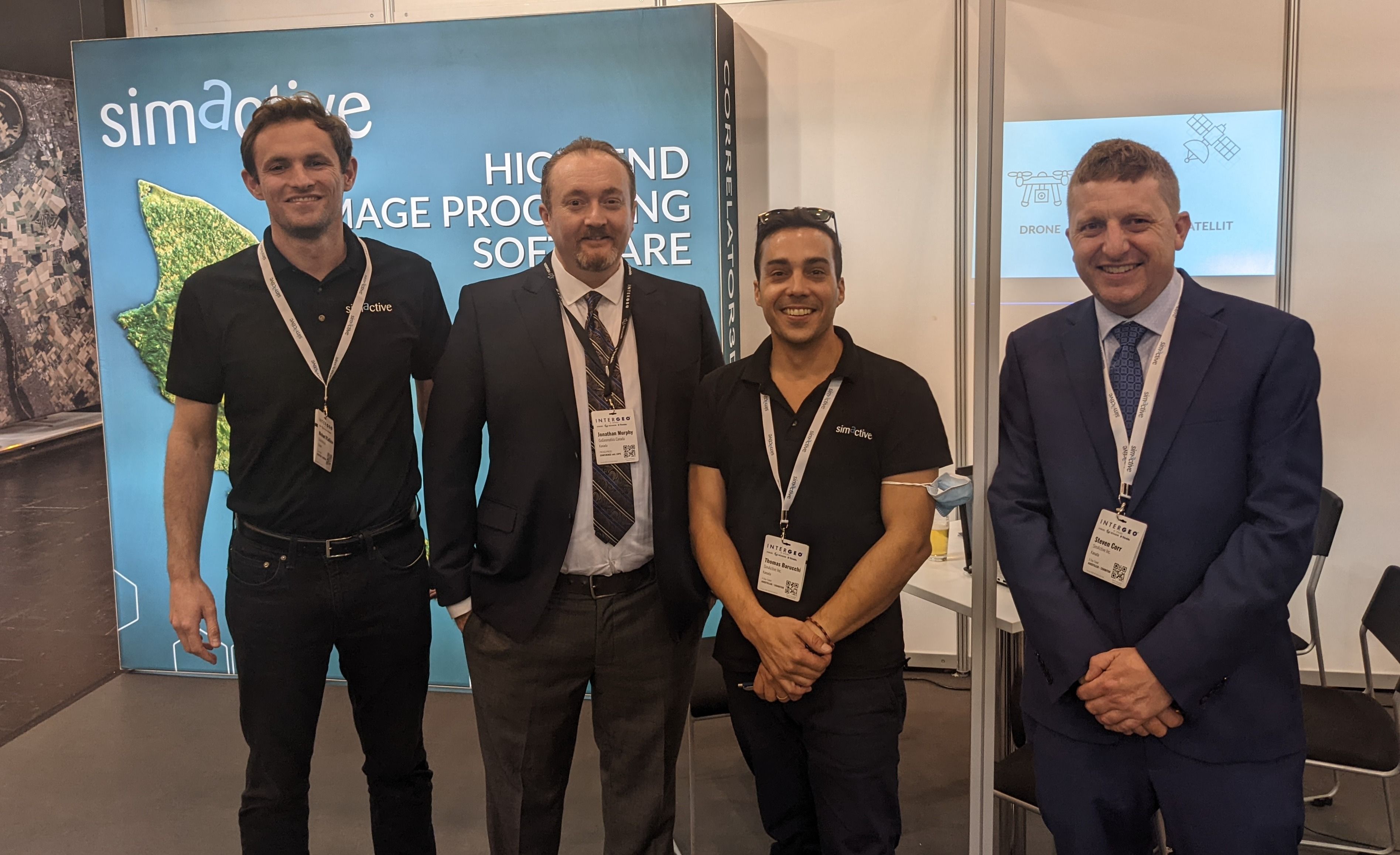
SimActive is a leading developer of photogrammetry software since 2003. The company introduced the first GPU-powered AT (Aerial Triangulation) and DSM (Digital Surface Model) generation engines in the industry, enabling multiple fold processing speed increases. Through continuous innovation and product updates since then, SimActive remains at the forefront of innovation as the technical standard the industry is measured against.
![]()
![]()
SOLV3D encompass is a web-based application that brings together geospatial datasets from many sources for visualization and collaboration between team members and external clients. Discover how SOLV3D encompass can make your geospatial workflows faster and easier.


The Space Flight Laboratory (SFL) lowers the entry barrier to space for end users who want performance and data without the complication of satellite manufacturing. SFL understands that today’s satellite service providers cannot tolerate high costs, and offers low-cost solutions amenable to mass production. Take advantage of SFL heritage, quality, and cost without being caught by unexpected risks of startup satellite development. We can accelerate your goals and independence while minimizing unnecessary investment in roadmaps.
Tallysman® is a developer, manufacturer, and provider of GNSS, Iridium antennas and accessories in support of our customers who are engaged in a broad range of satellite-based positioning, navigation, and data applications. Based in Ottawa Canada, Tallysman is focused on high function, high performance technology and solutions. Our core competencies include digital wireless networks, RF and Global Navigation Satellite Systems (GNSS) component design.


Be the first to comment