New technologies emerge all the time with lightning speed, but not all industries are equal in their rate of adopting the innovation. While fields such as business, medicine and manufacturing are at the forefront of early adoption, geomatics is taking a more conservative route. Nevertheless, modern tech has a lot to offer to the field, and the industry is already adapting to its cornerstone advancements, such as AR and machine learning. Here’s how.
3D Printing

Not long ago, 3D printers were only accessible to well-funded research labs. Now, they have become so affordable and popular that people are increasingly buying such devices for their homes. But 3D printers have also found their way into big-scale projects. The Netherlands has already 3D-printed a functioning concrete bridge while a 3D-printed neighborhood is in the works.
Similarly, the geomatics field has taken advantage of this technology, which allows the quick, inexpensive and accurate modeling of real-life objects and terrains. That, in turn, enables geospatial experts to test theories and problem-solving in close to real-life conditions — like how the U.S. Navy performs tests in its giant ocean simulator.
What’s more, when it comes to details, 3D printing allows not only the accurate representation of shapes, curves and other geometrical characteristics, but also the precise representation of textures thanks to the frequent and ongoing innovations in 3D printer-ready materials.
AR

AR is great. It makes mobile games come to life and overlays pool pictures to appear as if taken in shark-infested waters. But while we often hear about the entertainment advantages of AR, it is rarer to hear about the other — industry-related — implications of this technology.
One geomatics-related use of AR has to do with safety. For example, surveyors can mark AR areas with terrain-related dangers, especially ones hidden from the naked eye, such as underground waters and gas pipes.
AR is also applicable in urban planning: overlaying information over existing objects, allowing for more accurate planning and on-the-spot access to surveying data.
AR has something to offer to education as well. The Oregon Institute of Technology is training its geomatics students by using a literal sandbox. A projector then overlays an AR map over the sand, allowing educators and students to modify the sand’s landscape, with the AI changing the topographical representation accordingly.
VR

Skeptics once believed that VR was only a fad, but the technology is here to stay, with many industries benefiting from it. Gaming, education, medicine, and construction have all launched ambitious projects to make use of VR. Canada’s most famous professional poker player – Daniel Negreanu – makes regular appearances at VR poker games.
Namely, VR is a tool to visualize urban planning without disturbing traffic or the everyday lives of citizens. Decision-makers can sit in a conference room, wear VR headsets and watch the real-life impact of various options.
In addition, VR is useful in public debates on contentious construction projects. With significant alterations to the cityscape sometimes becoming a cause for public scrutiny, by using VR stakeholders (citizens, authorities, developers, etc.) can show their point of view (utilizing geospatial data) to see what the other side sees.
And just like with AR, the education side of geomatics also has something to gain. Through VR, students can remotely access a variety of terrains and conditions from all over the globe — by sitting in their classroom.
Machine Learning

Geomatics is a field that processes enormous amounts of data, and with the advancement of industry-related technology, datasets are growing more complex. Unlike traditional computing, which requires supervision, machine learning is a method that allows the data processing algorithm to teach itself. Thus, it only gets better the more data it processes.
Just as car manufacturers do with wind tunnels, machine learning can test various conditions and variables without having to do it on the field. For example, machine learning can help predict and assess the impact of natural disasters. That’s what the UNOSAT department of UNITAR does — analyzing satellite images for the UN.
Until recently, such an analysis was a laborious manual process that took lots of time and human capital, limiting the UN’s ability to act swiftly. But machine learning has come to help — like in the case of the Open AI Challenge, “which uses AI and machine learning to identify flood zones and high-risk areas in South Pacific Islands while accelerating humanitarian and development efforts across the region.”
Drones
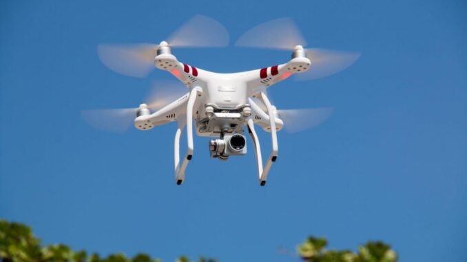
Drone surveying is no longer a novelty in some fields, such as agriculture and construction. But the potential is high for other areas as well, including geomatics.
Already equipped with high-res cameras, drones allow the recording of detailed terrain images. However, armed with more advanced tech such as LIDAR sensors, drones can exceed their usual usefulness. Indeed, such UAVs already exist and are in use.
While drones cannot yet replace satellite imaging when it comes to vast areas, they can quickly scan immediate regions and, combined with machine learning, create detailed maps. Paired with other AI features, drones could also autonomously gather, sort, refine and interpret data to be sent to a VR-powered engine for simple and interactive visualization.
Quite a few industries depend on geomatics to run their operations. From disaster relief to urban planning, geospatial data is key to proper operational execution. Such an essential job, therefore, requires precise execution. Thus, it is not unusual that the geomatics field is taking its time in ensuring that contemporary innovations will be of effective use. But as seen from the examples above, there are plenty of possibilities, and the industry is already using modern tech to fix problems and expand its horizons.


Be the first to comment