- Landsat Data and Wetlands
- Overture Maps Foundation will Release Data
- US Flood Risk Map
- Florida Division of Emergency Management Creates Interactive Map
- Geospatial Mapping To Assist Burn Patients
- Laser mapping reveals a forgotten Maya city
Bex Dunn: Landsat Data User + Wetland Explorer
Bex Dunn is an earth observation scientist at Geoscience Australia and is using Landsat data to gather a better understanding of wetlands.
During a recent Q&A, she revealed why Landsat data is crucial for managing wetlands. She mentions that the Landsat data record will show the temporal scale at which changes occur, and wetland managers can tell if the changes are new or something that has been happening for several decades. Bex also says that wetlands may be underappreciated as they are valuable ecosystems that benefit not only the wetland’s flora and fauna but locally and globally as they are great for sequestering carbon and contributing to the water cycle.
Lastly, Bex Dunn talks about the Landsat Next mission and how she looks forward to the increased observation frequency and spectral coverage that will reduce gaps in data for cloudy areas and improve response times for events at shorter timescales, such as floods.
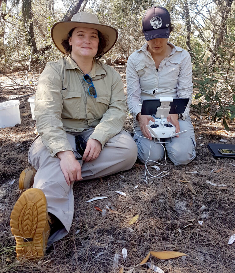
Bex Dunn on the left and Fernanda Adame using UAVs for wetland observation in Queensland, Australia. Source: NASA
The article can be viewed here
Meta, Microsoft and Amazon team up on maps project to crack Apple-Google duopoly
The Overture Maps Foundation, founded by Meta, Microsoft, Amazon and TomTom, will release data allowing companies to build their own maps for free using cleaned and formatted data. This data, collected by Meta and Microsoft, includes almost 60 million points of interest, including landmarks, restaurants, regional borders, and streets. Overture’s data can be used to create a detailed base layer for many different applications, and it hopes to receive regularly updated data from its members.
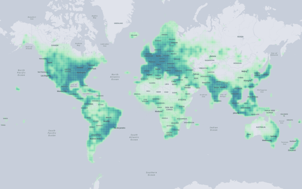
Almost 60 million points of interest were collected for Overture worldwide. Source: The Overture Maps Foundation
Article can be viewed here
Bristol Geo Intel Firm Prepares US Flood Risk Map
Population growth, natural variability, urban development, and climate change have all increased the severity and frequency of severe weather-related events in the United States. A new US Flood Map created by Fathom will provide new flood risk information that uses the latest terrain, observation, and climate information, providing a 10m resolution for hazard and risk information. This new map features comprehensive coverage, including every river, stream, and coastline in the US; LiDAR collected terrain data from 2020; climate data that includes flood risk for all emissions scenarios and changes in temperature; and a machine learning model for dam simulation.

Kansas City 1 in 1,000 year flood scenario comparing FEMA (top image) and Fathom (bottom image). Source: Geospatial World
Article can be viewed here
In Florida, Interactive Maps Tell the Story of Modern Risk Mitigation
A 500-page PDF from the Florida Division of Emergency Management (FDEM) was turned into an interactive map and StoryMap as an update for the Federal Emergency Management Agency’s (FEMA) five-year hazard mitigation plan. The team at FDEM used GIS to analyze climate, hazards, and social vulnerability to create these digital maps. A mitigation project that FDEM looked at was how they could retrofit schools and hospitals to withstand flooding, extreme heat, and high winds. They also looked at other projects to mitigate stormwater by increasing drainage and elevating homes in areas susceptible to flooding.
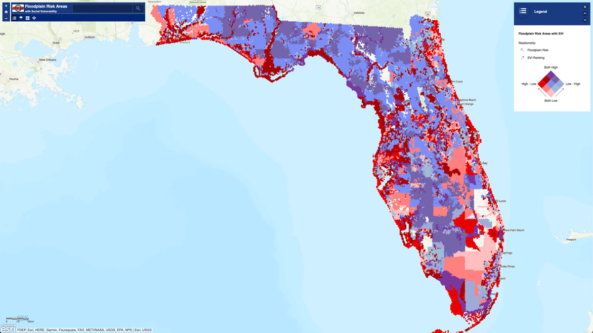
2023 State Hazard Mitigation Plan map of Flood risk in Florida. Source: Esri
Article can be viewed here
Researchers Use Geospatial Mapping To Assist Burn Patients
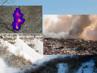
Using geospatial mapping, researchers at the University of Texas at Dallas are looking at environmental and social barriers burn survivors may have while re-entering into society. This project plans to improve burn survivors’ access to employment, food, transportation, and other essentials. The sociology program head Dr. Richard Scotch and public policy and GIS professor Dr. Dohyeong Kim are working with North Texas Burn Rehabilitation Model System researchers on this project. During this study, Dr. Kim will use GIS to map out all environmental and social barriers experienced by burn survivors and will highlight notable intervention hotspots. Using GIS and understanding the barriers faced by burn-injury survivors, this study hopes to pinpoint areas that need more support, including social services, mentorship, job assistance, and medical and mental health assistance.
Using geospatial mapping to assist burn patients. Source: The University of Texas at Dallas
Article can be viewed here
Laser mapping reveals a forgotten Maya city in the jungle.
Assistant professor in the Department of Civil Engineering at the University of Houston, Juan Carlos Fernandez-Diaz, was conducting an aerial archaeological survey using LiDAR in the Mexican state of Campeche and found a hidden city believed to have been abandoned 1,000 years ago. After six weeks of surveying, the city, which archeologists have named Ocomtun, is the site of 50-foot-tall structures that resemble pyramids with engravings and pottery, which they believe are from 600 to 900 AD. The article talks about how vital remote sensing technology is in finding these archaeological sites, particularly in areas with dense forests.

Juan Fernandez-Diaz, assistant professor in the Department of Civil Engineering at the University of Houston. Source: Jonathan Burke/University of Houston
Article can be viewed here



Be the first to comment