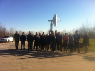
The Calgary GoGeomatics Social was a Hit!
I want to thank everybody who came out to our first Calgary social on March 6. I received so many new geomatics business cards to add to the GoGeomatics Canada’s growing collection. This really was […]
Interest in mapping is on the rise, as evidenced by services such as Google Earth, Virtual Earth, MapQuest, and any number of other web mapping mashups. These are all exciting developments, yet there is another […]
We have our first GoGeomatics Canada Newsletter. With over 5,000 geomatics subscribers the whole team is excited to start communicating jobs, events, and news to the community. If you are not already a subscriber you […]
So as I write this, we are nearing the end of 2012 (or possibly the end of the world as we know it) and I thought that, just in case, I would submit my top […]
To start the new year of right we are showcasing the top 5 GoGeomatics Magazine articles from 2012. We launched in September but these articles quickly rose to the top of the leader boards based […]
Modern Canada is internationally renowned for its cartographic practices and strong mapping systems. Canada is host to vast landscapes and diverse in climates and topography. These lands and waters were mapped and surveyed, by many […]
First off, HAPPY GIS DAY! Twitter was having a hayday with #GISDay tweets, and LinkedIn became a geospatial frenzy. What did you do for GIS Day? GoGeomatics Canada was happy to host our second annual […]
The essence of this article is: preparing a thick border around polygons for display on ArcGIS Online (but also in ArcMap); note I am using what is now – Nov 2012 – referred to as […]