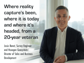
• facebook
  • Twitter
  • Linkedin
  • Youtube
  • Linkedin Group
  • Post a Job
  • Post an Ad
  • Post an Event
  • Post a Directory Listing
  • Post a Press Release
  • Media Kit
  • My Account
  • Login
GoGeomatics
  • MAGAZINE
    • BIM & GIS
    • Community
    • Conference news
    • Earth Observation
    • Education & Careers
    • GEOAI
    • Announcements
    • Reality Capture & Lidar
    • Science
    • Technology
  • Directories
    • ASSOCIATION
    • INDUSTRY
    • EDUCATION
    • Open Data
  • EVENTS
    • GeoIgnite Events
    • Events Calendar
    • GoGeomatics Meetups
  • Services
    • Advertising
    • Marketing
    • Post a Job
    • Post an Ad
    • Post an Event
    • Post a Press Release
    • Post a Directory Listing
    • Media Kit
    • Web Design
  • Find a Job
  • Volunteer
    • Start a GoGeomatics Group
    • Editors & Writers Group
  • About Us
    • About Us
    • Contact Us
    • Frequently Asked Questions
  • Videos
HomeTechnology

Technology

Education & Careers

Future technological trends: A Canadian Perspective from LiDAR CANEX 2024

22 April 2024 Alefiya Dungrawala | 3D Interactive model

At LiDAR CANEX 2024, a LiDAR panel of experts from different sectors discussed the latest and upcoming trends and services in 2024. Artificial intelligence was at the top of their list. Have a look at […]

Technology

Geospatial Digest for Earth Day April 22nd, 2024

22 April 2024 Volunteer Editors and Group Writers | British Columbia

Water Pollution in Ireland Esri Ireland has teamed up with the Dublin Urban Rivers LIFE (DURL) Project to tackle water pollution in Dublin’s rivers. Using ArcGIS, DURL has identified and fixed over 1,000 misconnected household […]

Technology

International Geospatial Digest for April 15th 2024

15 April 2024 Volunteer Editors and Group Writers | bird migration

US Warns Allies of China’s Military Assistance to Russia The US has issued warnings to its allies about China’s provision of geospatial intelligence to Russia for military purposes amid the ongoing conflict in Ukraine. As […]

Technology

LiDAR for Post Wildfire Mapping Applications at Lidar CANEX 2024

12 April 2024 Crystal Fitzpatrick | BC Ministry of Transportation and Infrastructure

Kenneth Ang, Project Manager and geomatics Lead at Terra Remote Sensing, recently presented at Lidar CANEX 2024 on LiDAR for post-wildfire mapping applications. Kenneth provided an overview of Terra Remote Sensing, with a specific focus […]

Technology

How the CanSLAM can: Building Canada’s National SLAM Circuit at Lidar CANEX 2024

12 April 2024 Jake MacLean | Calgary

In a dynamic and informative session at LiDAR CANEX 2024, Alex Hill-Stosky shed light on the groundbreaking initiative known as the CanSLAM Circuit, which he founded alongside Carina Butterworth of the Southern Alberta Institute of […]

Technology

Exploring Geospatial AI: Understanding and Preventing Deforestation

9 April 2024 Jake MacLean | AI

Global forests are one of our most important resources, not only for the service they provide as the lungs of the earth but also as a renewable and reliable resource for many people in industrial […]

Technology

Navigating Canada’s Climate Crisis: Harnessing Earth Observation for Resilience and Adaptation

9 April 2024 Anusuya Datta | air quality monitoring

Year 2023 now ranks as the fourth-worst year for insured losses in Canada, according to Catastrophe Indices and Quantification Inc. (CatIQ), as severe weather events such as hail, wildfire, wind, and flood events collectively caused […]

Technology

Canadian Geospatial Digest for April 8th, 2024

8 April 2024 Volunteer Editors and Group Writers | AccessNow

The ‘Nuanced’ Rise and Fall of Canada’s Tree Cover In collaboration with North Arrow, The Energy Mix introduces a monthly map series exploring climate change’s causes and effects. The inaugural map, sourced from Global Forest […]

Posts pagination

« 1 … 38 39 40 … 141 »

Events

Notice
There are no upcoming events.

View All Events

Services

  • Post a Job
  • Post an Ad
  • Post an Event
  • Post a Directory Listing
  • Post a Press Release
  • Media Kit
  • My Account
  • Login

Jobs

Post a Job
  • Software Engineer – Geographic Information System (GIS)
    Ottawa, ON
  • GIS Data Quality Analyst
    Burnaby, British Columbia
  • GIS Cartographer
    Montreal, QC
  • SENIOR PLANNER SPATIAL ANALYSIS SIPA
    Toronto, ON
View All Jobs
  • Directories
    • Associations Directory
    • Industry Directory
    • Education Programs
    • Open Data
  • Volunteer
    • Start a GoGeomatics Group
    • Editors & Writers Group
  • About Us
    • GoGeomatics Media Kit
    • Who We Are
    • Contact Us
    • FAQ’s
    • Advertising
    • Marketing
  • Subscribe
GoGeomatics
GoGeomatics is the largest and most popular communications hub promoting the Canadian geospatial community. The business was incorporated in 2011. GoGeomatics hosts over 100 fun, free, location technology networking events each year in cities across Canada.

© 2025 GoGeomatics

  • facebook
  • Twitter
  • Linkedin
  • Youtube
  • Linkedin Group