What is GeoAI?
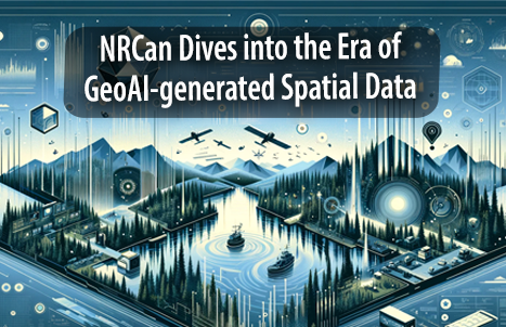
GeoAI is an abbreviation for Geographic Information Systems and Artificial Intelligence, representing a powerful amalgamation of spatial data, smart algorithms, and automation. The continual growth of satellite technology helps to generate high-resolution, real-time spatial data, improving GeoAI’s capabilities. This will give priceless insight into comprehending continuously changing landscapes.
CCMEO Moves forward with GeoAI
Natural Resources Canada (NRCan) announced in December 2023 that the Canadian Centre for Mapping and Earth Observation (CCMEO) has launched a set of GeoAI-generated spatial data. The data series is the initial release of 50,000 km2 of Canada’s roadways, forests, bodies of water, and houses. Since 2019, the Canada Centre for Mapping and Earth Observation (CCMEO) has made tactical investments using significant strategic efforts in developing cloud-based geospatial data management systems and advanced AI.
The GeoAI Series is a collection of geographic features that are:
- natural or artificial, like roads, buildings, lakes and rivers, and more
- identified from various sources such as aerial or satellite images
- automatically extracted by machine learning algorithms
Using artificial intelligence, this data set will be updated regularly to incorporate new places and time periods, ensuring that Canadians have access to current, open, and freely available geospatial information. This series is the outcome of CCMEO’s ongoing efforts in artificial intelligence to automate the map development process.
CCMEO can now build and publish maps in a quarter of the time required by traditional mapping, allowing for shorter delivery times and a new generation of geospatial possibilities.
This series stands out as unique by allowing numerous data extractions to occur at the same time and over the same geographic area.
Uses and Use Cases
Canada is the second largest country in the world by area. The capacity to recognize trends and changes around the vast Canadian landscape across time opens up a world of possibilities for data users. In traditional mapping techniques, strict accountability, validation, and correction are required for the continuous upkeep of fundamental datasets. As a result, GeoAI steps in to save the day as an ally.
By training and applying AI to recognize certain features in high-resolution photos, the majority of the mapping process can be automated and made considerably more efficient. The GeoAI system is nearly 1000 times faster than traditional human digitization processes! This opens the door to a plethora of new applications.
Use Cases
Land use classification
Land use monitoring is vital in measuring ecological and environmental changes. With the increasing spatial resolution of satellite imagery, traditional methods of classification cannot give a detailed insight into the spectral and spatial information on the objects. To overcome this limitation, it is necessary to develop an automated and efficient method of classification to map large scales of land. Land use classification is an excellent example of representing the potential of artificial intelligence combined with deep learning algorithms on satellite imagery.

GeoAI has classified various land use types, such as forests, bodies of water, buildings, roads, and so on. The ability to automatically understand these classes can greatly speed up and improve the accuracy of constructing base layers.
Change Detection
Change detection and its observations are more important than ever. Comparison analysis of satellite imagery from different time periods to identify patterns and differences is the most crucial factor for climate change mitigation.
GeoAI detects and tracks changes in geospatial data across time. For example, changes in land use due to development, infrastructure damage from a flood event, or reductions in vegetation coverage following a wildfire.

The difference between typical mapping and GeoAI-generated mapping is very obvious. The above example demonstrates an analysis of urban development for Quebec City between the years 2006 and 2022 along with hotspot analysis to identify buildings from the data series.
Development of High-Resolution Analysis-Ready Datasets
The better part of the time is spent on cleansing the data and preparing it for analysis. Analysis-Ready Dataset (ARD), is collected responsibly and assessed before releasing it so that the analysis of the data provides precise, uniform and error-free results. GeoAI-generated data series from recent data sources can help organizations or research institutes identify and focus on highly impacted areas.
Future of GeoAI
The future aim will be to consistently improve data quality by increasing processing models and refining colossal levels of data series. This data set is freely available to the public, and users are encouraged to take advantage of this brand-new effort. Using this sophisticated data, we dive deeper into the dataset and understand more about our planet and its functioning. This new approach is going to take us to new envisioned heights.
References:
https://www.mdpi.com/2072-4292/13/6/1225
https://geo.ca/initiatives/geobase/geoai/
https://datamanagement.hms.harvard.edu/collect-analyze/analysis-ready-datasets
https://www.jobingis.com/blog/The-Future-of-Geomatics-in-the-Age-of-Artificial-Intelligence


Be the first to comment