The city of Ottawa has seen its urban landscape change throughout its history. As in many major cities, small buildings have been replaced with larger ones as the city grew. After Ottawa was chosen as Canada’s capital, the federal government undertook projects that sometimes saw the removal of entire neighbourhoods in an effort to improve the city. Some buildings were replaced by national monuments and institutions, such as the War Memorial and the Supreme Court while whole neighbourhoods were demolished and left vacant for many years only to be redeveloped with modern buildings such as in Lebreton Flats and Lowertown.
While researching historic photos of Ottawa, I became fascinated with the buildings that had been lost. Although these photos provided a visual snapshot of these structures, their locations could not always be determined from these images. As I searched the Internet and books for the history of these buildings, there seemed to be no single source of information so I decided to create one. It seemed the best option was a map (particularly KML) showing their original locations.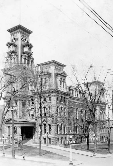
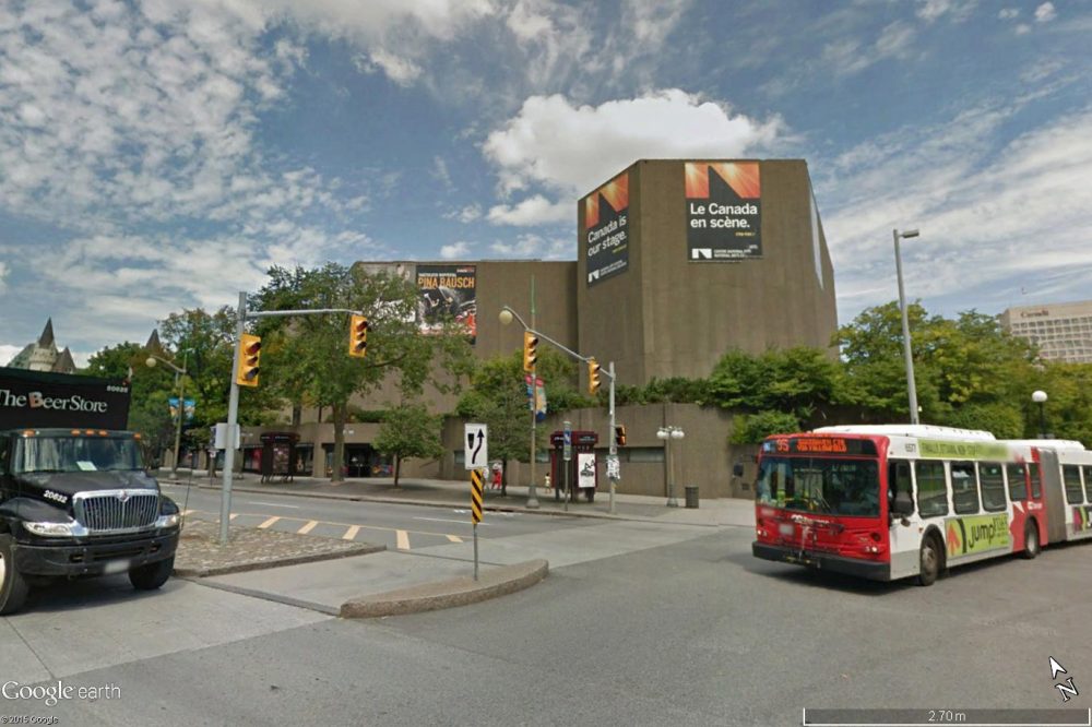
Original city hall of Ottawa at the corner of Elgin & Albert Streets now occupied by the National Arts Centre
A variety of commercial software was available for this project, such as ArcGIS and Global Mapper. To save on costs, the ones used in this project were Google Earth and open source software such as QGIS, GDAL and Python. These programs are all available for free.
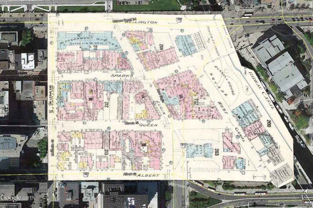
The Library and Archives Canada website provides a free series of Ottawa fire insurance maps from 1912. These maps include detailed outlines of all the roads and buildings within the urban area of Ottawa. The exact position of the buildings can easily be determined using these insurance maps. The only problem is, these maps are just digitized copies of the original prints and do not include any geographic information or coordinates. They required georeferencing.
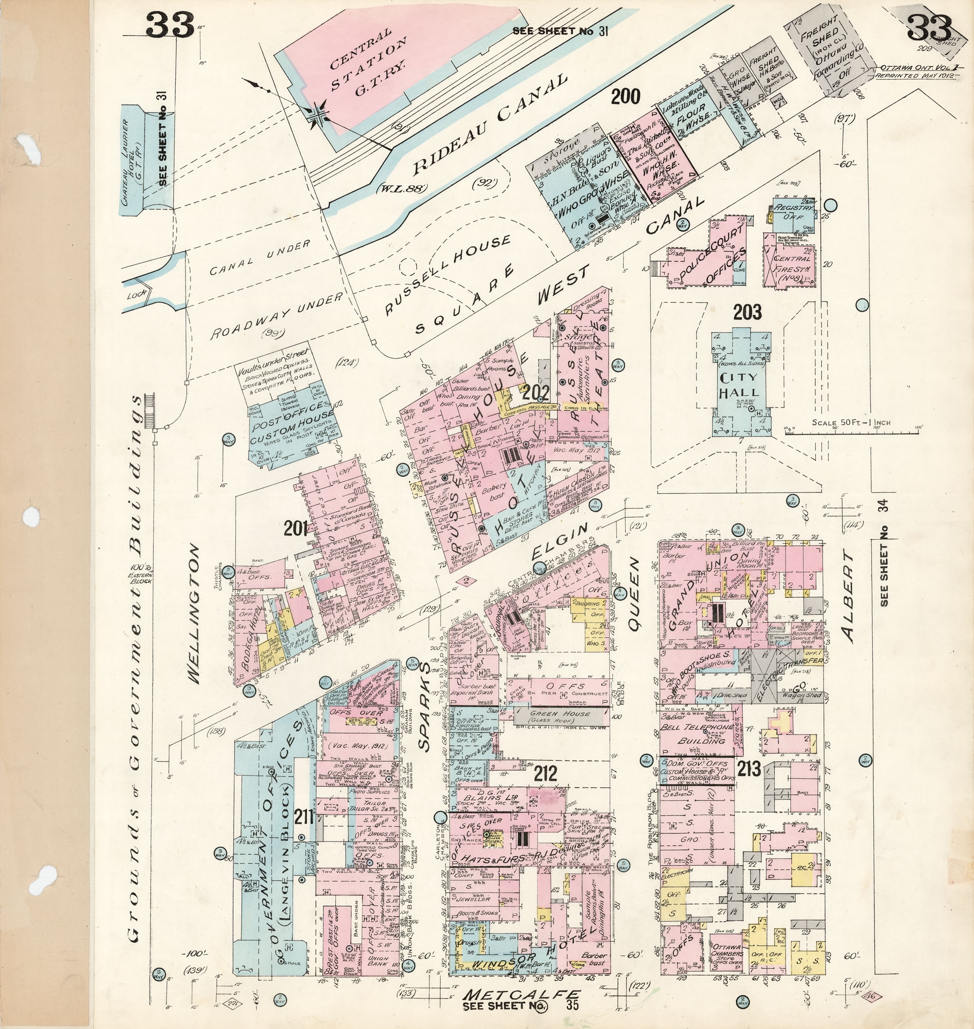
Example of a fire insurance map
For the georeferencing of the fire insurance maps, I used Google Earth and QGIS. It was important to choose features that existed both in 1912 and today. Fortunately, the City of Ottawa provides a dataset of property parcels for the entire city. The fire insurance maps used these parcels for the individual properties and roadways. Since much of the road parcels have remained the same since 1912, placing GCPs at the intersections of these roadways produced the best results. A KMZ file of the insurance map was created from the georeferenced image.
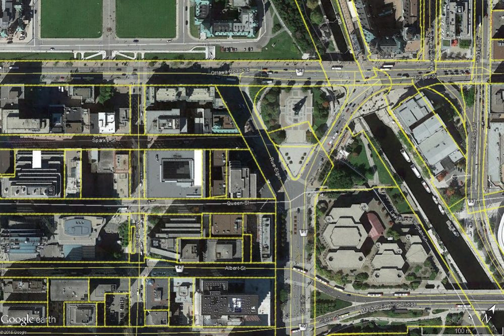
Property parcels (outlined in yellow) of the City of Ottawa
The polygons of the buildings were collected using the KMZ file in Google Earth and saved as a separate KML file.
Example of a fire insurance map overlaid in Google Earth
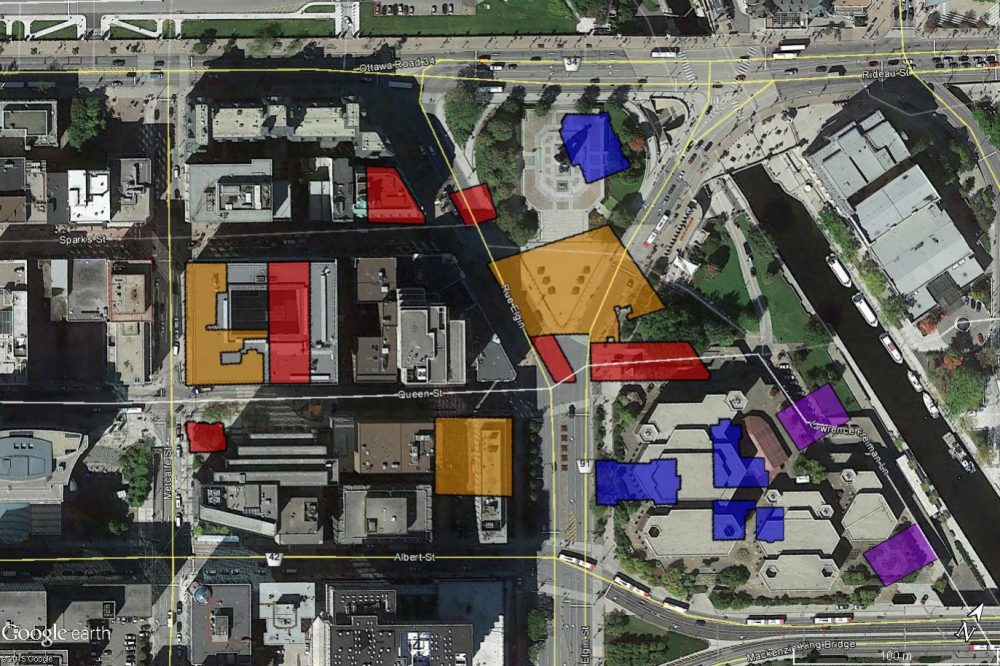
Buildings outlined using the insurance from the image above
As more and more buildings were identified, the amount of information seemed too much to store in one KML file. So a database was created to contain all the building data, including photos and sources. Scripts were also created to extract the information from the database and produce a final KML file containing all the buildings. The KML could now be uploaded to the Internet.
The final stage of the project was getting the information out to the public. Google Sites seemed the best choice to host my website and project.
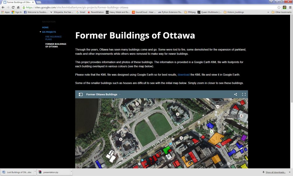
Example of the website I use to host the project
All photos gathered during research were uploaded to the website to avoid any lost external links in the future. The final KML file was also uploaded to the website. Since the project is ongoing as more lost buildings are discovered, the KML file will be uploaded continually in the future. This file is available for download. It was also important to include an interactive option for the website. The practical choice at the time was to embed a Google Maps widget on the website.
As I continue this project, I hope to identify as many of the buildings in Ottawa as possible that have been lost to redevelopment.


Be the first to comment