

In Canada, an estimated 3,600 wildfires burned approximately 581,004 acres in 2020 alone.1 Similarly, in the United States, an estimated 58,950 wildfires burned approximately 10,122,336 acres in 2020.2 To prepare for the summer fire season, thousands of crews consisting of superintendents, squad leaders, firefighters, and specialists including helicopter and air tanker pilots gear up with Avenza Maps to access up-to-date maps and information distributed by leadership teams, enabling them with knowledge about quickly changing situations while heading into the field to combat fires.
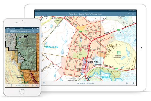
Organizations such as the United States Forest Service (USFS) and the British Columbia Wildfire Service (BCWS) benefit from the Avenza Maps platform that encompasses both the app and the Avenza Map Store. The mobile app uses geospatial technology that provides thousands of emergency response teams and support personnel with constant access to their GPS location to locate themselves accurately on any map. It continues to provide situational awareness without the risk of losing network connectivity reception and works even in the most remote areas where it does not rely on an internet connection to use map data. The app allows users to read map details clearly, find location coordinates, measure distances, and add placemarks and data points including photos.
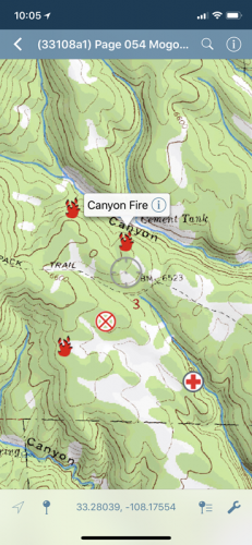
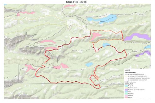
Advanced tools such as geofences can provide additional situational awareness by notifying users when they enter or exit a specified area around an incident point of interest. In addition, the Track-to-Area tool provides a very effective way to collect data about the perimeter and area of wildfires. Teams can record a GPS track around an incident and can easily convert it into an area directly in the app. This data collected can be exported into KML or Shapefile and be provided to the incident management team who can update master maps and data layers about wildfire shifts.
As more teams integrate Avenza Maps into their daily operations, the distribution of custom maps has become streamlined. The Arizona State Forestry Incident Management Team provides an incident-specific website to its firefighters who can quickly scan QR codes using the Avenza Maps app to receive the most updated version of maps before being deployed to an incident. Although many crews have the ability to import and use custom maps in the app generated by their respective GIS teams, the Avenza Map Store also provides optimal map coverage of national forests, grasslands, and federally managed lands – many of which are freely available and easily accessible.
To prepare for the fire season, workshops are being conducted throughout the year where volunteers and organizers receive Avenza Maps training as part of learning new techniques and technology. Get in touch with the regional forest service and fire volunteer communities in your area to find out more.
How to get Avenza Maps
The Avenza Maps app is available on the App Store and Google Play. Commercial and government use subscription licensing is available. For more information about Avenza Maps, visit www.avenzamaps.com. Pricing of each map is set by the publisher and free maps remain free to users through the Avenza Map Store.
Learn more through GeoIgnite
Avenza is a proud Silver sponsor of GeoIgnite and is presenting more during the Main Conference on April 23, 2021. In addition, Avenza is hosting a workshop session the following week on April 29, 2021 that will focus on a journey through the Avenza Maps platform. Registration for the event and workshop are now open.
1 Canada National Wildland Fire Situation Report
2 National Interagency Fire Center


Be the first to comment