• facebook
  • Twitter
  • Linkedin
  • Youtube
  • Linkedin Group
  • Post a Job
  • Post an Ad
  • Post an Event
  • Post a Directory Listing
  • Post a Press Release
  • Media Kit
  • My Account
  • Login
GoGeomatics
  • MAGAZINE
    • BIM & GIS
    • Community
    • Conference news
    • Earth Observation
    • Education & Careers
    • GEOAI
    • Announcements
    • Reality Capture & Lidar
    • Science
    • Technology
  • Directories
    • ASSOCIATION
    • INDUSTRY
    • EDUCATION
    • Open Data
  • EVENTS
    • GeoIgnite Events
    • Events Calendar
    • GoGeomatics Meetups
  • Services
    • Advertising
    • Marketing
    • Post a Job
    • Post an Ad
    • Post an Event
    • Post a Press Release
    • Post a Directory Listing
    • Media Kit
    • Web Design
  • Find a Job
  • Volunteer
    • Start a GoGeomatics Group
    • Editors & Writers Group
  • About Us
    • About Us
    • Contact Us
    • Frequently Asked Questions
  • Videos
Home3D Lidar point cloud

3D Lidar point cloud

LiDAR scan of highway in Equator|Create Smooth Contours from LiDAR|Create Smooth Contours from LiDAR|Screen showing a search for "Toronto" in Equator
Technology

Are you still sourcing topographic data the old way?

7 July 2022 Rebecca Swabey | 3D CAD

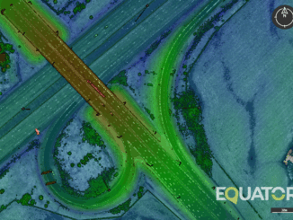
New tool empowers engineers to save thousands of dollars on surveying costs, win more work, and slash the time it takes to source quality data. Introduction When I was working as a water resources engineer, […]

|||||
Technology

TopoDOT Compares Data and Applications of UAV and LiDAR Point Cloud

4 July 2022 GoGeomatics Canada | 3D Lidar point cloud

On April 5, 2022, LiDAR COMEX 2022 held a live stream presentation on “data comparison and applications of UAV imagery-based point cloud and LiDAR-based point cloud for surveying and mapping. The speaker was Jennifer Triana, […]

|||
Technology

Elexicon Energy and Quantum Spatial Canada Pilot Comprehensive Mobile Mapping Project

28 August 2020 Sven Cowan | 2D CAD

Elexicon Energy (Elexicon) was formed in April 2019 by the merger of Veridian Connections and Whitby Hydro Electric Corporation. Owned by five municipal shareholders, the electric utility provides energy services to more than 169,000 residential […]

Events

Notice
There are no upcoming events.

View All Events

Services

  • Post a Job
  • Post an Ad
  • Post an Event
  • Post a Directory Listing
  • Post a Press Release
  • Media Kit
  • My Account
  • Login

Jobs

Post a Job
  • Canada Maps and Poster Gallery Volunteer Leads — GeoIgnite 2026
    remote
  • GIS & Data Analytics Lead
    Beaumont, AB
  • Lead Surveyor, Projects/Arpenteur-géomètre principal, projets; arpenteuse-géomètre principale, projets
    North Bay, Thunder Bay
  • Senior GIS Developer
    Calgary, AB
View All Jobs
  • Directories
    • Associations Directory
    • Industry Directory
    • Education Programs
    • Open Data
  • Volunteer
    • Start a GoGeomatics Group
    • Editors & Writers Group
  • About Us
    • GoGeomatics Media Kit
    • Who We Are
    • Contact Us
    • FAQ’s
    • Advertising
    • Marketing
  • Subscribe
GoGeomatics
GoGeomatics is the largest and most popular communications hub promoting the Canadian geospatial community. The business was incorporated in 2011. GoGeomatics hosts over 100 fun, free, location technology networking events each year in cities across Canada.

© 2025 GoGeomatics

  • facebook
  • Twitter
  • Linkedin
  • Youtube
  • Linkedin Group