• facebook
  • Twitter
  • Linkedin
  • Youtube
  • Linkedin Group
  • Post a Job
  • Post an Ad
  • Post an Event
  • Post a Directory Listing
  • Post a Press Release
  • Media Kit
  • My Account
  • Login
GoGeomatics
  • MAGAZINE
    • BIM & GIS
    • Community
    • Conference news
    • Earth Observation
    • Education & Careers
    • GEOAI
    • Announcements
    • Reality Capture & Lidar
    • Science
    • Technology
  • Directories
    • ASSOCIATION
    • INDUSTRY
    • EDUCATION
    • Open Data
  • EVENTS
    • GeoIgnite Events
    • Events Calendar
    • GoGeomatics Meetups
  • Services
    • Advertising
    • Marketing
    • Post a Job
    • Post an Ad
    • Post an Event
    • Post a Press Release
    • Post a Directory Listing
    • Media Kit
    • Web Design
  • Find a Job
  • Volunteer
    • Start a GoGeomatics Group
    • Editors & Writers Group
  • About Us
    • About Us
    • Contact Us
    • Frequently Asked Questions
  • Videos
Homeaccuracy

accuracy

Conference news

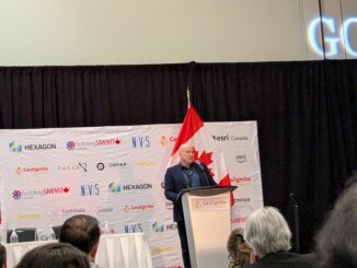
The AI Era: Reimagining Geospatial Work with Peter Rabley

26 May 2025 Alefiya Dungrawala | accountability

At GeoIgnite 2025, Peter Rabley, CEO of the Open Geospatial Consortium (OGC), took us through a lively, thought-provoking talk exploring the collision between artificial intelligence (AI) and the geospatial industry and oscillating between dystopian warnings […]

Community

Canada’s National RPAS Program Debuts at GoGeomatics Expo

22 July 2024 GoGeomatics Expo | accuracy

RPAS platforms and sensors have made significant strides since their commercial adoption almost a decade ago, quickly becoming essential tools for many professionals. This trend reflects the industry’s eagerness to embrace new technologies and apply […]

||||||
Technology

Accuracy and precision [Part I] : Are you being rigorous with your data?

5 August 2021 Leo Poon | accuracy

This article is the first part of a series about accuracy and precision, which briefly covers common factors that affect the quality of dataset during data acquisition process. Two more articles, particularly about GIS data […]

|||||||||||||||
Technology

UAV Surveys – How to Ensure Accuracy and Precision

12 April 2017 Thomas Hoppe | accuracy

For the past four years, I’ve been involved with the capture and delivery of data derived from drones. My experience has provided me with a good perspective on the quality of the data that can be […]

|||||||||||||||||||||
Education & Careers

My COGS GIS Education, Part II

22 March 2017 Richard Davenport | 2012

In my first article, I introduced the how and why I chose to attend COGS from the fall of 2014 to spring 2016. In Part 2, I wanted to give some insight into the first-year […]

||
Technology

New Galileo navigation system is experiencing clock failures

6 February 2017 David Boileau | 2015

  Since December 15, 2016, the new Galileo global satellite navigation system has been up and running. Unfortunately, there are some technical difficulties on the horizon, having to do with the clocks that are on […]

Community

The 5 most interesting things that happened in geomatics in 2016

21 December 2016 Florin-Daniel Cioloboc | 2016

Let’s take a step back and have a look at what happened this year. To be honest, it was pretty hard selection. There are way too many things happening at this point around the world. […]

|
Newsmakers & Press Releases

DigitalGlobe’s Basemap Suite Expands: 250 Million Square Kilometers of 30 cm Imagery

4 October 2016 GoGeomatics Newsmakers | accuracy

DigitalGlobe, Inc. (NYSE: DGI), the global leader in Earth imagery and information about our changing planet, today announced that its online Basemap Suite has reached a significant milestone, with the availability of more than 250 […]

Posts pagination

1 2 … 9 »

Events

Notice
There are no upcoming events.

View All Events

Services

  • Post a Job
  • Post an Ad
  • Post an Event
  • Post a Directory Listing
  • Post a Press Release
  • Media Kit
  • My Account
  • Login

Jobs

Post a Job
  • Canada Maps and Poster Gallery Volunteer Leads — GeoIgnite 2026
    remote
  • GIS & Data Analytics Lead
    Beaumont, AB
  • Lead Surveyor, Projects/Arpenteur-géomètre principal, projets; arpenteuse-géomètre principale, projets
    North Bay, Thunder Bay
  • Senior GIS Developer
    Calgary, AB
View All Jobs
  • Directories
    • Associations Directory
    • Industry Directory
    • Education Programs
    • Open Data
  • Volunteer
    • Start a GoGeomatics Group
    • Editors & Writers Group
  • About Us
    • GoGeomatics Media Kit
    • Who We Are
    • Contact Us
    • FAQ’s
    • Advertising
    • Marketing
  • Subscribe
GoGeomatics
GoGeomatics is the largest and most popular communications hub promoting the Canadian geospatial community. The business was incorporated in 2011. GoGeomatics hosts over 100 fun, free, location technology networking events each year in cities across Canada.

© 2025 GoGeomatics

  • facebook
  • Twitter
  • Linkedin
  • Youtube
  • Linkedin Group