• facebook
  • Twitter
  • Linkedin
  • Youtube
  • Linkedin Group
  • Post a Job
  • Post an Ad
  • Post an Event
  • Post a Directory Listing
  • Post a Press Release
  • Media Kit
  • My Account
  • Login
GoGeomatics
  • MAGAZINE
    • BIM & GIS
    • Community
    • Conference news
    • Earth Observation
    • Education & Careers
    • GEOAI
    • Announcements
    • Reality Capture & Lidar
    • Science
    • Technology
  • Directories
    • ASSOCIATION
    • INDUSTRY
    • EDUCATION
    • Open Data
  • EVENTS
    • GeoIgnite Events
    • Events Calendar
    • GoGeomatics Meetups
  • Services
    • Advertising
    • Marketing
    • Post a Job
    • Post an Ad
    • Post an Event
    • Post a Press Release
    • Post a Directory Listing
    • Media Kit
    • Web Design
  • Find a Job
  • Volunteer
    • Start a GoGeomatics Group
    • Editors & Writers Group
  • About Us
    • About Us
    • Contact Us
    • Frequently Asked Questions
  • Videos
Homeair quality monitoring

air quality monitoring

BIM & GIS

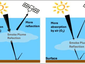
3D Mapping Transforms Smoke Monitoring

22 October 2025 Alefiya Dungrawala | 2D mapping

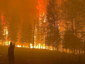
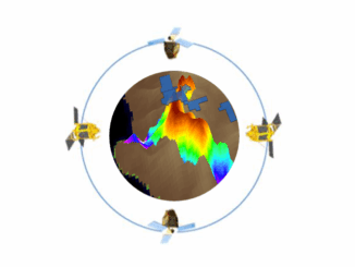
Wildfires across North America are no longer confined to a single season. Each year, they burn longer, spread faster, and shatter new records. Satellites have helped scientists track their movement and map the destruction in […]

Canada wildfire 2025
Earth Observation

Canada is on Fire: Maps, Satellite Data, Smoke Forecasts Powering Emergency Response

2 June 2025 Anusuya Datta | air quality monitoring

Wildfires are raging across Canada — from British Columbia to Nova Scotia — in what is fast becoming another catastrophic fire season. Hot, dry weather and shifting wind patterns are converging to create another intense […]

Technology

Navigating Canada’s Climate Crisis: Harnessing Earth Observation for Resilience and Adaptation

9 April 2024 Anusuya Datta | air quality monitoring

Year 2023 now ranks as the fourth-worst year for insured losses in Canada, according to Catastrophe Indices and Quantification Inc. (CatIQ), as severe weather events such as hail, wildfire, wind, and flood events collectively caused […]

||||||
Technology

The top 6 Satellite Remote Sensing Software tools

11 January 2021 Celso Isidro | Air Bus Space Agency

Nowadays, satellite remote sensing comes in handy and can now be employed in our day-to-day activities. This technology, with the assistance of GPS and GIS, provides tools and analysis relevant to real-time road mapping and […]

Events

Notice
There are no upcoming events.

View All Events

Services

  • Post a Job
  • Post an Ad
  • Post an Event
  • Post a Directory Listing
  • Post a Press Release
  • Media Kit
  • My Account
  • Login

Jobs

Post a Job
  • Canada Maps and Poster Gallery Volunteer Leads — GeoIgnite 2026
    remote
  • GIS & Data Analytics Lead
    Beaumont, AB
  • Lead Surveyor, Projects/Arpenteur-géomètre principal, projets; arpenteuse-géomètre principale, projets
    North Bay, Thunder Bay
  • Senior GIS Developer
    Calgary, AB
View All Jobs
  • Directories
    • Associations Directory
    • Industry Directory
    • Education Programs
    • Open Data
  • Volunteer
    • Start a GoGeomatics Group
    • Editors & Writers Group
  • About Us
    • GoGeomatics Media Kit
    • Who We Are
    • Contact Us
    • FAQ’s
    • Advertising
    • Marketing
  • Subscribe
GoGeomatics
GoGeomatics is the largest and most popular communications hub promoting the Canadian geospatial community. The business was incorporated in 2011. GoGeomatics hosts over 100 fun, free, location technology networking events each year in cities across Canada.

© 2025 GoGeomatics

  • facebook
  • Twitter
  • Linkedin
  • Youtube
  • Linkedin Group