api
Canadian Geomatics Innovation: Ecere Develops a Next Generation GIS
Not many companies undertake the ambitious goal of creating a new geospatial software suite from scratch. Ecere, a Canadian company…
The 5 most interesting things that happened in geomatics in 2016
Let’s take a step back and have a look at what happened this year. To be honest, it was pretty…
A List of Geospatial Open Data Resources in Canada
Recently, I read an article about the Canadian Geospatial Data Infrastructure (CGDI) that seeks to explain why the CGDI, among many…
Predicting the Future of the GIS in Canada
Editors note: This article has been jointly written by Bruce McCormack and Gordon Plunkett. Bios can be found at the…
Geospatial Development: Enhancing GIS curricula with programming skills at UNB
Geospatial information science and technology (GIS&T) has rapidly evolved over the last few decades. This evolution has created a highly…
Ten Online GIS Programs in Canada
After completing an undergraduate degree in 2015, (Geography and Environmental Studies at the University of Toronto) I needed to determine…
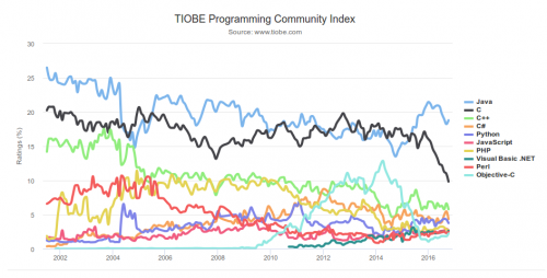
What are the Top Programming Languages in the GIS World?
Image source: www.tiobe.com Every now and again we hear about the importance of programming for Geographic Information Systems(GIS) professionals, that…
Literary Peregrinations: Geographers as Explorers
While I was reading Andrea Wulf’s “The Invention of Nature. Alexander von Humboldt’s New World”. I noted a comment on…
Montreal: SimActive Offers Free Trial of UAV Software
Montreal, Canada, October 11th, 2016 – SimActive Inc., a world-leading developer of photogrammetry software, is pleased to announce a new…
DigitalGlobe’s Basemap Suite Expands: 250 Million Square Kilometers of 30 cm Imagery
DigitalGlobe, Inc. (NYSE: DGI), the global leader in Earth imagery and information about our changing planet, today announced that its…
PCI Geomatics and PrecisionHawk Enter into Long Term Partnership
PCI Geomatics, a world leading developer of remote sensing and photogrammetric software and systems, announced today it has entered into…
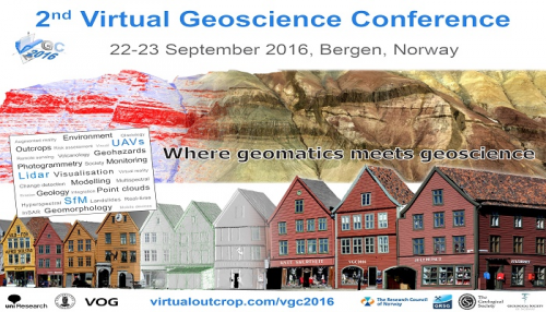
Conference: Where Geomatics Meets GeoScience
With now only one month to go until the 2nd Virtual Geoscience Conference (VGC 2016) takes place in Bergen, Norway,…


