• facebook
  • Twitter
  • Linkedin
  • Youtube
  • Linkedin Group
  • Post a Job
  • Post an Ad
  • Post an Event
  • Post a Directory Listing
  • Post a Press Release
  • Media Kit
  • My Account
  • Login
GoGeomatics
  • MAGAZINE
    • BIM & GIS
    • Community
    • Conference news
    • Earth Observation
    • Education & Careers
    • GEOAI
    • Announcements
    • Reality Capture & Lidar
    • Science
    • Technology
  • Directories
    • ASSOCIATION
    • INDUSTRY
    • EDUCATION
    • Open Data
  • EVENTS
    • GeoIgnite Events
    • Events Calendar
    • GoGeomatics Meetups
  • Services
    • Advertising
    • Marketing
    • Post a Job
    • Post an Ad
    • Post an Event
    • Post a Press Release
    • Post a Directory Listing
    • Media Kit
    • Web Design
  • Find a Job
  • Volunteer
    • Start a GoGeomatics Group
    • Editors & Writers Group
  • About Us
    • About Us
    • Contact Us
    • Frequently Asked Questions
  • Videos
HomeArchaeology GIS

Archaeology GIS

Education & Careers

Dr. Bob Maher Reflects on Geography Education at COGS

16 January 2023 Robert Maher | Archaeology GIS

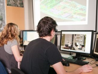
Originally Posted on Ernest Blair Experiment December 4, 2022 by maherrv It was 1980 when I joined the Nova Scotia Land Survey Institute (NSLSI) to teach Scientific Computer Programming (SCP) with Bruce Peveril. Bruce was primarily responsible […]

||
Newsmakers & Press Releases

Submit your Maps: 2023 Canadian Cartographic Association Mapping Competitions

10 January 2023 GoGeomatics Newsmakers | Archaeology GIS

GoGeomatics Canada is please to help promote excellence in Canadian Cartography by sharing these CCA competitions. President’s Prize The CCA President’s Prize recognizes excellence in student map design and production and is open to all […]

Community

2023 GeoIgnite Events Calendar: Happy New Year from GoGeomatics

10 January 2023 GoGeomatics Canada | 2023 Events

On behalf of management, staff, and volunteers we would like to wish everyone a very Happy New Year. Thank you to everyone who visited us over the course of 2022 and we look forward to seeing […]

No Picture
Community

GoGeomatics Canada Wishing you Holiday Cheer and a Happy New Year

13 December 2022 GoGeomatics Canada | 2023 GoGeomatics

On behalf of management, staff, and volunteers we would like to wish everyone a very Merry Christmas and a Happy New Year. Thank you to everyone who visited us over the course of 2022 and […]

|||
Newsmakers & Press Releases

Available Now: New 2023 Media Kit for GoGeomatics Canada

8 November 2022 GoGeomatics Canada | Archaeology GIS

GoGeomatics Canada is pleased to offer several affordable ways for you to advertise, raise your brand awareness, communicate, and engage with Canada’s geospatial sector. We track statistics and analytics for every campaign we run, so […]

|
Education & Careers

BCIT GIS Practicum or Project Sponsors Needed for 2023

25 August 2022 GoGeomatics Canada | Archaeology GIS

With full BCIT GIS programs starting this September, BCIT is looking for sponsors, either companies or government agencies, to accept a practicum or project with one or more students from January to May or June, […]

|||||
Community

Canada Announces Opportunities for Funding on projects totaling $1,000,000 in Geospatial

9 May 2022 GoGeomatics Newsmakers | Archaeology GIS

GeoConnections Announcement of Opportunities for the Fiscal Years 2022-2023 and 2023-2024 For this Announcement of Opportunities for the 2022-2023 and 2023-2024 fiscal years, the GeoConnections Program is focusing its funding on contribution projects totaling $1,000,000. […]

||||||
Technology

International Geospatial Briefing Feb. 28th: 1. Indian government starts work on mapping villages. 2. Scottish space sector charts path to a sustainable future. 3. Five ways AI is saving wildlife. 4. Satellite images show military movements by Russia. 5. Underground Railroad secrets revealed with drones, lasers and radar. 6. NASA ‘NACHOS’ Instrument May Help Predict Volcanic Eruptions.

28 February 2022 GoGeomatics Canada | Archaeology GIS

Indian Government starts work on mapping villages The Indian government is using geospatial technology and drones to map six lakh villages and prepare 3D maps of 100 Indian cities. Space minister Jitendra Singh said, “the […]

Posts pagination

« 1 … 18 19 20 »

Events

Notice
There are no upcoming events.

View All Events

Services

  • Post a Job
  • Post an Ad
  • Post an Event
  • Post a Directory Listing
  • Post a Press Release
  • Media Kit
  • My Account
  • Login

Jobs

Post a Job
  • Canada Maps and Poster Gallery Volunteer Leads — GeoIgnite 2026
    remote
  • GIS & Data Analytics Lead
    Beaumont, AB
  • Lead Surveyor, Projects/Arpenteur-géomètre principal, projets; arpenteuse-géomètre principale, projets
    North Bay, Thunder Bay
  • Senior GIS Developer
    Calgary, AB
View All Jobs
  • Directories
    • Associations Directory
    • Industry Directory
    • Education Programs
    • Open Data
  • Volunteer
    • Start a GoGeomatics Group
    • Editors & Writers Group
  • About Us
    • GoGeomatics Media Kit
    • Who We Are
    • Contact Us
    • FAQ’s
    • Advertising
    • Marketing
  • Subscribe
GoGeomatics
GoGeomatics is the largest and most popular communications hub promoting the Canadian geospatial community. The business was incorporated in 2011. GoGeomatics hosts over 100 fun, free, location technology networking events each year in cities across Canada.

© 2025 GoGeomatics

  • facebook
  • Twitter
  • Linkedin
  • Youtube
  • Linkedin Group