• facebook
  • Twitter
  • Linkedin
  • Youtube
  • Linkedin Group
  • Post a Job
  • Post an Ad
  • Post an Event
  • Post a Directory Listing
  • Post a Press Release
  • Media Kit
  • My Account
  • Login
GoGeomatics
  • MAGAZINE
    • BIM & GIS
    • Community
    • Conference news
    • Earth Observation
    • Education & Careers
    • GEOAI
    • Announcements
    • Reality Capture & Lidar
    • Science
    • Technology
  • Directories
    • ASSOCIATION
    • INDUSTRY
    • EDUCATION
    • Open Data
  • EVENTS
    • GeoIgnite Events
    • Events Calendar
    • GoGeomatics Meetups
  • Services
    • Advertising
    • Marketing
    • Post a Job
    • Post an Ad
    • Post an Event
    • Post a Press Release
    • Post a Directory Listing
    • Media Kit
    • Web Design
  • Find a Job
  • Volunteer
    • Start a GoGeomatics Group
    • Editors & Writers Group
  • About Us
    • About Us
    • Contact Us
    • Frequently Asked Questions
  • Videos
Homecarleton university

carleton university

||
Education & Careers

Carleton’s Offers Summer Geospatial Training Courses Online

21 June 2021 GoGeomatics Canada | carleton university

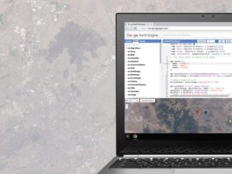
This summer, Carleton University’s Faculty of Arts and Social Sciences and the Department of Geography and Environmental Studies has an exciting opportunity for anyone interested in learning more about Google Earth Engine and SAR Remote Sensing. […]

||||||
Technology

Canadian Geospatial Briefing May 10th: Developing Tools to Protect Canada’s Biodiversity; Tracking impact of industrial projects on B.C. species at risk; 3D satellite mapping shows that glaciers are melting faster than ever; Geospatial Maturity Index shows that Calgary is a leader in GIS programs; Community engagement to measure impact of climate change on coastal environments in the Estuary and Gulf of St Lawrence; Surprising locations in Canada that have seen the largest increase in house prices

10 May 2021 GoGeomatics Canada | 3D Mapping

Carleton and Partners Developing Tools to Protect Canada’s Biodiversity Dr. Joseph Bennett, a biology professor at Carleton University and his team will develop support tools that will assist partner organizations with prioritizing resources to help […]

||||||||||||||||||||||||||||||||||||||||||
Community

2019-2020 Back to School Socials in Pictures – Thank you Sponsors & Participants!

7 November 2019 Jon Murphy | 2019 GoGeomatics

The 6th annual GoGeomatics 2019 Back to School Socials have been a tremendous success.  After coming off the success of GeoIgnite 2019 National Conference in Ottawa. Our groups and group leaders across the country came […]

|||
Technology

In Rome: Bridging the Gap Between Archaeology and Geostatistics

15 January 2019 Alan D.K. Armstrong | Archaeology

Canadian Alan Armstrong returns us to Rome for this next article in his series on archaeology and GIS. It’s been a few months longer than previously expected but I am back, and with results to […]

|||||||
Community

A summary of the 2017 Conference of the Canadian Cartographic Association: “150 Years of Cartography: Past, Present and Future”

28 June 2017 Els Aelvoet | 2017

The 42nd Annual Conference of the Canadian Cartographic Association was held, May 31st thru June 2nd, at Carleton University. Inspired by the 150th birthday of Canada, the guiding theme of this year’s conference was “150 […]

Newsmakers & Press Releases

CCA Ottawa Conference: “150 Years of Cartography: Past, Present and Future”

13 March 2017 GoGeomatics Newsmakers | 2017

The 42nd Annual Conference of the Canadian Cartographic Association “150 Years of Cartography: Past, Present and Future” Location: Carleton University, Ottawa, ON – River Building Date: Wednesday, May 31 – Friday, June 2, 2017 This […]

||Figure5: iMapBC Start|Cadastral Fabric Definition|Cadastral Fabric Definition|Cadastral Fabric Definition
Community

The Integrated Cadastral Information (ICI) Society and ParcelMap BC

30 January 2017 GIS Program Langara CS | 2016

This is the first of two articles on the release of ParcelMap BC Data, which we see as a significant event in the movement towards Open GIS Data in Canada. This month we’ll cover the […]

||
Community

Postal Codes: Canada Post Backs Down on Crowdsourced Open Data

6 June 2016 Jon Murphy | 2012

Have you ever felt the wrath of a Canadian Crown Corporation? In 2011 Canada Post set its sights on Ervin Ruci and by 2012 had sued him personally for copyright infringement.  The copyright Canada Post […]

Posts pagination

« 1 2 3 … 5 »

Events

Notice
There are no upcoming events.

View All Events

Services

  • Post a Job
  • Post an Ad
  • Post an Event
  • Post a Directory Listing
  • Post a Press Release
  • Media Kit
  • My Account
  • Login

Jobs

Post a Job
  • Canada Maps and Poster Gallery Volunteer Leads — GeoIgnite 2026
    remote
  • GIS & Data Analytics Lead
    Beaumont, AB
  • Lead Surveyor, Projects/Arpenteur-géomètre principal, projets; arpenteuse-géomètre principale, projets
    North Bay, Thunder Bay
  • Senior GIS Developer
    Calgary, AB
View All Jobs
  • Directories
    • Associations Directory
    • Industry Directory
    • Education Programs
    • Open Data
  • Volunteer
    • Start a GoGeomatics Group
    • Editors & Writers Group
  • About Us
    • GoGeomatics Media Kit
    • Who We Are
    • Contact Us
    • FAQ’s
    • Advertising
    • Marketing
  • Subscribe
GoGeomatics
GoGeomatics is the largest and most popular communications hub promoting the Canadian geospatial community. The business was incorporated in 2011. GoGeomatics hosts over 100 fun, free, location technology networking events each year in cities across Canada.

© 2025 GoGeomatics

  • facebook
  • Twitter
  • Linkedin
  • Youtube
  • Linkedin Group