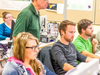
fact

GNOSIS – A New Geomatics Software Suite

Creating a new GIS from scratch is a tough undertaking. It involves a lot of innovation. Ecere, a Canadian company…

Canadian flag

Ten Interesting Facts about the Geography of Canada

This year Canada will celebrate its 150th birthday on July 1st. Most of you, like me, will be out celebrating…

High Resolution Mapping Along the Coastal Zone Workshop

Event Recap: COGS & CIG & GANS Cooperate for Mapping Workshop

The Canadian Institute of Geomatics (CIG) Nova Scotia Branch and the Geomatics Association of Nova Scotia (GANS), two regional professional organizations that foster the application of geographic information within the geomatics sector recently collaborated to host a high resolution mapping workshop at the Centre of Geographic Sciences (COGS) in Lawrencetown, Nova Scotia.

High Resolution Mapping Along the Coastal Zone - https://geomatics.one

Atlantic Canada: COGS: Geomatics Professionals Coming to Discuss High Resolution Coastal Mapping

High Resolution Coastal Zone Mapping This collaborative effort by GANS & the CIG will engage the geospatial community & increase awareness on the value…

Planifier la Géomatisation d’une Organisation de la Base Vers le Sommet

Vous êtes peut-être un analyste, un professionnel ou un spécialiste au sein d’un département et qui utilise énormément la géomatique.…

Marine Geomatics Primer: Using UUVs to Take Flight Underwater

Unmanned Underwater Vehicles One of the most interesting things to happen in regards to marine geomatics technology has been the…

Canadian Geomatics Innovation: Ecere Develops a Next Generation GIS

Not many companies undertake the ambitious goal of creating a new geospatial software suite from scratch. Ecere, a Canadian company…

Interview with Ted Mackinnon: Promoting Canadian GIS & Geomatics on Twitter

GoGeomatics has been actively using Twitter to reach out to the geospatial community since 2009. We have written and hosted…

Canadian flag

List of Canadian Geomatics Conferences and Events for 2017

This is our list Canadian geomatics conferences and events for 2017. Here you will find events pertaining to GIS, remote…

Planning an Enterprise GIS from the Bottom Up

You might be an observant professional in a department that uses GIS. Your organization may be large and have many…

Fall Reading in Canada: landscape, language, geography

Last week, I picked up a copy of Robert MacFarlane’s ‘Landmarks’. I had read all of his previous works and…

Canada Takes Part: Arctic Spatial Data Infrastructure Meets in Anchorage

The Arctic SDI Board, which includes mapping executives from Canada, Kingdom of Denmark, Finland, Iceland, Norway, Russia, Sweden and the…