• facebook
  • Twitter
  • Linkedin
  • Youtube
  • Linkedin Group
  • Post a Job
  • Post an Ad
  • Post an Event
  • Post a Directory Listing
  • Post a Press Release
  • Media Kit
  • My Account
  • Login
GoGeomatics
  • MAGAZINE
    • BIM & GIS
    • Community
    • Conference news
    • Earth Observation
    • Education & Careers
    • GEOAI
    • Announcements
    • Reality Capture & Lidar
    • Science
    • Technology
  • Directories
    • ASSOCIATION
    • INDUSTRY
    • EDUCATION
    • Open Data
  • EVENTS
    • GeoIgnite Events
    • Events Calendar
    • GoGeomatics Meetups
  • Services
    • Advertising
    • Marketing
    • Post a Job
    • Post an Ad
    • Post an Event
    • Post a Press Release
    • Post a Directory Listing
    • Media Kit
    • Web Design
  • Find a Job
  • Volunteer
    • Start a GoGeomatics Group
    • Editors & Writers Group
  • About Us
    • About Us
    • Contact Us
    • Frequently Asked Questions
  • Videos
Homefeatures

features

VGI Data|The Geo-Wiki Project
Community

VGI: the Wild West of Data and GIS

18 November 2013 Matthew Boyter | 2012

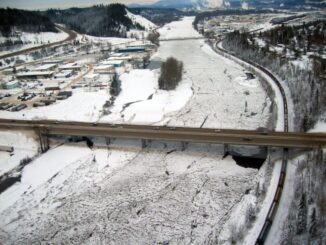
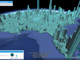
In recent years, high–resolution spaceborne imagery (HRSI), up to 50cm spatial resolution, has become readily available for no cost using such applications as Google Earth and Bing Maps. Thanks to this new availability of free […]

No Picture
Community

The Economics of Using the Term Geomatics

11 November 2013 Greg Duffy | application

I am very pleased for our industry that the discussions, led by GoGeomatics, surrounding the term Geomatics has been enthusiastic and roundly presented. For reasons I cannot quickly explain, my mind goes to the basics […]

Lidar / GPS Terrain Modelling for Ice Jam Emergency Response|Lidar / GPS Terrain Modelling for Ice Jam Emergency Response
Community

Prince George BC: Lidar / GPS Terrain Modelling for Ice Jam Emergency Response

7 November 2013 McElhanney | Acquisition

Unprecedented ice jams led to extensive flooding in Prince George as temperatures dipped to record lows in the winter of 2007/2008. City officials declared a state of local emergency on December 11, 2007, ordering dozens […]

No Picture
Community

GoGeomatics is seeking a Bilingual GIS Data Specialist to work in Africa

10 October 2013 GoGeomatics Canada | africa

GoGeomatics is seeking a bilingual (French/English) GIS Data Specialist to work in Africa on a large scale multicultural project. Responsibilities: Working under the GIS Manager as part of the GIS team, the GIS Data Specialist […]

No Picture
Community

LiDAR Reveals Hidden Archaeological Ruins

4 September 2013 McElhanney | 2012

In April 2012, McElhanney conducted an extensive aerial LiDAR survey in support of archaeological research in Cambodia. It was the first such project in Southeast Asia and the world’s largest archaeological LiDAR survey to date, […]

GEOINT Canada||Kandahar Airfield Afghanistan Neil Thompson|Neil Thompson with Canadian Military Geo Tech's in the field
Education & Careers

Neil Thompson: Geospatial Intelligence & Canadian Military

23 July 2013 GoGeomatics Canada | 2014

GoGeomatics had the chance to interview Neil Thompson, the Managing partner of the WCGroup. Neil is also the former Director of Geospatial Intelligence for the Canadian Forces and a retired Colonel.  You can have a […]

||||||||||
Technology

Designing with Information: GIS with Dimension, Ease of Use & Visually Unique

15 July 2013 Edgar Baculi | accuracy

Geomatics and other industries which desire data in accurate yet visually stimulating presentations of communication and information are frequently turning heads at the evolving use of infographics. This inquiry of data and technology fused with […]

No Picture
Community

The TECTERRA Geomatics Showcase 2013 is just over a month away: Why you shouldn’t miss this event

15 May 2013 Lindsay Hischebett | 2013

 For the third year in a row the TECTERRA Geomatics Showcase is back – and this year, it’s bigger and better than ever! Incorporating tradeshow style exhibitor booths and top-notch plenary sessions, the TECTERRA Geomatics […]

Posts pagination

« 1 … 12 13 14 15 »

Events

Notice
There are no upcoming events.

View All Events

Services

  • Post a Job
  • Post an Ad
  • Post an Event
  • Post a Directory Listing
  • Post a Press Release
  • Media Kit
  • My Account
  • Login

Jobs

Post a Job
  • BIM Specialist
    Burnaby, BC
  • GIS Analyst
    Virden MB
  • GIS Analyst Student – Summer 2026
    Saint John NB
  • GIS Analyst & Developer
    Nanaimo, BC
View All Jobs
  • Directories
    • Associations Directory
    • Industry Directory
    • Education Programs
    • Open Data
  • Volunteer
    • Start a GoGeomatics Group
    • Editors & Writers Group
  • About Us
    • GoGeomatics Media Kit
    • Who We Are
    • Contact Us
    • FAQ’s
    • Advertising
    • Marketing
  • Subscribe
GoGeomatics
GoGeomatics is the largest and most popular communications hub promoting the Canadian geospatial community. The business was incorporated in 2011. GoGeomatics hosts over 100 fun, free, location technology networking events each year in cities across Canada.

© 2026 GoGeomatics

  • facebook
  • Twitter
  • Linkedin
  • Youtube
  • Linkedin Group