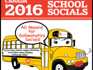
• facebook
  • Twitter
  • Linkedin
  • Youtube
  • Linkedin Group
  • Post a Job
  • Post an Ad
  • Post an Event
  • Post a Directory Listing
  • Post a Press Release
  • Media Kit
  • My Account
  • Login
GoGeomatics
  • MAGAZINE
    • BIM & GIS
    • Community
    • Conference news
    • Earth Observation
    • Education & Careers
    • GEOAI
    • Announcements
    • Reality Capture & Lidar
    • Science
    • Technology
  • Directories
    • ASSOCIATION
    • INDUSTRY
    • EDUCATION
    • Open Data
  • EVENTS
    • GeoIgnite Events
    • Events Calendar
    • GoGeomatics Meetups
  • Services
    • Advertising
    • Marketing
    • Post a Job
    • Post an Ad
    • Post an Event
    • Post a Press Release
    • Post a Directory Listing
    • Media Kit
    • Web Design
  • Find a Job
  • Volunteer
    • Start a GoGeomatics Group
    • Editors & Writers Group
  • About Us
    • About Us
    • Contact Us
    • Frequently Asked Questions
  • Videos
Homegeospatial

geospatial

|
Newsmakers & Press Releases

URISA Heads to Toronto for GIS-Pro 2016

9 September 2016 GoGeomatics Newsmakers | 2016

The Urban and Regional Information Systems Association (URISA), in partnership with its Ontario, Alberta and British Columbia Chapters, is pleased to share the details of GIS-Pro 2016: URISA’s 54th Annual Conference. The event will take […]

|||||
Technology

How Canadian Remote Sensing Was Made Commercially Successful & Exportable

7 September 2016 Robert Ryerson | activity

This piece started as a note on some of my experience as an international consultant in remote sensing specifically and geomatics more generally. But as I looked more and more at the role of consulting, […]

No Picture
Community

GIS Health Studies: Conduct Spatial Exposure Assessments

5 September 2016 Anders Erickson | 2016

Interested in how to conduct different types of spatial exposure assessments for air pollution or other exposures to a population?  PHDA04: Spatial Epidemiology and Outbreak Detection is a great place to start. Exposure assessment is the […]

BCIT GIS student project Tetrad||BCIT GIS Student Posters|
Education & Careers

Become a BCIT GIS Student Project / Practicum Sponsor

1 September 2016 Karl Kliparchuk | 2017

The BCIT GIS department has been graduating students for 25+ years.  Our students come from BC, but as well, across Canada and international.  Our program is known to be very demanding, and creates students that […]

Newsmakers & Press Releases

CIG Advancements in Geomatics 2016 Conference in New Brunswick Sept 26th-28th

31 August 2016 GoGeomatics Newsmakers | 2016

Advancements in Geomatics – Research and Collaboration for Informed Decisions in a Changing World The Canadian Institute of Geomatics (CIG) New Brunswick Branch and the Conference Organizing Committees, invite you to join us as a […]

No Picture
Newsmakers & Press Releases

Airobotics Selects SimActive’s Photogrammetry Software for its Automated Industrial Drone Solution

30 August 2016 GoGeomatics Newsmakers | 2016

Montreal, Canada, August 30th, 2016 – SimActive Inc., a world-leading developer of photogrammetry software, is pleased to announce that Airobotics has chosen Correlator3D™ for its drone platforms. The software will be used to derive mapping […]

No Picture
Newsmakers & Press Releases

International Spatial Symposium in Quebec City: CAMUSS 2016

29 August 2016 GoGeomatics Newsmakers | 2016

You are cordially invited to participate in the Second International Symposium on Cellular Automata Modeling for Urban and Spatial Systems (CAMUSS 2016) that will be held in a beautiful UNESCO World Heritage Site, Quebec City, […]

|A portrait of Jessi Mielke
Education & Careers

Jessi Mielke Esri’s Certification Manager Chats About the Esri Technical Certification Program

29 August 2016 Brian Bancroft | advice

For the last 6 months I’ve been writing articles and discussing my experience in regards to the Esri technical certification program.  You can see a list of my prior articles below. – Esri Technical Certification: […]

Posts pagination

« 1 … 89 90 91 … 137 »

Events

Notice
There are no upcoming events.

View All Events

Services

  • Post a Job
  • Post an Ad
  • Post an Event
  • Post a Directory Listing
  • Post a Press Release
  • Media Kit
  • My Account
  • Login

Jobs

Post a Job
  • Volunteer Editorial Contributor – Be Part of Canada’s Geomatics Story
    Remote
  • Systems Analyst – Asset Management and GIS
    Yellowknife, Northwest Territories
  • Canada Maps and Poster Gallery Volunteer Leads — GeoIgnite 2026
    remote
  • Geospatial Systems Analyst (GIS Developer Analyst)
    Edmonton
View All Jobs
  • Directories
    • Associations Directory
    • Industry Directory
    • Education Programs
    • Open Data
  • Volunteer
    • Start a GoGeomatics Group
    • Editors & Writers Group
  • About Us
    • GoGeomatics Media Kit
    • Who We Are
    • Contact Us
    • FAQ’s
    • Advertising
    • Marketing
  • Subscribe
GoGeomatics
GoGeomatics is the largest and most popular communications hub promoting the Canadian geospatial community. The business was incorporated in 2011. GoGeomatics hosts over 100 fun, free, location technology networking events each year in cities across Canada.

© 2026 GoGeomatics

  • facebook
  • Twitter
  • Linkedin
  • Youtube
  • Linkedin Group