The Canadian Institute of Geomatics (CIG) is pleased to announce its new President, Rodolphe Devillers, PhD, Professor in Geography at Memorial University of Newfoundland, Canada, where he leads the Marine Geomatics Research Lab, a team exploring the use of GIS and spatial analysis for improving our understanding of the marine environment. Mr. Devillers was sworn in at the CIG Annual General Meeting held on September 26, 2016 at the Delta Fredericton in Fredericton, New Brunswick. He is joined on the CIG Executive by Vice-President G. Brent Hall, PhD, who is currently Director of Education and Research at Esri Canada Limited; Immediate Past President Mr. Giannelia, BAA, President of The Airborne Sensing Corporation, Toronto; Treasurer Mr. Gilles Champoux, retired from the Directorate of Real Property Planning with National Defence Headquarters in Ottawa.
More information is provided on the CIG website and full bios will be published in the December issue of Geomatica.The Canadian Institute of Geomatics is the Canadian association that represents the interests of all groups in the geomatics community and is the Canadian member to the International Federation of Surveying (FIG), the International Society of Photogrammetry and Remote Sensing (ISPRS), the International Cartographic Association (ICA) and is a founding member of GeoAlliance Canada.
President’s Citation 2016
It is the President’s prerogative each year to award a President’s Citation to an individual who has displayed dedication and commitment to the Institute in an exemplary manner. For his last duties as President, Mr. Giannelia presented this year’s President Citation to:
Steeve Guillemette – In appreciation for his exceptional commitment to the Institute through his continued support and his dedication.
Songnian Li – In appreciation for his special contribution and dedication to the Institute’s international affairs, and his support as the Canadian ISPRS representative.
Izaak de Rijcke – For his dedication and leadership as Editor in managing and promoting Geomatica.
One of the most versatile and powerful sensor systems, becoming standard kit for surveyors and reality capture practitioners, is Handheld SLAM. However, there have been few practical guides published. This one is timely, comprehensive, and […]
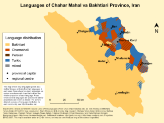
We’ve likely all seen maps of languages, though most of us don’t necessarily think about where they come from—or what they really mean. As noted in a previous GoGeomatics article from 2022, languages are important […]
A Conversation with Jeff Clark Jeff Clark is the principal and lead cartographer at Clark Geomatics, a map design studio based in North Vancouver, BC. With a professional background rooted in geophysics and GIS, Clark […]


Be the first to comment