Heritage

GIS: Parks Canada Receives Award for Enterprise Approach to Data Management

OTTAWA, Esri Canada User Conference – October 6, 2015 – Parks Canada fosters public understanding, appreciation and enjoyment of Canada’s…

Archaeology & UAV: AG-Wing has covered 41,250 Acres in Easter Island

AG-Wing small unmanned aerial system has covered the whole Easter Island in about a week, 41,250 acres in the southeastern…

Beyond the Outer Shores

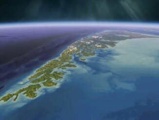
For over fifty years, the islands off the coast of British Columbia and Alaska have been called ‘the outer shores’.…

Governments of Canada and Manitoba invest in building state-of-the-art Churchill Marine Observatory

Shelly Glover, Minister of Canadian Heritage and Official Languages and Minister responsible for Manitoba, and Manitoba Premier Greg Selinger visited…

Storytelling: Haida Gwaii

Haida Gwaii is a rich source for stories. There are many perspectives and many different formats. In the Haida culture…

COM DEV secures access to key technology with strategic investment in Anokiwave

CAMBRIDGE, ON, May 12, 2015 /CNW/ – COM DEV International Ltd. (TSX:CDV) today announced that it is making a US$500,000 investment…

Island Geography: Haida Gwaii

Canada, with its endless coastline, has thousands of islands. Besides the physical islands with tangible, defined boundaries, there are also…

Alex Trebek Gives $100K to Support Canadian Geographic Challenge

OTTAWA, ON – Sudbury-born Alex Trebek, celebrity host of the long-running TV quiz show Jeopardy!, has donated US$100,000 to celebrate…

The Changing Face of Geography: Learning Opportunitites

This article is a companion piece to the September 23rd article “The Changing Face of Geomatics: Learning Opportunities,” which focused…

All the Geomatics Acronyms You Wanted to Know but were Too Afraid to Ask

Here in Canada, there are many geomatics acronyms that get tossed around. During the recent “Team Canada” event that the…

Carleton Researcher Fraser Taylor Releases Interactive Online Arctic Atlas

This new online, interactive atlas,  http://paninuittrails.org/index.html constructed from historical records, accounts, maps, trails and place names and visualized using innovative…

Ontario: NEONet is receiving $500,000 for a GIS Mapping Project Involving 20 Communities

Bulletin: Supporting Economic Development in Timmins Region Ontario Creating Jobs, Strengthening Northern Economy Ministry of Northern Development and Mines Ontario…