information management
Careers In Land Surveying
Land surveying is an exciting Geomatics Career Field that is in high demand and often over looked by many young people…
The Art of Being a Cadastral Surveyor: Key abilities every surveyor needs
The Art of Being a Cadastral Surveyor: The key abilities every surveyor needs There is an art to being a…
Canada Takes Part: Arctic Spatial Data Infrastructure Meets in Anchorage
The Arctic SDI Board, which includes mapping executives from Canada, Kingdom of Denmark, Finland, Iceland, Norway, Russia, Sweden and the…
PCI Geomatics Delivers High Volume Production System (GXL) to Skymap Global in Singapore
MARKHAM, Ontario, Canada—May 25, 2016: PCI Geomatics, a world leading developer of remote sensing and photogrammetric software and systems, announced…
GIS Certification: Options and Discussion
There are many GIS and geomatics certification options available to Canadians. They have been discussed in detail in previous articles. …
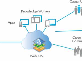
Paul Barker: What is Web GIS? Exploring the ‘new’ GIS
GIS has always been an integral part of forward thinking organizations. However, it has long struggled to break out of…
GIS Certification: AOLS Certificate of Registration
Among the various types of GIS and Geomatics certifications available to Canadians, The Association of Ontario Land Surveyors (AOLS)…
GIS: Parks Canada Receives Award for Enterprise Approach to Data Management
OTTAWA, Esri Canada User Conference – October 6, 2015 – Parks Canada fosters public understanding, appreciation and enjoyment of Canada’s…
CloverPoint to Showcase Insight(TM) and Latest in Mapping Technology at TECTERRA 2015 Geomatics Show
CloverPoint will be presenting our latest GIS, mapping, and land management solutions used by First Nations, and facility managers at…
Seisland Surveys Wins Esri Canada’s Award of Excellence in GIS
Cloud-based oil and gas information management solution supports effective emergency response CALGARY, Esri Canada User Conference – May 27, 2015…
West Parry Sound Geography Network Wins Esri Canada’s Award of Excellence in GIS
Use of mapping technology facilitates efficient data sharing and increased collaboration among rural municipalities Thunder Bay, ON, Esri Canada User…
CloverPoint Celebrates 23 Years in Geospatial Technology
CloverPoint, a leader in GIS, mapping, facilities management, and location technology is pleased to be celebrating 23 years in business.…