marine
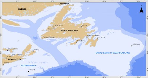
Grand Banks to the Gulf of Mexico: My Canadian Geomatics Career
I often contemplate what it would have been like working at the same job for an entire career. Mind you,…
Event Recap: COGS & CIG & GANS Cooperate for Mapping Workshop
The Canadian Institute of Geomatics (CIG) Nova Scotia Branch and the Geomatics Association of Nova Scotia (GANS), two regional professional organizations that foster the application of geographic information within the geomatics sector recently collaborated to host a high resolution mapping workshop at the Centre of Geographic Sciences (COGS) in Lawrencetown, Nova Scotia.
Atlantic Canada: COGS: Geomatics Professionals Coming to Discuss High Resolution Coastal Mapping
High Resolution Coastal Zone Mapping This collaborative effort by GANS & the CIG will engage the geospatial community & increase awareness on the value…
Marine Geomatics Primer: Using UUVs to Take Flight Underwater
Unmanned Underwater Vehicles One of the most interesting things to happen in regards to marine geomatics technology has been the…
Feb 7-8: Two Day Workshop on High Resolution Mapping Along Coastal Zones
The coastal zone, that dynamic geographic region where the interaction of the sea and land occurs, is vital to the…
New Brunswick: CARIS Announces release of HIPS and SIPS™ 10
Fredericton, NB, Canada – November 01, 2016 – Teledyne CARIS™ is pleased to announce the release of HIPS and SIPS™ 10.…
The Canadian Institute of Geomatics (CIG) New President: Rodolphe Devillers
The Canadian Institute of Geomatics (CIG) is pleased to announce its new President, Rodolphe Devillers, PhD, Professor in Geography at…
Become a BCIT GIS Student Project / Practicum Sponsor
The BCIT GIS department has been graduating students for 25+ years. Our students come from BC, but as well, across…
EMSA expands use of RADARSAT-2 information for maritime applications
MacDonald, Dettwiler and Associates Ltd. a global communications and information company announced that it has signed a four year contract…
Teledyne Optech introduces low-cost, automated airborne surveying at GEOINT 2016
Teledyne Optech is pleased to announce that it will showcase its latest airborne systems including the autonomous Optech Eclipse at…
Teledyne to Acquire CARIS
Teledyne Technologies Incorporated (NYSE:TDY) (“Teledyne”) and CARIS jointly announced that the CARIS business and its international affiliates (collectively, “CARIS”) have…
An API for the World’s Weather & Climate Data
Planet OS is excited to announce the launch of our first API designed specifically for geospatial and Earth observation data.…


