mobile

Making a Crow Attack Web Page With Open Source GIS Tools

Of all the pleasant events that happen in spring, crow attacks rank at the bottom of the pile. Crows become…

Keystone Aerial Surveys, Inc. optimizes efficiency with Optech Galaxy

Teledyne Optech is pleased to announce that Keystone Aerial Surveys, Inc. has accepted delivery of the most capable airborne lidar…

PCI Geomatics Delivers High Volume Production System (GXL) to Skymap Global in Singapore

MARKHAM, Ontario, Canada—May 25, 2016: PCI Geomatics, a world leading developer of remote sensing and photogrammetric software and systems, announced…

eyesMap3D: The most accurate and powerful 3D photo modeling software

Global based technology company eCapture announced today the launch of its versatile and intuitive software eyesMap3D, to generate accurate 3D…

Teledyne Optech introduces low-cost, automated airborne surveying at GEOINT 2016

Teledyne Optech is pleased to announce that it will showcase its latest airborne systems including the autonomous Optech Eclipse at…

Pickett and Associates Boosts Surveying Capabilities with the Optech Galaxy

Teledyne Optech is pleased to announce that Pickett and Associates has upgraded their airborne surveying capabilities with the highly advanced…

New Autonomous Airborne Mapping Solution Redefines Industry Expectations

Teledyne Optech is pleased to announce the latest addition to its innovative line of airborne laser terrain mappers, the Optech…

Paul Barker: What is Web GIS? Exploring the ‘new’ GIS

GIS has always been an integral part of forward thinking organizations. However, it has long struggled to break out of…

2016 Student UAS Competition- Phase 1 Winners

Phase 1 of the 2016 Student UAS Competition is complete. A judging panel, comprised of Canadian subject matter experts, has…

Low-cost Feature-Rich RTK Receiver

SkyTraq Technology, a Taiwanese GNSS positioning technology company, introduces S2525F8-RTK, a low-cost, low-power, single frequency RTK receiver for applications requiring…

A Shared Vision

Every year, a small team of Esri staff come to COGS to recruit new talent. As part of the interview…

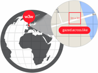
Location Encoding Systems – Could geographic coordinates be replaced and at what cost?

Geocoding is the process of converting a street address into a physical location that can be described with a pair…