model

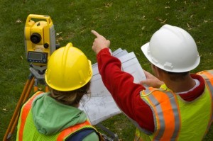
The Art of Being a Cadastral Surveyor: Key abilities every surveyor needs

The Art of Being a Cadastral Surveyor:  The key abilities every surveyor needs There is an art to being a…

Operational GIS Jobs in the Canadian Military

Whether its businesses, governments or for personal use, Geomatics offers everyday solutions to the worlds questions. The Canadian Armed Forces…

New Brunswick: CARIS Announces release of HIPS and SIPS™ 10

Fredericton, NB, Canada – November 01, 2016 – Teledyne CARIS™ is pleased to announce the release of HIPS and SIPS™ 10.…

Montreal: SimActive Offers Free Trial of UAV Software

Montreal, Canada, October 11th, 2016 – SimActive Inc., a world-leading developer of photogrammetry software, is pleased to announce a new…

DigitalGlobe’s Basemap Suite Expands: 250 Million Square Kilometers of 30 cm Imagery

DigitalGlobe, Inc. (NYSE: DGI), the global leader in Earth imagery and information about our changing planet, today announced that its…

GoGeomatics Kelowna: September Success & October Social With Talk from Esri Canada

GoGeomatics Kelowna’s first Back-to-School September social was a huge success!    Among the attendees were a great group from Stantec, our…

UAVs in Canada – Key Exposures to Loss and Ways to Protect Yourself

This article was written by Mark Sampson for the Association of Ontario Land Surveyors. Mark’s contact details are at the…

50 Years a Geographer: My Top Ten books about Geography

In celebration of Geography Week, it seemed like a good idea to issue a challenge: list the top ten books…

URISA Heads to Toronto for GIS-Pro 2016

The Urban and Regional Information Systems Association (URISA), in partnership with its Ontario, Alberta and British Columbia Chapters, is pleased…

Earth Observation Represents a $43 Billion Opportunity Over Next 10 Years

NSR’s Satellite-Based Earth Observation (EO), 8th Edition report, released yesterday, projects data, value-added services, information products, and big data analytics…

How Canadian Remote Sensing Was Made Commercially Successful & Exportable

This piece started as a note on some of my experience as an international consultant in remote sensing specifically and…

GIS Health Studies: Conduct Spatial Exposure Assessments

Interested in how to conduct different types of spatial exposure assessments for air pollution or other exposures to a population? …