Community
GoGeomatics announces: Geography Awareness Week Program 2022
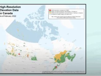
GoGeomatics is celebrating Geography Awareness Week and GIS day 2022 by hosting a series of talks and webinars. The first day(17th) is free for everyone wishing to attend online. The second day (19th) is our […]