NV5
NV5 Announces Gold Sponsorship for LidarCANEX 2025 and GeoIgnite 2025
We are pleased to announce that NV5, a leading provider of geospatial services, will be a Gold Sponsor for our…
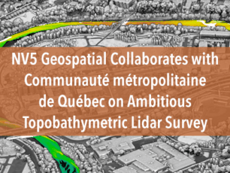
NV5 Geospatial Collaborates with Communauté métropolitaine de Québec on Ambitious Topobathymetric Lidar Survey
The earliest French settlers in North America were drawn in the 16th century to the area now known as Québec…
International Geospatial Digest April 24th, 2023
Digital twin technology brings Pompeii to life How Satellite Data Is Helping Tackle the Urban Heat Issue NV5 closes acquisition…
NV5 Geospatial Supports Natural Resources Canada in Topobathymetric Lidar Survey of South and North Saskatchewan Rivers
Over the last decade, a growing number of municipal and regional governments across North America have invested in topobathymetric lidar…
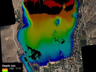
NV5 Geospatial Helps Okanagan Basin Water Board Protect Important Local Communities Through Near-Shore Topobathymetric Lidar Survey
The Okanagan Valley in British Columbia is one of Western Canada’s most attractive tourist destinations, with local communities offering a…
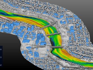
NV5 Geospatial Supports Flood Risk Mapping in Montreal Through Canada’s Largest Riverine Topobathymetric Lidar Survey
The Greater Montréal Area completed Canada’s largest-ever riverine topobathymetric lidar survey inresponse to two major flooding events within the last…
GeoIgnite Talk On YouTube: A closer look at the NV5 Geospatial 2020 aerial topobathymetric lidar survey of Montreal
In case you missed it GoGeomatics is highlighting one of the most interesting talks from GeoIgnite from this past April.…
Canadian Geospatial Briefing for January 18th: Scientists flag hotspots for protection; MNR releases solar potential tool; Transport Canada invests in its Aerial Surveillance Program; MDA is GeoIgnite Platinum Sponsor; CSA releases its first AO; NV5 Geospatial gains momentum in Canada
Scientists flag Rocky Mountains, Hudson Bay as hotspots for protection In 2017 an expert team was put together to advise…