• facebook
  • Twitter
  • Linkedin
  • Youtube
  • Linkedin Group
  • Post a Job
  • Post an Ad
  • Post an Event
  • Post a Directory Listing
  • Post a Press Release
  • Media Kit
  • My Account
  • Login
GoGeomatics
  • MAGAZINE
    • BIM & GIS
    • Community
    • Conference news
    • Earth Observation
    • Education & Careers
    • GEOAI
    • Announcements
    • Reality Capture & Lidar
    • Science
    • Technology
  • Directories
    • ASSOCIATION
    • INDUSTRY
    • EDUCATION
    • Open Data
  • EVENTS
    • GeoIgnite Events
    • Events Calendar
    • GoGeomatics Meetups
  • Services
    • Advertising
    • Marketing
    • Post a Job
    • Post an Ad
    • Post an Event
    • Post a Press Release
    • Post a Directory Listing
    • Media Kit
    • Web Design
  • Find a Job
  • Volunteer
    • Start a GoGeomatics Group
    • Editors & Writers Group
  • About Us
    • About Us
    • Contact Us
    • Frequently Asked Questions
  • Videos
Homeocean

ocean

||
Technology

How is MDA and the Government of Canada Addressing Illegal Fishing?

9 February 2023 GoGeomatics Canada | Archaeology GIS

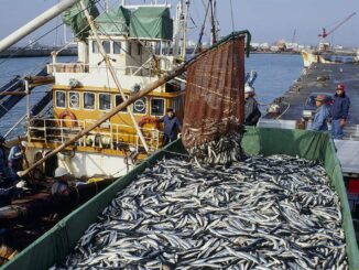
MDA and the Government of Canada are using advanced radar satellites to stop illegal fishing. Illegal and unregulated fishing accounts for 11 to 26 million tonnes, or roughly 12 to 28 per cent, of fishing […]

|
Newsmakers & Press Releases

International Hydrographic and Hydrospatial School – Laval University Sept 19 – 27, 2022

31 August 2022 GoGeomatics Newsmakers | Canada

The crucial role of detailed knowledge of the seabed has never been so well highlighted as recently with the proclamation by the United Nations of the Decade of Ocean Sciences for Sustainable Development (2021 – […]

|
Technology

Maxar Technologies Gives Us a New Ocean View From the Crow’s Nest

28 April 2022 GoGeomatics Canada | broad-area surveillance

Maxar’s Maritime Monitoring System is Filling the Need Protecting our seas has become a bit easier. As part of Canada’s National Geospatial Conference, GeoIgnite 2022, Winter Geo, Bryan Smith, Director of Maritime Product Management at […]

||||||||
Technology

International Geospatial Briefing Sep 13th: Interactive Map Shows the Best Time to Photograph Fall Foliage; New interactive 3D map lets you see downtown Tampa in a new way; Geospatial Commission launches pilots to improve how data about land is used in the UK; Drop a Raindrop on This Magical Map and Watch Its Journey to the Ocean; FireWatch maps aim to help keep homes, community safe from wildfire; Geospatial Data Essential to Protect Snow Leopard in Mongolia

13 September 2021 GoGeomatics Canada | 3D Mapping

Interactive Map Shows the Best Time to Photograph Fall Foliage Photographers will not have difficulty planning fall photoshoots anymore and can easily choose optimal shooting days with this interactive fall foliage prediction map that shows when the […]

||||||
Technology

The Dark Vessel Detection (DVD) Program – MDA/DFO program takes aim at illegal fishing

17 March 2021 Jake MacLean | Barbados

Canada has always been a leader in the geospatial community, from Roger Tomlinson’s pioneering work creating the first computerized GIS in 1963 to the leadership we provide with RADARSAT and other programs today. Canadian schools […]

Events

Notice
There are no upcoming events.

View All Events

Services

  • Post a Job
  • Post an Ad
  • Post an Event
  • Post a Directory Listing
  • Post a Press Release
  • Media Kit
  • My Account
  • Login

Jobs

Post a Job
  • Canada Maps and Poster Gallery Volunteer Leads — GeoIgnite 2026
    remote
  • GIS & Data Analytics Lead
    Beaumont, AB
  • Lead Surveyor, Projects/Arpenteur-géomètre principal, projets; arpenteuse-géomètre principale, projets
    North Bay, Thunder Bay
  • Senior GIS Developer
    Calgary, AB
View All Jobs
  • Directories
    • Associations Directory
    • Industry Directory
    • Education Programs
    • Open Data
  • Volunteer
    • Start a GoGeomatics Group
    • Editors & Writers Group
  • About Us
    • GoGeomatics Media Kit
    • Who We Are
    • Contact Us
    • FAQ’s
    • Advertising
    • Marketing
  • Subscribe
GoGeomatics
GoGeomatics is the largest and most popular communications hub promoting the Canadian geospatial community. The business was incorporated in 2011. GoGeomatics hosts over 100 fun, free, location technology networking events each year in cities across Canada.

© 2025 GoGeomatics

  • facebook
  • Twitter
  • Linkedin
  • Youtube
  • Linkedin Group