office
Contrasting: GIS & Geomatics Education in Canada and China
I have studied Geographic Information Systems (GIS) in both Canada and China. Last summer I completed my master in geography at…
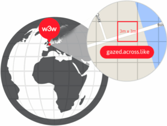
what3words adopted by six national mapping agencies
what3words, the multi-award winning location reference system, has today announced that six national mapping agencies have adopted 3-word addresses. Used…
The Art of Being a Cadastral Surveyor: Key abilities every surveyor needs
The Art of Being a Cadastral Surveyor: The key abilities every surveyor needs There is an art to being a…
NB 911 Bureau Receives Esri Canada Award of Excellence in GIS
FREDERICTON, Esri Canada User Conference – October 25, 2016 – Esri Canada today presented the NB 911 Bureau, a branch…
UAVs in Canada – Key Exposures to Loss and Ways to Protect Yourself
This article was written by Mark Sampson for the Association of Ontario Land Surveyors. Mark’s contact details are at the…
The Importance of Students & Young Professionals in Canada’s Geomatics Community
With the help of our sponsors GoGeomatics Canada is bringing students and young geospatial professionals together at 11 events from…
URISA Heads to Toronto for GIS-Pro 2016
The Urban and Regional Information Systems Association (URISA), in partnership with its Ontario, Alberta and British Columbia Chapters, is pleased…
How Canadian Remote Sensing Was Made Commercially Successful & Exportable
This piece started as a note on some of my experience as an international consultant in remote sensing specifically and…
Become a BCIT GIS Student Project / Practicum Sponsor
The BCIT GIS department has been graduating students for 25+ years. Our students come from BC, but as well, across…
Using Colour Transparency to Map Election Results
As the 2016 United States presidential election careens towards its conclusion in November, GIS plays a prominent role in both planning…
Canadian Institute of Geomatics Expands Executive Team with New VP Dr Brent Hall
Ottawa, August 16, 2016 – The Canadian Institute of Geomatics (CIG), the largest and most influential geospatial knowledge network in…
Countdown to Launch: DigitalGlobe’s WorldView-4 Earth Imaging Satellite
Final preparations are underway at Lockheed Martin to ship DigitalGlobe’s WorldView-4 earth imaging satellite to Vandenberg Air Force Base for…