
Community

Last year GoGeomatics brought our readers up to date on the 2012 country report from NRCan to the United Nations. This year we are taking a look at some of the highlights of the 2014 […]
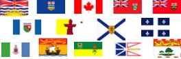
The Canadian Council on Geomatics (CCOG) has been around for over 40 years. Despite that, many people in geomatics aren’t aware of the significant role this federal-provincial-territorial government organization plays in the sector. To help […]

GAC 2015 Supports the GIS Education Community Everything begins and ends with geospatial information. Now more than ever, GIS and geomatics methodologies are gaining wide acceptance and adoption. GIS and geomatics tools were once […]
The City of Surrey launched its open data program as part of its commitment to an open, transparent and accessible government. The new Open Data Catalogue comprises more data sets than any other municipality in […]

GoGeomatics recently published a press release on the launch of the Esri Canada GIS Centres of Excellence in Higher Education. To get a better understanding of these new programs, we caught up with Dr. Brent […]
TORONTO – July 29, 2014 – Esri Canada, the leading provider of geographic information system (GIS) solutions, is pleased to announce the launch of its GIS Centres of Excellence initiative which is aimed at encouraging […]
The open data movement has been the talk of the nation, encouraging transparency of governance and good management of data. Goodness, what a magical moment it must be to witness the head of a government […]