people

Google Summer of Code Projects: Open Source Geospatial 4 every student

Are you are university student who has solid programming skills, geospatial knowledge and is continuously aiming to become better at…

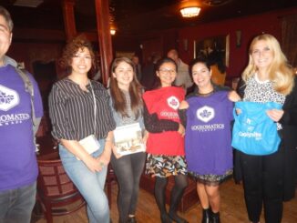
COGS NSCC students use Geomatics to explore the history of Black Loyalists & Joggins Fossil Cliff

NSCC students make major impact in two small communities with huge historical significance Students at Nova Scotia Community College’s Centre…

My COGS GIS Education, Part II

In my first article, I introduced the how and why I chose to attend COGS from the fall of 2014…

GIS Open Source versioning tool for a multi-user Distributed Environment (part 2)

Cet article est aussi disponible en français. This article is the 2nd part of GIS Open Source versioning tool for a multi-user Distributed…

URISA BC: Vancouver Call for Presentations on GIS Trends in Community Engagement

Call for Presentations Following the success of our December event, the URISA BC Executive Team is busy planning our next…

Eastern Canada

Grand Banks to the Gulf of Mexico: My Canadian Geomatics Career

I often contemplate what it would have been like working at the same job for an entire career. Mind you,…

GNOSIS – A New Geomatics Software Suite

Creating a new GIS from scratch is a tough undertaking. It involves a lot of innovation. Ecere, a Canadian company…

Esri Canada Community Maps Program: Why more communities need to take advantage of this

The Community Maps Program (CMP) was introduced by Esri Canada in 2009 allowing organizations to share and host geographic data. …

CIG – Newfoundland and Labrador: Free Lunch and Geomatics Lecture March 2nd

The Canadian Institute of Geomatics, Newfoundland Branch, is delighted to host a FREE luncheon on Thursday, March 2, 2017, at…

Canadian flag

Ten Interesting Facts about the Geography of Canada

This year Canada will celebrate its 150th birthday on July 1st. Most of you, like me, will be out celebrating…

High Resolution Mapping Along the Coastal Zone Workshop

Event Recap: COGS & CIG & GANS Cooperate for Mapping Workshop

The Canadian Institute of Geomatics (CIG) Nova Scotia Branch and the Geomatics Association of Nova Scotia (GANS), two regional professional organizations that foster the application of geographic information within the geomatics sector recently collaborated to host a high resolution mapping workshop at the Centre of Geographic Sciences (COGS) in Lawrencetown, Nova Scotia.

Geospatial Earth Observation Using Blimps, Balloons and Kites

These days drones are all the rage. Nevertheless, there are other ways to collect data from the sky! Blimps, balloons and kites…