• facebook
  • Twitter
  • Linkedin
  • Youtube
  • Linkedin Group
  • Post a Job
  • Post an Ad
  • Post an Event
  • Post a Directory Listing
  • Post a Press Release
  • Media Kit
  • My Account
  • Login
GoGeomatics
  • MAGAZINE
    • BIM & GIS
    • Community
    • Conference news
    • Earth Observation
    • Education & Careers
    • GEOAI
    • Announcements
    • Reality Capture & Lidar
    • Science
    • Technology
  • Directories
    • ASSOCIATION
    • INDUSTRY
    • EDUCATION
    • Open Data
  • EVENTS
    • GeoIgnite Events
    • Events Calendar
    • GoGeomatics Meetups
  • Services
    • Advertising
    • Marketing
    • Post a Job
    • Post an Ad
    • Post an Event
    • Post a Press Release
    • Post a Directory Listing
    • Media Kit
    • Web Design
  • Find a Job
  • Volunteer
    • Start a GoGeomatics Group
    • Editors & Writers Group
  • About Us
    • About Us
    • Contact Us
    • Frequently Asked Questions
  • Videos
Homephotogrammetric

photogrammetric

||
Technology

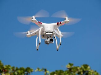
GeoIgnite 2020 Video: How to challenge the Lasers-scanning market at the cost of a drone

28 September 2020 Lindsey Goncalves | AI

Session: How to challenge the Lasers-scanning market at the cost of a drone and simple tools combined with Artificial Intelligence and Pix4D processing software Session date: July 24, 2020. Speakers: J. Carlos Maia, Photogrammetric Eng. […]

|||||||||||||||
Technology

UAV Surveys – How to Ensure Accuracy and Precision

12 April 2017 Thomas Hoppe | accuracy

For the past four years, I’ve been involved with the capture and delivery of data derived from drones. My experience has provided me with a good perspective on the quality of the data that can be […]

|||||
Education & Careers

The Art of Being a Cadastral Surveyor: Key abilities every surveyor needs

16 November 2016 Manminder 'Meena' Kaur | 3D

The Art of Being a Cadastral Surveyor:  The key abilities every surveyor needs There is an art to being a land surveyor.  Surveyors take extremely accurate measurements with sophisticated tools to create plans that become legal […]

||||
Education & Careers

Canadian Surveyors “Remark” on History with Elk Pass Boundary Restoration Survey

17 October 2016 Association of British Columbia Land Surveyors | 2012

The Alberta-British Columbia Boundary Commission has just completed a monument restoration survey to restore a number of deteriorated provincial boundary monuments in the Elk Pass area of the Rocky Mountains. The work was undertaken by […]

Newsmakers & Press Releases

PCI Geomatics and PrecisionHawk Enter into Long Term Partnership

29 September 2016 GoGeomatics Newsmakers | Acquisition

PCI Geomatics, a world leading developer of remote sensing and photogrammetric software and systems, announced today it has entered into a long term partnership with PrecisionHawk, a leader in the commercial Unmanned Aerial Systems (UAS) […]

No Picture
Newsmakers & Press Releases

Keystone Aerial Surveys, Inc. optimizes efficiency with Optech Galaxy

28 June 2016 GoGeomatics Newsmakers | 3D

Teledyne Optech is pleased to announce that Keystone Aerial Surveys, Inc. has accepted delivery of the most capable airborne lidar system on the market, the Optech Galaxy. As a provider of millions of miles of […]

No Picture
Newsmakers & Press Releases

PCI Geomatics Delivers High Volume Production System (GXL) to Skymap Global in Singapore

25 May 2016 GoGeomatics Newsmakers | 2016

MARKHAM, Ontario, Canada—May 25, 2016: PCI Geomatics, a world leading developer of remote sensing and photogrammetric software and systems, announced today that SkyMap Global of Singapore has become a key commercial GXL customer in Asia. […]

No Picture
Newsmakers & Press Releases

eyesMap3D: The most accurate and powerful 3D photo modeling software

11 May 2016 GoGeomatics Newsmakers | 2015

Global based technology company eCapture announced today the launch of its versatile and intuitive software eyesMap3D, to generate accurate 3D models and point clouds, which measure directly from images. What are the benefits of using […]

Posts pagination

1 2 … 5 »

Events

Notice
There are no upcoming events.

View All Events

Services

  • Post a Job
  • Post an Ad
  • Post an Event
  • Post a Directory Listing
  • Post a Press Release
  • Media Kit
  • My Account
  • Login

Jobs

Post a Job
  • Canada Maps and Poster Gallery Volunteer Leads — GeoIgnite 2026
    remote
  • GIS & Data Analytics Lead
    Beaumont, AB
  • Lead Surveyor, Projects/Arpenteur-géomètre principal, projets; arpenteuse-géomètre principale, projets
    North Bay, Thunder Bay
  • Senior GIS Developer
    Calgary, AB
View All Jobs
  • Directories
    • Associations Directory
    • Industry Directory
    • Education Programs
    • Open Data
  • Volunteer
    • Start a GoGeomatics Group
    • Editors & Writers Group
  • About Us
    • GoGeomatics Media Kit
    • Who We Are
    • Contact Us
    • FAQ’s
    • Advertising
    • Marketing
  • Subscribe
GoGeomatics
GoGeomatics is the largest and most popular communications hub promoting the Canadian geospatial community. The business was incorporated in 2011. GoGeomatics hosts over 100 fun, free, location technology networking events each year in cities across Canada.

© 2025 GoGeomatics

  • facebook
  • Twitter
  • Linkedin
  • Youtube
  • Linkedin Group